Category:Hochspeyer
Jump to navigation
Jump to search
municipality of Germany | |||||
| Upload media | |||||
| Instance of |
| ||||
|---|---|---|---|---|---|
| Location | Kaiserslautern, Rhineland-Palatinate, Germany | ||||
| Population |
| ||||
| Area |
| ||||
| Elevation above sea level |
| ||||
| official website | |||||
 | |||||
Subcategories
This category has the following 8 subcategories, out of 8 total.
B
- Bahnhof Hochspeyer (5 F)
C
- Cemetery of Hochspeyer (5 F)
F
- Forsthaus Amsohl (2 F)
N
T
- Townhall of Hochspeyer (9 F)
V
- Viadukt B37 (Hochspeyer) (4 F)
Media in category "Hochspeyer"
The following 37 files are in this category, out of 37 total.
-
20210626 Hochspeyer 01.jpg 6,016 × 4,016; 9.84 MB
-
20210626 Hochspeyer 02.jpg 6,016 × 4,016; 6.81 MB
-
20210626 Hochspeyer 03.jpg 6,016 × 4,016; 8.31 MB
-
Dorfbrunnen Hochspeyer.PNG 485 × 646; 758 KB
-
Franzosenwoog.JPG 3,072 × 2,304; 2.29 MB
-
Gemeindewappen Hochspeyer.svg 500 × 607; 59 KB
-
Hinter der katholischen Kirche St. Laurentius - panoramio.jpg 1,593 × 1,548; 525 KB
-
Hochspeyer 01.jpg 2,560 × 1,920; 2.3 MB
-
Hochspeyer 02.jpg 2,560 × 1,920; 2.4 MB
-
Hochspeyer 03.jpg 2,560 × 1,920; 2.32 MB
-
Hochspeyer 04.jpg 2,560 × 1,920; 2.36 MB
-
Hochspeyer 05.jpg 2,560 × 1,920; 2.6 MB
-
Hochspeyer Bahnlinie Westen.jpg 5,472 × 3,648; 16.68 MB
-
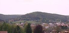
Hochspeyer Fernansicht.JPG 1,600 × 1,200; 881 KB
-
Hochspeyer Freibad Kleinkindbereich.JPG 1,600 × 1,200; 878 KB
-
Hochspeyer Freibad Schwimmerbecken.JPG 1,600 × 1,200; 876 KB
-
Hochspeyer Freibad Spielbereich.JPG 1,600 × 1,200; 883 KB
-
Hochspeyer Humberg.JPG 799 × 387; 34 KB
-
Hochspeyer im Landkreis Kaiserslautern.png 858 × 630; 10 KB
-
Hochspeyer in KL.svg 296 × 205; 205 KB
-
Hochspeyer Teilansicht.JPG 800 × 600; 228 KB
-
Hochsppeyerfrühes20jahrhundert.jpg 569 × 367; 59 KB
-
Im Sängerheim singt der Volkschor Hochspeyer. - panoramio.jpg 1,533 × 1,533; 387 KB
-
Kaninchenheim-0401.jpg 4,943 × 3,295; 15.59 MB
-
LOGO tushochspeyer.jpg 443 × 443; 47 KB
-
Mönchsweg.PNG 461 × 346; 426 KB
-
Neubaugebiet Pfarracker.JPG 800 × 600; 150 KB
-
Pirmin-Diehl-Haus Hochspeyer 03.jpg 2,560 × 1,920; 2.34 MB
-
Protestantische Kirche und Eisenbahnbrücke - panoramio.jpg 1,647 × 1,608; 317 KB
-
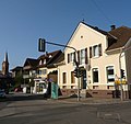
Protestantische Kirche und Ortsmitte - panoramio.jpg 2,016 × 1,896; 451 KB
-
Ritterstein 158 Meisenkopfersohl.JPG 2,272 × 1,704; 2.65 MB
-
Ritterstein 272 Hochspeyerbach Ursprung im Bad.JPG 1,136 × 852; 355 KB
-
Ruine Frechtenthalerhof.JPG 2,272 × 1,704; 2.09 MB
-
Steiler Weg am Heiligenberg.jpg 4,608 × 3,456; 3.61 MB
-
Umleitung - Hochspeyer - geo.hlipp.de - 28281.jpg 640 × 465; 81 KB
-
Wappen hochspeyer vg.jpg 207 × 250; 15 KB
-
Wappen Hochspeyer.png 217 × 250; 87 KB


