Category:History of St. Angelo Fort
Jump to navigation
Jump to search
Media in category "History of St. Angelo Fort"
The following 17 files are in this category, out of 17 total.
-

-
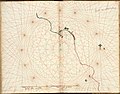
 AMH-2583-NA Maps of the forts at Cananor, Cranganor, Coylan and Calicoilan.jpg 2,400 × 1,737; 564 KB
-
 48Cannore Fort.jpg 1,729 × 1,304; 597 KB
-
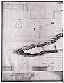
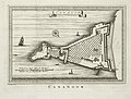
 AMH-2584-NA Map of the fort at Cananoor.jpg 2,400 × 1,674; 571 KB
-
 AMH-2586-NA Plan to reduce the fort at Cananoor.jpg 2,400 × 1,551; 475 KB
-
 AMH-2587-NA Plan to reduce the fort at Cananoor, with some changes.jpg 2,400 × 1,554; 355 KB
-
 AMH-4482-NA Planned reduction of the fort at Cananoor with several changes.jpg 2,400 × 1,564; 393 KB
-
 AMH-5351-NA Photograph of a map with a plan to make the fort at Cananoor smaller.jpg 1,835 × 2,400; 578 KB
-
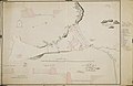
 AMH-6378-NA Map of the coast of Malabar around Cananore.jpg 2,400 × 1,884; 749 KB
-
 AMH-6959-KB View of Cananoor.jpg 2,400 × 1,915; 1.14 MB
-
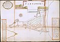
 AMH-8014-KB Floor plan of the fort Cananoor.jpg 2,400 × 1,820; 875 KB
-
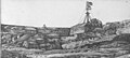
 Canamore, part of the fort, the Church, and Coorg Hills.jpg 1,000 × 470; 149 KB
-
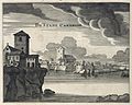
 Cannanore Lendas da Índia.png 1,424 × 936; 821 KB
-
 Cannonore fort & Bay'; a watercolor by John Johnston, c.1795-1801.jpg 976 × 645; 193 KB
-
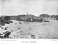
 Fort at Kannur.jpg 976 × 441; 145 KB
-
 Fortaleza de cananor.jpg 6,038 × 4,166; 6 MB
-
 കണ്ണൂർ കടൽത്തീരം..jpg 950 × 652; 191 KB


