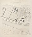
Category:Historical plans of the Palais du Louvre
Jump to navigation
Jump to search
Subcategories
This category has the following 2 subcategories, out of 2 total.
Media in category "Historical plans of the Palais du Louvre"
The following 59 files are in this category, out of 59 total.
-
Plan of the Louvre with the modifications by Lescot - Berty 1868 after p168 – Gallica 2013.png 3,775 × 5,509; 10.23 MB
-
Bastiments v1 (Gregg 1972 p27) - Louvre second and first storey plans.jpg 6,508 × 3,454; 2.87 MB
-
Les appartements du Louvre sous Henri III.jpg 1,280 × 797; 867 KB
-
Plan de Paris de Bullet et Blondel (détail).jpg 3,334 × 2,206; 2.51 MB
-
Louvre - Plan au rez-de-chaussée - Architecture françoise Tome4 Livre6 Pl5.jpg 12,614 × 10,340; 35.16 MB
-
Louvre - Plan du premier étage - Architecture françoise Tome4 Livre6 Pl6.jpg 10,351 × 9,688; 26.34 MB
-
Aile Napoléon on an 1830 plan of the Louvre by Charles Vasserot.jpg 2,500 × 1,250; 732 KB
-
Quartier du Louvre, 1836.jpg 3,454 × 2,556; 5.06 MB
-
Aile Napoléon on an 1852 plan of the Louvre by Visconti.jpg 2,498 × 1,248; 739 KB
-
Atlas des anciens plans de Paris - Plan archéologique de Paris 1 - BHVP.jpg 5,616 × 6,526; 8.76 MB
-
Atlas du plan général de la ville de Paris - Sheet 36 - David Rumsey.jpg 17,778 × 12,494; 45.45 MB
-
Distribution du Louvre pour l'Institut National Pl. XI, G.30077.jpg 1,854 × 3,000; 1,008 KB
-
Expansion plan of Palais du Louvre.png 1,269 × 1,530; 46 KB
-
Extrait du plan de Nicolas de Fer d'après Jouvin de 1676.jpg 693 × 626; 479 KB
-
Huguet, Plan historique du Louvre et des Tuileries, 1853 - Gallica.jpg 4,614 × 3,422; 1.36 MB
-
Impasse du Doyenné.png 1,444 × 996; 1.43 MB
-
Imprimerie Lemercier, Plan du palais du Louvre, 1853 - Gallica.jpg 3,990 × 6,026; 1.48 MB
-
Louvre-Tuilerie.jpg 1,130 × 616; 731 KB
-
Paris-atlas by Fernand Bournon - 08. 1er arrondissement - David Rumsey.jpg 5,977 × 4,571; 21.37 MB
-
Petit atlas pittoresque - 19. 4e arrondissement - Quartier du Louvre. No. 14 - David Rumsey.jpg 8,561 × 6,348; 16.35 MB
-
Petit atlas pittoresque 05 - 1er arrondissement, n° 4, quartier des Tuileries - BHVP.jpg 4,021 × 3,261; 2.92 MB
-
Petit atlas pittoresque 15 - 4e arrondissement, n° 14, quartier du Louvre - BHVP.jpg 3,956 × 3,191; 2.56 MB
-
Plan historique du Louvre, 1850-1900 - Gallica.jpg 4,016 × 3,342; 1.34 MB
-
Plan of Louvre - Twenty centuries of Paris, 1913 - Flickr.jpg 2,898 × 1,458; 1.14 MB
-
Plan of Louvre - Twenty centuries of Paris, 1913 - Internet Archive.jpg 1,759 × 1,112; 1.2 MB
-
Plan of Louvre and Tuileries - Karl Baedeker, Paris and environs, 1881 - Flickr.jpg 2,880 × 1,968; 886 KB
-
Plan of Louvre and Tuileries - Karl Baedeker, Paris and environs, 1913 - Flickr.jpg 3,664 × 2,462; 1,022 KB
-
Plan of Louvre and Tuileries - Mary Knight Potter, The Art of the Louvre, 1905 - Flickr.jpg 3,918 × 2,022; 1.88 MB
-
Plan relatif au programe décrété le 30 Juin 1793 par la Convention Nationale - Stanford Libraries.jpg 17,353 × 11,193; 20.24 MB
-
Plan relatif au programe décrété le 30 Juin 1793 par la Convention Nationale - Stanford Libraries.tif 17,353 × 11,193; 185.26 MB
-
Quartier du Louvre, 1380, 1595, 1876.jpg 4,416 × 3,312; 1.76 MB
-
Quartier du Louvre, 1595.jpg 1,846 × 2,156; 2.25 MB
-
SouthWestWing 1836.jpg 313 × 445; 26 KB
-
SouthWestWing 1857.jpg 722 × 739; 59 KB
-
SouthWestWing.jpg 820 × 880; 134 KB


