Category:Historical maps of the Carpathian Mountains
Jump to navigation
Jump to search
Subcategories
This category has only the following subcategory.
P
- Ptolemy's 8th European Map (38 F)
Media in category "Historical maps of the Carpathian Mountains"
The following 48 files are in this category, out of 48 total.
-
 1000BC Migrations Europe.png 1,475 × 1,200; 1.56 MB
-

-
 1916 bird's eye view map - Dall'Adriatico al Mar Nero.jpg 11,886 × 8,284; 13.98 MB
-
 Ungarn BV043560211.jpg 3,277 × 2,181; 1.42 MB
-

-
 Austria hungary 1911 and post war borders.jpg 1,525 × 1,166; 389 KB
-
 Austria hungary 1911.gif 907 × 687; 397 KB
-
 Austria hungary 1911.jpg 1,521 × 1,155; 1.76 MB
-
 Carpathians in Moravia 1.jpg 1,613 × 831; 305 KB
-
 Carpathians in Moravia 2.jpg 2,072 × 698; 378 KB
-
 Carte de la Pologne ; Hongrie. Région des Carpathes - btv1b53064427x.jpg 7,885 × 10,796; 14.98 MB
-
 Celts in Europe with color key.jpg 450 × 456; 134 KB
-
 Celts in Europe-fr.svg 933 × 690; 165 KB
-
 Celts in Europe.png 450 × 314; 14 KB
-
 Chernyakhov-pt.svg 737 × 452; 1.56 MB
-
 Chernyakhov.PNG 777 × 471; 10 KB
-
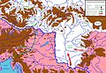
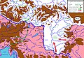
 Gepid kingdom 6th century - es.svg 1,102 × 1,154; 218 KB
-
 Gepid kingdom 6th century - pt.svg 1,102 × 1,154; 223 KB
-
 Gepid kingdom 6th century - ru.svg 1,033 × 1,082; 161 KB
-
 Gepid kingdom 6th century - zh.svg 1,102 × 1,154; 82 KB
-
 Gepid kingdom 6th century-hu.svg 1,102 × 1,154; 70 KB
-
 Gepid kingdom 6th century-sr.png 858 × 894; 53 KB
-
 Gepid kingdom 6th century.png 858 × 894; 55 KB
-
 Great Moravia-deu.png 1,323 × 1,122; 533 KB
-
 Hongrie. Région des Carpathes - btv1b8446072h.jpg 10,798 × 6,327; 8.66 MB
-
 Hunnenwanderung.png 1,024 × 764; 553 KB
-
 Huns450.png 719 × 697; 185 KB
-
 Huns450es.svg 3,202 × 2,535; 1.06 MB
-
 Karpaten BV042518404.jpg 3,984 × 3,465; 2.15 MB
-

-
 Lombard state 526.png 986 × 704; 51 KB
-
 Longobárd állam.jpg 963 × 580; 95 KB
-
 Marcomannia e Sarmatia 170 dC V1.1 fr.png 1,280 × 886; 1.76 MB
-
 Marcomannia e Sarmatia 170 dC V1.1.JPG 1,280 × 886; 280 KB
-
 Marcomannia e Sarmatia 170 dC.jpg 1,280 × 886; 286 KB
-
 NE 600ad.jpg 1,439 × 1,086; 502 KB
-
 Poland under Boleslaw Chrobry.jpg 604 × 384; 83 KB
-
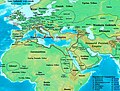
 Roman Empire 125 (cropped).png 487 × 308; 171 KB
-
 Roman Empire 125 general map-zh.png 2,732 × 2,271; 6.07 MB
-
 Roman Empire 125 general map-zh.svg 2,732 × 2,271; 6.55 MB
-
 Roman Empire 125 general map.SVG 2,186 × 1,817; 1.77 MB
-
 Roman Empire 125 political map-de.svg 2,186 × 1,817; 6.32 MB
-
 Roman Empire 125 political map-zh.png 2,049 × 1,703; 2.99 MB
-
 Roman Empire 125 political map-zh.svg 2,732 × 2,271; 2.02 MB
-
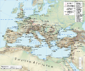
 Roman Empire 125 political map.png 2,186 × 1,817; 3.21 MB
-
 Roman Empire 125 political map.svg 2,186 × 1,817; 3.25 MB
-
 Roman Empire 125.png 2,186 × 1,817; 4.43 MB
-
 Vandals Migration it.PNG 1,725 × 1,739; 527 KB

_-_btv1b53063657k.jpg)


_Hongrie_-_R%C3%A9gion_des_Carpathes_-_btv1b53063698p_(2_of_2).jpg)


._Traduit_de_l%27allemand,_avec_l%27autorisation_de_l%27auteur_et_annot%C3%A9e_sous_la_direction_de_Emm._de_Margerie._Avec_une_pr%C3%A9f._par_Marcel_Bertrand_(1897)_(14775872444).jpg)


.png)


