Category:Historical maps of Zittau
Jump to navigation
Jump to search
Media in category "Historical maps of Zittau"
The following 18 files are in this category, out of 18 total.
-
 Bundesarchiv Bild 196-05054, Zittau ( Nord ).jpg 800 × 789; 132 KB
-
 Bundesarchiv Bild 196-05154, Zittau ( Süd ).jpg 800 × 658; 81 KB
-
 Fotothek df rp-c 0690048 Zittau. Oberreit, Sect. Zittau, 1844-46.jpg 800 × 515; 266 KB
-

-

-

-

-

-

-

-

-

-
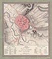 Grundriss Zittau 1805.jpg 6,731 × 7,638; 14.2 MB
-
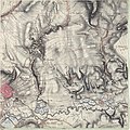
 Meilenblatt B 362 Olbersdorf.jpg 8,560 × 8,560; 26.68 MB
-
 Meilenblatt B 363 Zittau.jpg 8,570 × 8,550; 30.57 MB
-
 Meilenblatt B 365 Eichgraben.jpg 8,570 × 8,530; 16.95 MB
-
 Zittau 1744.jpg 500 × 442; 103 KB
-
 Zittau-1647-Merian.jpg 3,176 × 2,486; 2.22 MB
.jpg)
.jpg)


.jpg)
.jpg)
.jpg)
_und_Pfortm%C3%BChle_(T),_Ausschnitt_aus,_Prospekt_der_Stadt.jpg)
_und_Pfortm%C3%BChle_(T),_Ausschnitt_aus,_Prospekt_der_Stadt.jpg)
_und_Hospital_St._Jacob_(O),_Ausschnitt_aus,_Prospekt_d.jpg)
.jpg)
,_Ausschnitt_aus,_Die_Stadt_Zittau_1643_(Sign.,_VIII_129).jpg)


