Category:Historical maps of Berlin (georeferenced)
Jump to navigation
Jump to search
English: This Category contains old map sheets of Berlin that are georeferenced and rectified
Deutsch: Diese Kategorie enthält alte Karten von Berlin, die entzerrt und georeferenziert wurden, um sie zum Beispiel in GoogleEarth anzeigen zu können
Media in category "Historical maps of Berlin (georeferenced)"
The following 8 files are in this category, out of 8 total.
-
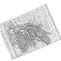
 Brockhaus 14 Karte Berlin und Umgebung (rectified).jpg 3,516 × 3,000; 4.61 MB
-
 Lindholz Plan von Berlin und Koeln um 1660 (georeferenced).png 1,008 × 941; 359 KB
-
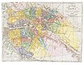
 Map de berlin 1789 (georeferenced).jpg 1,648 × 1,373; 1.24 MB
-
 Rhode Berlin 1772 (Lotter) (georeferenced).jpg 5,750 × 4,290; 4.74 MB
-
 Schmettau Plan de la ville de Berlin (georeferenced) (Panke-SchönhauserGraben).jpg 1,786 × 1,359; 1.08 MB
-
 Schmettau Plan de la ville de Berlin (georeferenced).jpg 5,200 × 5,224; 5.73 MB
-
 Selter Grundriss von Berlin 1846 (georeferenced) (Blumenstraße).jpg 2,303 × 1,483; 1.18 MB
-
 Selter Grundriss von Berlin 1846 (georeferenced).jpg 9,500 × 7,347; 11.44 MB
.jpg)
.png)
.jpg)
_(georeferenced).jpg)
_(Panke-Sch%C3%B6nhauserGraben).jpg)
.jpg)
_(Blumenstra%C3%9Fe).jpg)
.jpg)