Category:Historical maps of Adana
Jump to navigation
Jump to search
Media in category "Historical maps of Adana"
The following 11 files are in this category, out of 11 total.
-
 1752 Adena detail map Turkish Empire by Moll BPL 17082.png 1,068 × 748; 1.87 MB
-
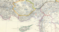 1861 Adana detail map Turkey in Asia, Asia Minor, and Transcaucasia by Johnston.png 1,249 × 686; 1.73 MB
-
 1998ceyhanearthquake.png 179 × 98; 12 KB
-
 A new map of Turkey in Asia by Monsr d'Anville-detail.png 2,290 × 1,328; 4.85 MB
-
 Adana 1909.png 676 × 463; 185 KB
-
 Adana Yeşiloba Şehitliği.png 1,016 × 564; 32 KB
-

-
 Karte Des Taurus und seiner Nebenzweige in den Paschaliken Adana und Marasch.jpg 7,042 × 9,204; 16.7 MB
-
 Map of Asia Minor (detail) 1777.png 2,098 × 1,184; 2.69 MB
-
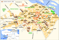
 The City of Adana.gif 700 × 488; 72 KB
-
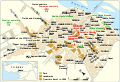 The City of Adana.svg 692 × 471; 478 KB


%27_(11058812926).jpg)

_1777.png)

