Category:Historical map series for Israel and Palestine
Jump to navigation
Jump to search
Media in category "Historical map series for Israel and Palestine"
The following 200 files are in this category, out of 1,751 total.
(previous page) (next page)-
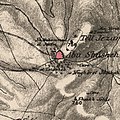
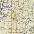
 Beit itab on 1920s map.png 667 × 478; 805 KB
-
 Historical map series for the area of 'Ajjur (1870s).jpg 737 × 741; 259 KB
-

-
 Historical map series for the area of 'Ajjur (1940s).jpg 737 × 741; 342 KB
-
 Historical map series for the area of 'Ajjur (modern).jpg 737 × 741; 94 KB
-
 Historical map series for the area of 'Akbara (1870s).jpg 747 × 751; 242 KB
-

-
 Historical map series for the area of 'Akbara (1940s).jpg 747 × 751; 303 KB
-
 Historical map series for the area of 'Akbara (modern).jpg 747 × 751; 75 KB
-
 Historical map series for the area of Abil al-Qamh (1870s).jpg 750 × 754; 260 KB
-

-
 Historical map series for the area of Abil al-Qamh (1940s).jpg 750 × 754; 294 KB
-
 Historical map series for the area of Abil al-Qamh (modern).jpg 750 × 754; 74 KB
-
 Historical map series for the area of Abu al-Fadl, Ramle (1870s).jpg 739 × 743; 176 KB
-
-
 Historical map series for the area of Abu al-Fadl, Ramle (1940s).jpg 739 × 743; 252 KB
-
 Historical map series for the area of Abu al-Fadl, Ramle (modern).jpg 739 × 743; 157 KB
-
 Historical map series for the area of Abu Kishk (1870s).jpg 741 × 745; 177 KB
-

-
 Historical map series for the area of Abu Kishk (1940s).jpg 741 × 745; 252 KB
-
 Historical map series for the area of Abu Kishk (modern).jpg 741 × 745; 134 KB
-
 Historical map series for the area of Abu Shusha (1870s).jpg 739 × 742; 245 KB
-

-
 Historical map series for the area of Abu Shusha (1940s).jpg 739 × 742; 281 KB
-
 Historical map series for the area of Abu Shusha (modern).jpg 739 × 742; 69 KB
-
 Historical map series for the area of Abu Shusha, Haifa (1870s).jpg 745 × 748; 167 KB
-
-
 Historical map series for the area of Abu Shusha, Haifa (1940s).jpg 745 × 748; 323 KB
-
 Historical map series for the area of Abu Shusha, Haifa (modern).jpg 745 × 748; 114 KB
-
 Historical map series for the area of Abu Zurayq (1870s).jpg 745 × 749; 178 KB
-

-
 Historical map series for the area of Abu Zurayq (1940s).jpg 745 × 749; 314 KB
-
 Historical map series for the area of Abu Zurayq (modern).jpg 745 × 749; 123 KB
-
 Historical map series for the area of Achziv (1870s).jpg 748 × 752; 171 KB
-

-
 Historical map series for the area of Achziv (1940s).jpg 748 × 752; 194 KB
-
 Historical map series for the area of Achziv (modern).jpg 748 × 752; 93 KB
-
 Historical map series for the area of Acre, Israel (1870s).jpg 872 × 876; 238 KB
-
 Historical map series for the area of Acre, Israel (modern).jpg 872 × 876; 246 KB
-
 Historical map series for the area of Ajanjul (1870s).jpg 739 × 742; 195 KB
-

-
 Historical map series for the area of Ajanjul (1940s).jpg 739 × 742; 286 KB
-
 Historical map series for the area of Ajanjul (modern).jpg 739 × 742; 106 KB
-
 Historical map series for the area of al-'Abbasiyya (1870s).jpg 740 × 744; 147 KB
-

-
 Historical map series for the area of al-'Abbasiyya (1940s).jpg 740 × 744; 216 KB
-
 Historical map series for the area of al-'Abbasiyya (modern).jpg 740 × 744; 165 KB
-
 Historical map series for the area of al-'Abisiyya (1870s).jpg 750 × 753; 113 KB
-

-
 Historical map series for the area of al-'Abisiyya (1940s).jpg 750 × 753; 259 KB
-
 Historical map series for the area of al-'Abisiyya (modern).jpg 750 × 753; 68 KB
-
 Historical map series for the area of al-'Ubaydiyya (1870s).jpg 745 × 749; 176 KB
-

-
 Historical map series for the area of al-'Ubaydiyya (1940s).jpg 745 × 749; 246 KB
-
 Historical map series for the area of al-'Ubaydiyya (modern).jpg 745 × 749; 75 KB
-
 Historical map series for the area of al-'Ulmaniyya (1870s).jpg 749 × 752; 145 KB
-
-
 Historical map series for the area of al-'Ulmaniyya (1940s).jpg 749 × 752; 220 KB
-
 Historical map series for the area of al-'Ulmaniyya (modern).jpg 749 × 752; 80 KB
-

-
 Historical map series for the area of al-'Urayfiyya (1940s).jpg 624 × 753; 199 KB
-
 Historical map series for the area of al-'Urayfiyya (modern).jpg 624 × 753; 45 KB
-
 Historical map series for the area of al-Ashrafiyya (1870s).jpg 744 × 747; 155 KB
-

-
 Historical map series for the area of al-Ashrafiyya (1940s).jpg 744 × 747; 238 KB
-
 Historical map series for the area of al-Ashrafiyya (modern).jpg 744 × 747; 85 KB
-
 Historical map series for the area of al-Barriyya (1870s).jpg 739 × 742; 224 KB
-

-
 Historical map series for the area of al-Barriyya (1940s).jpg 739 × 742; 239 KB
-
 Historical map series for the area of al-Barriyya (modern).jpg 739 × 742; 91 KB
-
 Historical map series for the area of al-Bassa (1870s).jpg 749 × 752; 254 KB
-

-
 Historical map series for the area of al-Bassa (1940s).jpg 749 × 752; 278 KB
-
 Historical map series for the area of al-Bassa (modern).jpg 749 × 752; 139 KB
-
 Historical map series for the area of al-Batani al-Gharbi (1870s).jpg 738 × 741; 156 KB
-

-
 Historical map series for the area of al-Batani al-Gharbi (1940s).jpg 738 × 741; 205 KB
-

-
 Historical map series for the area of al-Batani al-Sharqi (1870s).jpg 738 × 741; 136 KB
-
-
 Historical map series for the area of al-Batani al-Sharqi (1940s).jpg 738 × 741; 197 KB
-
-
 Historical map series for the area of al-Bira, Baysan (1870s).jpg 745 × 748; 201 KB
-
-
 Historical map series for the area of al-Bira, Baysan (1940s).jpg 745 × 748; 271 KB
-
 Historical map series for the area of al-Bira, Baysan (modern).jpg 745 × 748; 51 KB
-
 Historical map series for the area of al-Birwa (1870s).jpg 747 × 751; 228 KB
-
-
 Historical map series for the area of al-Birwa (1940s).jpg 747 × 751; 274 KB
-
 Historical map series for the area of al-Birwa (modern).jpg 747 × 751; 96 KB
-
 Historical map series for the area of al-Burayj (1870s).jpg 738 × 741; 244 KB
-

-
 Historical map series for the area of al-Burayj (1940s).jpg 738 × 741; 323 KB
-
 Historical map series for the area of al-Burayj (modern).jpg 738 × 741; 52 KB
-
 Historical map series for the area of al-Burj, Ramle (1870s).jpg 739 × 743; 185 KB
-

-
 Historical map series for the area of al-Burj, Ramle (1940s).jpg 739 × 743; 257 KB
-
 Historical map series for the area of al-Burj, Ramle (modern).jpg 739 × 743; 219 KB
-
 Historical map series for the area of al-Butayha (1870s).jpg 747 × 751; 152 KB
-

-
 Historical map series for the area of al-Butayha (1940s).jpg 747 × 751; 226 KB
-
 Historical map series for the area of al-Butayha (modern).jpg 747 × 751; 67 KB
-
 Historical map series for the area of al-Butaymat (1870s).jpg 744 × 748; 209 KB
-

-
 Historical map series for the area of al-Butaymat (1940s).jpg 744 × 748; 286 KB
-
 Historical map series for the area of al-Butaymat (modern).jpg 744 × 748; 77 KB
-
 Historical map series for the area of al-Buwayziyya (1870s).jpg 749 × 753; 248 KB
-

-
 Historical map series for the area of al-Buwayziyya (1940s).jpg 749 × 753; 274 KB
-
 Historical map series for the area of al-Buwayziyya (modern).jpg 749 × 753; 64 KB
-
-
 Historical map series for the area of al-Dalhamiyya (1940s).jpg 745 × 749; 212 KB
-
 Historical map series for the area of al-Dalhamiyya (modern).jpg 745 × 749; 69 KB
-
 Historical map series for the area of al-Damun (1870s).jpg 747 × 751; 204 KB
-

-
 Historical map series for the area of al-Damun (1940s).jpg 747 × 751; 266 KB
-
 Historical map series for the area of al-Damun (modern).jpg 747 × 751; 61 KB
-
 Historical map series for the area of al-Dawayima (1870s).jpg 736 × 740; 224 KB
-
-
 Historical map series for the area of al-Dawayima (1940s).jpg 736 × 740; 303 KB
-
 Historical map series for the area of al-Dawayima (modern).jpg 736 × 740; 59 KB
-
 Historical map series for the area of al-Dawwara (1870s).jpg 750 × 753; 73 KB
-
-
 Historical map series for the area of al-Dawwara (1940s).jpg 750 × 753; 227 KB
-
 Historical map series for the area of al-Dawwara (modern).jpg 750 × 753; 69 KB
-

-
 Historical map series for the area of al-Dirbashiyya (1940s).jpg 624 × 752; 192 KB
-
 Historical map series for the area of al-Dirbashiyya (modern).jpg 624 × 752; 44 KB
-
 Historical map series for the area of al-Dirdara (1870s).jpg 748 × 752; 91 KB
-
-
 Historical map series for the area of al-Dirdara (1940s).jpg 748 × 752; 186 KB
-
 Historical map series for the area of al-Dirdara (modern).jpg 748 × 752; 56 KB
-
 Historical map series for the area of al-Faluja (1870s).jpg 737 × 740; 131 KB
-

-
 Historical map series for the area of al-Faluja (1940s).jpg 737 × 740; 231 KB
-
 Historical map series for the area of al-Faluja (modern).jpg 737 × 740; 109 KB
-
 Historical map series for the area of al-Fatur (1870s).jpg 743 × 747; 152 KB
-
-
 Historical map series for the area of al-Fatur (1940s).jpg 743 × 747; 210 KB
-
 Historical map series for the area of al-Fatur (modern).jpg 743 × 747; 68 KB
-
 Historical map series for the area of al-Ghabisiyya (1870s).jpg 748 × 752; 203 KB
-

-
 Historical map series for the area of al-Ghabisiyya (1940s).jpg 748 × 752; 179 KB
-
 Historical map series for the area of al-Ghabisiyya (modern).jpg 748 × 752; 81 KB
-
 Historical map series for the area of al-Ghazzawiyya (1870s).jpg 744 × 747; 136 KB
-

-
 Historical map series for the area of al-Ghazzawiyya (1940s).jpg 744 × 747; 249 KB
-
 Historical map series for the area of al-Ghazzawiyya (modern).jpg 744 × 747; 109 KB
-
 Historical map series for the area of al-Ghubayya al-Fawqa (1870s).jpg 745 × 748; 182 KB
-
-
 Historical map series for the area of al-Ghubayya al-Fawqa (1940s).jpg 745 × 748; 325 KB
-
 Historical map series for the area of al-Ghubayya al-Fawqa (modern).jpg 745 × 748; 105 KB
-
 Historical map series for the area of al-Ghubayya al-Tahta (1870s).jpg 745 × 748; 171 KB
-
-
 Historical map series for the area of al-Ghubayya al-Tahta (1940s).jpg 745 × 748; 327 KB
-
 Historical map series for the area of al-Ghubayya al-Tahta (modern).jpg 745 × 748; 116 KB
-
 Historical map series for the area of al-Haditha, Ramle (1870s).jpg 739 × 743; 235 KB
-
-
 Historical map series for the area of al-Haditha, Ramle (1940s).jpg 739 × 743; 284 KB
-
 Historical map series for the area of al-Haditha, Ramle (modern).jpg 739 × 743; 144 KB
-
 Historical map series for the area of al-Hamidiyya (1870s).jpg 744 × 748; 204 KB
-
-
 Historical map series for the area of al-Hamidiyya (1940s).jpg 744 × 748; 272 KB
-
 Historical map series for the area of al-Hamidiyya (modern).jpg 744 × 748; 51 KB
-
 Historical map series for the area of al-Hamma, Tiberias (1870s).jpg 745 × 749; 56 KB
-

-

-
 Historical map series for the area of al-Hamra' (1940s).jpg 749 × 753; 193 KB
-
 Historical map series for the area of al-Hamra' (modern).jpg 749 × 753; 74 KB
-
 Historical map series for the area of al-Hamra, Baysan (1870s).jpg 743 × 747; 146 KB
-

-
 Historical map series for the area of al-Hamra, Baysan (1940s).jpg 743 × 747; 232 KB
-
 Historical map series for the area of al-Hamra, Baysan (modern).jpg 743 × 747; 44 KB
-
 Historical map series for the area of al-Haram, Jaffa (1870s).jpg 741 × 745; 156 KB
-

-
 Historical map series for the area of al-Haram, Jaffa (1940s).jpg 741 × 745; 212 KB
-
 Historical map series for the area of al-Haram, Jaffa (modern).jpg 741 × 745; 136 KB
-
 Historical map series for the area of al-Husayniyya, Safad (1870s).jpg 748 × 752; 159 KB
-

-
 Historical map series for the area of al-Husayniyya, Safad (1940s).jpg 748 × 752; 203 KB
-

-
 Historical map series for the area of Al-Imara (1870s).jpg 734 × 738; 219 KB
-

-
 Historical map series for the area of Al-Imara (1940s).jpg 734 × 738; 206 KB
-
 Historical map series for the area of Al-Imara (modern).jpg 734 × 738; 60 KB
-
 Historical map series for the area of al-Ja'una (1870s).jpg 748 × 751; 221 KB
-
-
 Historical map series for the area of al-Ja'una (1940s).jpg 748 × 751; 293 KB
-
 Historical map series for the area of al-Ja'una (modern).jpg 748 × 751; 144 KB
-
 Historical map series for the area of al-Jaladiyya (1870s).jpg 737 × 741; 158 KB
-
-
 Historical map series for the area of al-Jaladiyya (1940s).jpg 737 × 741; 234 KB
-
 Historical map series for the area of al-Jaladiyya (modern).jpg 737 × 741; 65 KB
-
 Historical map series for the area of al-Jalama, Haifa (1870s).jpg 746 × 749; 206 KB
-
-
 Historical map series for the area of al-Jalama, Haifa (1940s).jpg 746 × 749; 315 KB
-
 Historical map series for the area of al-Jalama, Haifa (modern).jpg 746 × 749; 126 KB
-
 Historical map series for the area of al-Jalama, Tulkarm (1870s).jpg 743 × 747; 127 KB
-

-
 Historical map series for the area of al-Jalama, Tulkarm (1940s).jpg 743 × 747; 170 KB

.jpg)
.jpg)
.jpg)
.jpg)
.jpg)
.jpg)
.jpg)
.jpg)
.jpg)
.jpg)
.jpg)
.jpg)
.jpg)
.jpg)
.jpg)
.jpg)
.jpg)
.jpg)
.jpg)
.jpg)
.jpg)
.jpg)
.jpg)
.jpg)
.jpg)
.jpg)
.jpg)
.jpg)
.jpg)
.jpg)
.jpg)
.jpg)
.jpg)
.jpg)
.jpg)
.jpg)
.jpg)
.jpg)
.jpg)
.jpg)
.jpg)
.jpg)
.jpg)
.jpg)
.jpg)
.jpg)
.jpg)
.jpg)
.jpg)
.jpg)
.jpg)
.jpg)
.jpg)
.jpg)
.jpg)
.jpg)
.jpg)
.jpg)
.jpg)
.jpg)
.jpg)
.jpg)
.jpg)
.jpg)
.jpg)
.jpg)
.jpg)
.jpg)
.jpg)
.jpg)
.jpg)
.jpg)
.jpg)
.jpg)
.jpg)
.jpg)
.jpg)
.jpg)
.jpg)
.jpg)
.jpg)
.jpg)
.jpg)
.jpg)
.jpg)
.jpg)
.jpg)
.jpg)
.jpg)
.jpg)
.jpg)
.jpg)
.jpg)
.jpg)
.jpg)
.jpg)
.jpg)
.jpg)
.jpg)
.jpg)
.jpg)
.jpg)
.jpg)
.jpg)
.jpg)
.jpg)
.jpg)
.jpg)
.jpg)
.jpg)
.jpg)
.jpg)
.jpg)
.jpg)
.jpg)
.jpg)
.jpg)
.jpg)
.jpg)
.jpg)
.jpg)
.jpg)
.jpg)
.jpg)
.jpg)
.jpg)
.jpg)
.jpg)
.jpg)
.jpg)
.jpg)
.jpg)
.jpg)
.jpg)
.jpg)
.jpg)
.jpg)
.jpg)
.jpg)
.jpg)
.jpg)
.jpg)
.jpg)
.jpg)
.jpg)
.jpg)
.jpg)
.jpg)
.jpg)
.jpg)
.jpg)
.jpg)
.jpg)
.jpg)
.jpg)
.jpg)
.jpg)
.jpg)
.jpg)
.jpg)
.jpg)
.jpg)
.jpg)
.jpg)
.jpg)
.jpg)
.jpg)
.jpg)
.jpg)
.jpg)
.jpg)
.jpg)
.jpg)
.jpg)
.jpg)
.jpg)
.jpg)
.jpg)
.jpg)
.jpg)
.jpg)
.jpg)
.jpg)
.jpg)
.jpg)
.jpg)
.jpg)
.jpg)
.jpg)
.jpg)
.jpg)
.jpg)
.jpg)
.jpg)
.jpg)
.jpg)
.jpg)
.jpg)
.jpg)