Category:Historical images of Caudry
Jump to navigation
Jump to search
| Object location | | View all coordinates using: OpenStreetMap |
|---|
Français : Cette catégorie regroupe les images anciennes de Caudry. Pour les images contemporaines, voir Category:Caudry.
Media in category "Historical images of Caudry"
The following 68 files are in this category, out of 68 total.
-
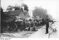 Bundesarchiv Bild 146-1977-106-31, Deutsche Versorgungstruppe.jpg 800 × 537; 61 KB
-
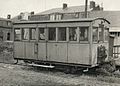 Caudry - Autorail Campagne n° 4 des Chemins de fer du Cambrésis.jpg 1,356 × 971; 753 KB
-
 Caudry - Basilique Sainte-Maxellende en 1923.jpg 898 × 1,435; 618 KB
-
 Caudry - Basilique Sainte-Maxellende.jpg 873 × 1,303; 451 KB
-
 Caudry - Chapelle Sainte-Maxellende en 1936.jpg 980 × 1,551; 335 KB
-
 Caudry - Chapelle Sainte-Maxellende.jpg 866 × 1,278; 750 KB
-
 Caudry - Château Pirou et Chapelle Sainte-Maxellende en 1925.jpg 1,557 × 977; 798 KB
-
 Caudry - Draisine M22 des Chemins de fer du Cambrésis.jpg 1,446 × 932; 712 KB
-
 Caudry - Entrée du Stade Louis-Sandras.jpg 1,284 × 836; 540 KB
-
 Caudry - Fabrication de la dentelle.jpg 1,426 × 893; 675 KB
-
 Caudry - Gare (A).jpg 1,437 × 865; 601 KB
-
 Caudry - Gare (B).jpg 1,288 × 828; 661 KB
-
 Caudry - Gare (C).jpg 1,503 × 944; 837 KB
-
 Caudry - Gare des Chemins de fer du Cambrésis.jpg 1,572 × 981; 688 KB
-
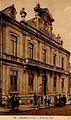
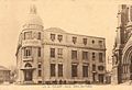
 Caudry - Hôtel de ville (B).jpg 1,506 × 985; 933 KB
-
 Caudry - Hôtel de ville.jpg 757 × 1,278; 732 KB
-
 Caudry - Hôtel des Postes en 1914.jpg 1,438 × 994; 957 KB
-
 Caudry - Hôtel des Postes.jpg 1,437 × 987; 780 KB
-
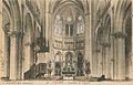 Caudry - Intérieur de la Basilique Sainte-Maxellende.jpg 1,558 × 995; 798 KB
-
 Caudry - L'abside de la Basilique Sainte-Maxellende.jpg 1,445 × 921; 689 KB
-
 Caudry - La Retorderie.jpg 1,279 × 821; 560 KB
-
 Caudry - La Rue Bonneville en 1911.jpg 1,526 × 945; 839 KB
-
 Caudry - La Sucrerie.jpg 1,508 × 937; 636 KB
-
 Caudry - Le Chœur de la Basilique Sainte-Maxellende.jpg 770 × 1,300; 475 KB
-
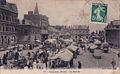 Caudry - Le marché.jpg 1,534 × 946; 656 KB
-
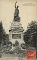 Caudry - Le Monument aux Morts en 1927.jpg 793 × 1,279; 509 KB
-
 Caudry - Le square en 1924.jpg 1,530 × 970; 769 KB
-
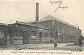 Caudry - Les Ateliers Gabet-Devouge et la Société Caudrésienne en 1904.jpg 1,471 × 965; 799 KB
-
 Caudry - Locomotive des Chemins de fer du Cambrésis (A).jpg 1,365 × 955; 577 KB
-
 Caudry - Locomotive des Chemins de fer du Cambrésis (B).jpg 1,367 × 978; 666 KB
-
 Caudry - Locomotive des Chemins de fer du Cambrésis (C).jpg 1,346 × 959; 675 KB
-
 Caudry - Locomotive des Chemins de fer du Cambrésis (D).jpg 1,441 × 986; 629 KB
-
 Caudry - Locomotive Super-Pacific en gare.jpg 1,329 × 976; 752 KB
-
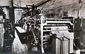
 Caudry - Métier à broder Saurer.jpg 1,430 × 912; 786 KB
-
 Caudry - Métiers pour la fabrication des rideaux.jpg 1,567 × 961; 723 KB
-
 Caudry - Photochrome de l'Hospice des Vieillards en 1906.jpg 1,276 × 820; 731 KB
-
 Caudry - Photochrome de la Rue Gambetta.jpg 1,506 × 955; 915 KB
-
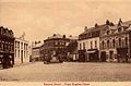 Caudry - Place Eugène-Fiévet.jpg 1,426 × 941; 744 KB
-
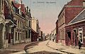
 Caudry - Rue de Saint-Quentin.jpg 1,302 × 805; 570 KB
-
 Caudry - Rue de Valenciennes.jpg 1,437 × 902; 855 KB
-
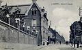
 Caudry - Rue Jacquard, École de Filles en 1922.jpg 1,525 × 985; 933 KB
-
 Caudry - Un coin du square Fiévet en 1920.jpg 1,509 × 970; 775 KB
-
 Caudry - Un métier à dentelle avec son Jacquard.jpg 1,293 × 827; 623 KB
-
 Caudry - Un métier à dentelle en 1924.jpg 1,472 × 888; 675 KB
-
 Caudry - Un train arrive en gare.jpg 1,079 × 751; 486 KB
-
 Caudry - Voiture à essieux des Chemins de fer du Cambrésis.jpg 1,352 × 862; 571 KB
-
 Caudry - Vue panoramique en 1907.jpg 1,505 × 881; 573 KB
-
 Caudry - Vue panoramique en 1929.jpg 1,521 × 975; 1.01 MB
-
 Caudry - Vue panoramique.jpg 1,336 × 753; 628 KB
-
 Caudry - Vue sur la gare des Chemins de fer du Cambrésis.jpg 1,452 × 883; 547 KB
-
 Caudry - Wagon des Chemins de fer du Cambrésis (B).jpg 1,361 × 956; 621 KB
-
 Caudry - Wagon des Chemins de fer du Cambrésis.jpg 1,443 × 975; 542 KB
-
 Caudry - Wagon-voyageurs des Chemins de fer du Cambrésis (B).jpg 1,577 × 974; 687 KB
-
 Caudry - Wagon-voyageurs des Chemins de fer du Cambrésis.jpg 1,342 × 949; 641 KB
-
 Caudry - Wagons-citernes des Chemins de fer du Cambrésis.jpg 1,454 × 995; 595 KB
-
 Caudry Kommandantur.jpg 821 × 537; 350 KB
-
 Mairie Caudry.jpg 1,277 × 425; 327 KB
-
 Markt Caudry Anf20Jh 150px.jpg 639 × 469; 48 KB
-
 Ortskommandantur 1WK.jpg 637 × 462; 47 KB
-
 Caudry - Fabrique Preux et Carpentier dite Transvaal.jpg 1,517 × 1,009; 662 KB
-
 Caudry - La sortie du Transvaal.jpg 1,292 × 826; 626 KB
-
 Caudry - Photochrome des Ateliers Carpentier et Preux en 1906.jpg 1,526 × 985; 913 KB
-
 Caudry - Usine du Transvaal.jpg 1,299 × 827; 559 KB
-
 Caudry - Fabrication du tulle, Métier à broder.jpg 1,530 × 979; 875 KB
-
 Caudry - Fabrication du tulle, Mécanique à dévider, en 1909.jpg 1,526 × 982; 869 KB
-
 Caudry - Machine à tulle grec.jpg 1,521 × 956; 981 KB
-
 Caudry - Métier à tulle uni.jpg 1,431 × 929; 1,021 KB
-
 Caudry - Métiers pour la fabrication du tulle.jpg 1,336 × 831; 573 KB


.jpg)
.jpg)
.jpg)

.jpg)


.jpg)
.jpg)
.jpg)
.jpg)


.jpg)

.jpg)


