Category:Historic Maps of Berlin-Reinickendorf
Jump to navigation
Jump to search
Media in category "Historic Maps of Berlin-Reinickendorf"
The following 14 files are in this category, out of 14 total.
-
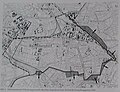
 Schneider, Plan von Berlin, 1802; Berlin-Reinickendorf (cropped).jpg 1,012 × 656; 269 KB
-
 Berlin 1905 Meyers Konversationslexikon 6. Auflage; Berlin-Reinickendorf (cropped).jpg 1,948 × 1,261; 1.38 MB
-
 Boehm Umgebungskarte von Berlin 1851; Berlin-Reinickendorf (cropped).jpg 1,768 × 1,026; 993 KB
-
 Brockhaus14Karte-BerlinUndUmgebung-Rosenthal.jpg 922 × 621; 398 KB
-
 Gedenktafel Wittestr 37 (Reind) Russiche Kirche5.jpg 3,651 × 2,672; 7.77 MB
-

-

-

-

-
 Straube Umgegend von Berlin und Potsdam 1886; Berlin-Reinickendorf (cropped).jpg 1,549 × 954; 753 KB
-

-

-
 Urmesstischblatt 3446 (Berlin Nord) um 1840; Berlin-Reinickendorf (cropped).jpg 1,269 × 1,117; 739 KB
-
 Wilhelmsruh Gebietsaustausch 1938.jpg 648 × 498; 73 KB
.jpg)
.jpg)
.jpg)

_Russiche_Kirche5.jpg)
_in_12_Bl%C3%A4ttern_VI_Berlin;_Berlin-Reinickendorf_(cropped).jpg)
.jpg)
.jpg)
.jpg)
.jpg)
.jpg)
;_Berlin-Reinickendorf_(cropped).jpg)
_um_1840;_Berlin-Reinickendorf_(cropped).jpg)
