Category:Hirwaun
Jump to navigation
Jump to search
Cymraeg: Pentref ger Aberdâr ym mhen gogleddol Cwm Cynon, Rhondda Cynon Taf, yw Hirwaun. Yn ôl y cyfrifiad diwethaf yn 2001, y mae rhyw 4,000 o drigolion yn byw yn y pentref a hynny'n tyfu o hyd wrth i fwy o ystadau tai newydd gael eu codi.
English: Hirwaun (Welsh meaning : 'Long Meadow') is the name of an electoral ward, a community, and a village at the northwest end of the Cynon Valley in the County Borough of Rhondda Cynon Taf, South Wales. The village of Hirwaun is four miles from the town of Aberdare, and comes under Aberdare for postal reasons. According to the 2001 census, Hirwaun has a population of around 4,000 people.
village and community in Rhondda Cynon Taf, Wales, UK   | |||||
| Upload media | |||||
| Instance of | |||||
|---|---|---|---|---|---|
| Location | Rhondda Cynon Taf, Wales | ||||
| Heritage designation |
| ||||
| Population |
| ||||
 | |||||
Subcategories
This category has the following 2 subcategories, out of 2 total.
H
- Hirwaun War Memorial (8 F)
P
Media in category "Hirwaun"
The following 200 files are in this category, out of 530 total.
(previous page) (next page)-
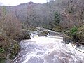 'Looneys Leap' - geograph.org.uk - 4771570.jpg 1,280 × 960; 301 KB
-
 2010 Wales Rhondda Cynon Taf Community Hirwaun map.svg 512 × 737; 416 KB
-
 2024 Wales Rhondda Cynon Taf Community Hirwaun map.svg 512 × 737; 369 KB
-
 A casualty of Storm Dennis - geograph.org.uk - 6399246.jpg 2,048 × 1,536; 2.05 MB
-
 A coal train departs from Tower. - geograph.org.uk - 843332.jpg 640 × 423; 74 KB
-
 A coal train is loading at Tower Mine - geograph.org.uk - 804420.jpg 640 × 436; 69 KB
-

-
 A virgin stile - geograph.org.uk - 6739475.jpg 1,536 × 2,048; 1.3 MB
-
 A4059 at Penderyn - geograph.org.uk - 2223871.jpg 640 × 480; 53 KB
-
 A4059 at Penderyn Distillery - geograph.org.uk - 3133379.jpg 640 × 480; 488 KB
-
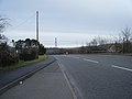 A4059 near Hirwaun - geograph.org.uk - 2223861.jpg 640 × 480; 49 KB
-
 A465 east of Hirwaun - geograph.org.uk - 3791615.jpg 640 × 481; 55 KB
-
 A465 south of Bryn Du - geograph.org.uk - 3791077.jpg 640 × 481; 51 KB
-
 A465 west of Nant-hir Reservoir - geograph.org.uk - 3791610.jpg 640 × 480; 78 KB
-
 A470 at Brecon Beacons National Park boundary - geograph.org.uk - 5896111.jpg 1,024 × 820; 177 KB
-
 Abandoned mine workings by the river Sychryd - geograph.org.uk - 2909048.jpg 1,024 × 768; 213 KB
-
 Abandoned quarry, Cadair Fawr - geograph.org.uk - 516676.jpg 640 × 480; 157 KB
-
 Above the Hepste valley - geograph.org.uk - 6739696.jpg 2,048 × 1,536; 1.21 MB
-
 Afon Hepste - geograph.org.uk - 1445230.jpg 640 × 480; 147 KB
-
 Afon Mellte - geograph.org.uk - 3512204.jpg 690 × 518; 227 KB
-

-
 Ancient and modern on Mynydd y Glog - geograph.org.uk - 3720071.jpg 640 × 480; 51 KB
-

-
 Beacons Park bungalows, Penderyn - geograph.org.uk - 3059796.jpg 640 × 430; 64 KB
-
 Behind Sgwd yr Eira - geograph.org.uk - 3523541.jpg 960 × 720; 142 KB
-
 Behind Sgwd yr Eira waterfall - geograph.org.uk - 2777289.jpg 640 × 480; 79 KB
-
 Behind the watery curtain - Penderyn, Rhondda Cynon Taf - geograph.org.uk - 3952428.jpg 1,484 × 1,012; 398 KB
-

-
 Berth-lwyd farm at Nant-Ddu - geograph.org.uk - 4399815.jpg 640 × 480; 120 KB
-

-
 Bluebells at the Llwyn-onn Reservoir - geograph.org.uk - 6047386.jpg 800 × 582; 206 KB
-

-
 Boundary wall - geograph.org.uk - 6548383.jpg 2,048 × 1,536; 1.46 MB
-
 Brecon Beacons panorama - geograph.org.uk - 6739301.jpg 5,474 × 3,738; 7.07 MB
-
 Brecon Road - geograph.org.uk - 6547348.jpg 3,651 × 2,738; 2.65 MB
-
 Bridge over stream on A4059 - geograph.org.uk - 2223901.jpg 640 × 480; 44 KB
-
 Bridge over the Taf Fawr - geograph.org.uk - 2361742.jpg 2,816 × 2,112; 2.28 MB
-
 Broken weirs on the Mellte - geograph.org.uk - 2906305.jpg 1,200 × 720; 214 KB
-
 Burnt forestry ground in the Brecon Beacons - geograph.org.uk - 3422256.jpg 4,000 × 3,000; 3.63 MB
-
 Burnt forestry ground in the Brecon Beacons - geograph.org.uk - 3422306.jpg 4,000 × 3,000; 4.08 MB
-
 Bwa Maen - geograph.org.uk - 4785908.jpg 2,448 × 3,264; 2.94 MB
-
 Cadair Fawr - geograph.org.uk - 5218778.jpg 640 × 480; 75 KB
-
 Cadair Fawr, gully - geograph.org.uk - 5041127.jpg 1,024 × 768; 144 KB
-
 Cae Felin Parc, Hirwaun - geograph.org.uk - 1845387.jpg 640 × 480; 61 KB
-
 Cairn on Mynydd Cefn-y-gyngon - geograph.org.uk - 5932017.jpg 5,184 × 3,888; 7.26 MB
-
 Cairn on Mynydd Cefn-y-gyngon - geograph.org.uk - 5932022.jpg 4,894 × 3,670; 7.38 MB
-
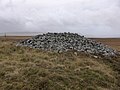 Cairn on the moor - geograph.org.uk - 3720096.jpg 640 × 480; 73 KB
-
 Cantref reservoir - geograph.org.uk - 3431834.jpg 4,000 × 3,000; 3.4 MB
-
 Cantref reservoir - geograph.org.uk - 3431836.jpg 4,000 × 3,000; 3.19 MB
-
 Cantref Reservoir - geograph.org.uk - 4402641.jpg 640 × 480; 42 KB
-
 Cantref reservoir dam - geograph.org.uk - 3431830.jpg 4,000 × 3,000; 3.7 MB
-
 Car Park at Garwnant - geograph.org.uk - 3131389.jpg 640 × 480; 96 KB
-
 Car park at Garwnant centre - geograph.org.uk - 2361687.jpg 2,112 × 2,816; 2.54 MB
-
 Car Park at Garwnant Forest Centre - geograph.org.uk - 4611175.jpg 640 × 428; 104 KB
-
 Car park, Garwnant Visitor Centre - geograph.org.uk - 5450501.jpg 1,024 × 768; 801 KB
-
 Cardiff Arms Hotel Hirwaun.jpg 1,024 × 768; 93 KB
-

-

-

-
 Cattle grid on A4059 - geograph.org.uk - 2223885.jpg 640 × 480; 44 KB
-
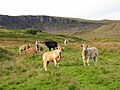 Cattle near Hirwaun - geograph.org.uk - 5931960.jpg 4,640 × 3,480; 4.84 MB
-
 Cattle near Hirwaun - geograph.org.uk - 5931962.jpg 5,184 × 3,888; 5.77 MB
-
 Cefn Cadlan - geograph.org.uk - 5305462.jpg 640 × 480; 81 KB
-
 Cefn Cadlan - geograph.org.uk - 5305467.jpg 640 × 480; 85 KB
-
 Cefn Cadlan - geograph.org.uk - 5305472.jpg 640 × 480; 82 KB
-
 Cefn Cadlan - geograph.org.uk - 5305479.jpg 640 × 480; 81 KB
-
 Cemetery in Hirwaun - geograph.org.uk - 5482766.jpg 4,000 × 3,000; 4.24 MB
-
 Ceunant Du - geograph.org.uk - 6555095.jpg 2,048 × 1,536; 1.38 MB
-
 Changing Area at Craig-y-Ddinas Carpark - geograph.org.uk - 2906678.jpg 1,024 × 768; 198 KB
-
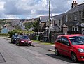 Chapel Road houses, Penderyn - geograph.org.uk - 3059770.jpg 640 × 489; 65 KB
-
 Chapel Road-Lamb Road junction - geograph.org.uk - 2223877.jpg 640 × 480; 56 KB
-
 Chickens in Penderyn - geograph.org.uk - 3422177.jpg 4,000 × 3,000; 4.57 MB
-
 Children's play area, Penderyn - geograph.org.uk - 3059964.jpg 640 × 395; 64 KB
-
 Cilhepste Cerrig - geograph.org.uk - 6739465.jpg 2,048 × 1,536; 1.18 MB
-
 Cilhepste Fach - geograph.org.uk - 3512181.jpg 690 × 518; 224 KB
-
 Climbers on Craig y Ddinas near Hirwaun - geograph.org.uk - 6435457.jpg 1,795 × 1,196; 628 KB
-
 Coal train at Hirwaun - geograph.org.uk - 5293447.jpg 1,973 × 2,631; 2.15 MB
-
 Coal train at Hirwaun - geograph.org.uk - 5293453.jpg 3,817 × 2,863; 4.66 MB
-
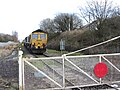 Coal train at Hirwaun - geograph.org.uk - 5293458.jpg 3,532 × 2,648; 4.23 MB
-
 Coal train at Tower Colliery - geograph.org.uk - 5293079.jpg 3,772 × 2,829; 5.03 MB
-
 Coal train at Tower Colliery - geograph.org.uk - 5293493.jpg 3,693 × 2,770; 5.03 MB
-
 Coal train in Hirwaun - geograph.org.uk - 5293085.jpg 3,892 × 2,919; 3.93 MB
-
 Coal train in Hirwaun - geograph.org.uk - 5293537.jpg 3,505 × 2,628; 3.54 MB
-
 Coal train leaving Hirwaun - geograph.org.uk - 5293539.jpg 3,347 × 2,510; 3.88 MB
-
 Coed Penmilaid - geograph.org.uk - 5700587.jpg 640 × 480; 133 KB
-

-
 Craig y Ddinas - geograph.org.uk - 4789650.jpg 2,448 × 3,264; 1.99 MB
-
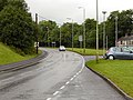
 Croesbychan Roundabout on the A465.jpg 960 × 600; 136 KB
-

-
-

-

-
-
 Cwm afon sych - Dry river valley - geograph.org.uk - 5687274.jpg 640 × 480; 79 KB
-
 Cwm Cadlan pumping station - geograph.org.uk - 6555090.jpg 2,048 × 1,536; 1.59 MB
-
 Cwm Cadlan road - geograph.org.uk - 918063.jpg 640 × 480; 92 KB
-
 Cwm Llysiog from Coed Taf Fawr - geograph.org.uk - 4396275.jpg 640 × 480; 65 KB
-
 Cwman Nant Hir - Nant Hir Hollow - geograph.org.uk - 5687071.jpg 640 × 479; 94 KB
-
-
 Cyffordd o lwybrau - Junction of paths - geograph.org.uk - 5700577.jpg 640 × 480; 124 KB
-

-
 Derelict footbridge near the Nant Ddu Lodge - geograph.org.uk - 3431825.jpg 4,000 × 3,000; 5.46 MB
-
 Derelict Lodge - geograph.org.uk - 5120740.jpg 3,264 × 2,448; 3.47 MB
-
 Dinas Rock Aerial Tramway - geograph.org.uk - 4567970.jpg 1,200 × 1,600; 430 KB
-
-
 Dinas Rock Mines - geograph.org.uk - 4567943.jpg 1,600 × 1,200; 439 KB
-
 Dinas Rock Tunnel - geograph.org.uk - 4567920.jpg 1,200 × 1,600; 387 KB
-
 Dining table - geograph.org.uk - 6739051.jpg 2,048 × 1,536; 1.04 MB
-
 Direction Sign – Signpost - geograph.org.uk - 6505202.jpg 640 × 640; 203 KB
-
 Direction Sign – Signpost - geograph.org.uk - 6591441.jpg 682 × 1,024; 132 KB
-
 Disused quarries on Cadair Fawr - geograph.org.uk - 3422170.jpg 4,000 × 3,000; 2.79 MB
-
 Disused railway carriages - geograph.org.uk - 6547340.jpg 4,032 × 3,024; 5.58 MB
-
 Disused railway line at Hirwaun - geograph.org.uk - 484226.jpg 640 × 480; 170 KB
-
 Disused tips on Moel Penderyn - geograph.org.uk - 3422210.jpg 4,000 × 3,000; 3.7 MB
-
 Dolgynog houses, Penderyn - geograph.org.uk - 3059942.jpg 640 × 378; 54 KB
-
 Down the green route - geograph.org.uk - 4236058.jpg 600 × 800; 155 KB
-
 Downstream view from behind Sgwd yr Eira - geograph.org.uk - 3422295.jpg 4,000 × 3,000; 3.84 MB
-
 Dragonfly - panoramio - The Ian Taylor.jpg 3,648 × 2,736; 3.56 MB
-
 Drink and drive ^ - panoramio.jpg 2,048 × 1,536; 1.19 MB
-
 Electricity substation - geograph.org.uk - 6547336.jpg 4,032 × 3,024; 3.67 MB
-
 Entrance road to Penderyn Quarry - geograph.org.uk - 3059395.jpg 640 × 413; 80 KB
-
 Entrance to Garwnant - geograph.org.uk - 3131355.jpg 640 × 480; 94 KB
-
 Entrance to Penderyn Quarry - geograph.org.uk - 3059393.jpg 640 × 457; 62 KB
-
 Entrance to Welsh Water site, Penderyn - geograph.org.uk - 6738543.jpg 1,536 × 2,048; 1.54 MB
-
 Entrance to Ysgubor Fawr Farm, Penderyn - geograph.org.uk - 3060702.jpg 640 × 480; 128 KB
-
 Fallen tree - geograph.org.uk - 6739706.jpg 2,048 × 1,536; 1.45 MB
-
 Falls - geograph.org.uk - 369533.jpg 640 × 480; 166 KB
-
 Falls on the Garw Nant - geograph.org.uk - 5183504.jpg 1,152 × 768; 396 KB
-
 Farmland near Penderyn - geograph.org.uk - 3422182.jpg 4,000 × 3,000; 3.73 MB
-
 Farmland near Tor y Foel - geograph.org.uk - 6399186.jpg 2,048 × 1,536; 1.05 MB
-
 Felled area of Sycamore Grove - geograph.org.uk - 4504100.jpg 2,560 × 1,920; 2.83 MB
-

-
-
 Ffin y rhostir - Moorland boundary - geograph.org.uk - 5687193.jpg 640 × 480; 95 KB
-
 Ffin y rhostir - Moorland boundary. - geograph.org.uk - 5687244.jpg 640 × 480; 95 KB
-
 Field corner - geograph.org.uk - 3719919.jpg 640 × 480; 153 KB
-
 Field in the Brecon Beacons - geograph.org.uk - 3422219.jpg 4,000 × 3,000; 3.38 MB
-
 Fields near Penderyn - geograph.org.uk - 3422203.jpg 4,000 × 3,000; 3.16 MB
-
 Fire Station in Hirwaun - geograph.org.uk - 3049974.jpg 3,648 × 2,736; 1.55 MB
-
 Footbridge for the All Ability Trail over the Garwant Fawr - geograph.org.uk - 3074796.jpg 3,648 × 2,736; 3.03 MB
-
 Footbridge over Garw Nant - geograph.org.uk - 5185527.jpg 1,152 × 768; 353 KB
-
 Footbridge over the stream - geograph.org.uk - 3719818.jpg 640 × 480; 114 KB
-
 Footpath and stile - geograph.org.uk - 6547294.jpg 4,032 × 3,024; 6.74 MB
-
 Footpath at the forest centre - geograph.org.uk - 4200662.jpg 640 × 480; 226 KB
-
 Footpath near Penderyn - geograph.org.uk - 3422190.jpg 4,000 × 3,000; 3.02 MB
-
 Footpath passing beneath Sgwd yr Eira - geograph.org.uk - 3167389.jpg 640 × 480; 122 KB
-
 Ford and footbridge on the Afon Cynon in Penderyn - geograph.org.uk - 5293491.jpg 4,000 × 3,000; 5.11 MB
-
 Ford at Penderyn - geograph.org.uk - 484232.jpg 640 × 480; 198 KB
-
 Forest Frenzy, Garwnant Forest Centre - geograph.org.uk - 3167686.jpg 640 × 559; 144 KB
-
 Forestry boundary and footpath - geograph.org.uk - 3422226.jpg 4,000 × 3,000; 3.83 MB
-

-
 Former Nebo chapel, Hirwaun - geograph.org.uk - 1845746.jpg 562 × 640; 73 KB
-
 Fox tracks - geograph.org.uk - 6739732.jpg 2,189 × 2,917; 2.54 MB
-
 Garn Ddu - geograph.org.uk - 479351.jpg 640 × 433; 68 KB
-
 Garwnant Forest Centre - geograph.org.uk - 4600710.jpg 640 × 428; 92 KB
-
 Garwnant information Centre - geograph.org.uk - 3131383.jpg 640 × 480; 98 KB
-
 Gate and electricity poles on Cefn y Llethyr Hir - geograph.org.uk - 5932042.jpg 5,184 × 3,888; 3.31 MB
-
 Gated enclosure - geograph.org.uk - 6738556.jpg 1,536 × 2,048; 1.67 MB
-
 Gateway to field - geograph.org.uk - 6555099.jpg 2,048 × 1,536; 860 KB
-
 Gelli Neuadd - geograph.org.uk - 6555058.jpg 2,048 × 1,536; 916 KB
-
 Ger - near Tyle Morgrug - geograph.org.uk - 4293689.jpg 640 × 480; 120 KB
-
 Ger Beili Helyg - Near Beili Helyg - geograph.org.uk - 5687258.jpg 640 × 480; 80 KB
-
 Ger Bryn Du - Near Bryn Du - geograph.org.uk - 5687170.jpg 640 × 480; 94 KB
-

-
 Ger Cwm Ynysmintan - Near Cwm Ynysmintan - geograph.org.uk - 5449327.jpg 640 × 480; 146 KB
-

-

-
 Ger Nant Cadlan - Near Nant Cadlan - geograph.org.uk - 5700555.jpg 640 × 480; 109 KB
-
 Ger Pen Twyn Isaf - Near Pen Twyn Isaf - geograph.org.uk - 5700473.jpg 640 × 480; 117 KB
-

-
 Ger Twyn y Glog - Near Twyn y Glog - geograph.org.uk - 5688287.jpg 640 × 480; 85 KB
-
 Giant's Chair in Coed Taf Fawr - geograph.org.uk - 4744104.jpg 640 × 480; 61 KB
-
 Gingerly crossing the marshy terrain - geograph.org.uk - 3422324.jpg 4,000 × 3,000; 4.17 MB
-

-

-
 Gwaun ddiarffordd - A remote fen - geograph.org.uk - 5687011.jpg 640 × 480; 86 KB
-
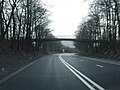
 Heads of the Valleys Road bridge in Hirwaun - geograph.org.uk - 5293532.jpg 4,000 × 3,000; 3.95 MB
-

-

-

-
 Hen wal sych - Old dry stone wall - geograph.org.uk - 5686987.jpg 640 × 480; 142 KB
-
 Heol Cwm Cadlan - Cwm Cadlan Road - geograph.org.uk - 5737153.jpg 640 × 480; 81 KB
-

-
 Hepste valley - geograph.org.uk - 6743300.jpg 2,854 × 1,883; 3.03 MB
-
-
 Hirwaun - geograph.org.uk - 5007638.jpg 640 × 480; 58 KB
-
 Hirwaun Fire Station - geograph.org.uk - 460574.jpg 640 × 426; 155 KB
-
 Hirwaun Fire Station - geograph.org.uk - 5041213.jpg 1,024 × 768; 133 KB
-
 Hirwaun Library - geograph.org.uk - 1845796.jpg 640 × 558; 66 KB
-
 Hirwaun Macmillan Walk by Aberdare Blog.jpg 320 × 480; 114 KB
-
 Hirwaun Post Office - geograph.org.uk - 1845808.jpg 640 × 514; 70 KB
-
 Hirwaun station site geograph-3895801-by-Ben-Brooksbank.jpg 2,358 × 1,448; 2.36 MB
-
 Hirwaun Telephone Exchange - geograph.org.uk - 6169569.jpg 2,592 × 1,944; 1.39 MB
-
 Hirwaun, Afon Cynon - geograph.org.uk - 5041180.jpg 768 × 1,024; 265 KB
-
 Hirwaun, clock tower - geograph.org.uk - 5041166.jpg 1,024 × 768; 142 KB
-
 Hirwaun, Glancynon Inn - geograph.org.uk - 5041226.jpg 1,024 × 769; 133 KB
-
 Hirwaun, Penmark Row - geograph.org.uk - 5041159.jpg 1,024 × 768; 120 KB
-
 Hirwaun, St. Lleurwg's - geograph.org.uk - 5041195.jpg 1,024 × 768; 192 KB
-

-


