Category:Hirschaid
Jump to navigation
Jump to search
municipality of Germany    | |||||
| Upload media | |||||
| Instance of |
| ||||
|---|---|---|---|---|---|
| Part of |
| ||||
| Location | Bamberg, Upper Franconia, Bavaria, Germany | ||||
| Population |
| ||||
| Area |
| ||||
| Elevation above sea level |
| ||||
| official website | |||||
 | |||||
Subcategories
This category has the following 12 subcategories, out of 12 total.
Media in category "Hirschaid"
The following 40 files are in this category, out of 40 total.
-
 Wappen Hirschaid.svg 512 × 559; 26 KB
-
 Wappen von Hirschaid.png 212 × 231; 11 KB
-
 Denkmal für die jüdischen Bürger von Hirschaid.jpg 3,304 × 2,932; 5.73 MB
-
 Digitales Orthofoto von Hirschaid (Bayerische Vermessungsverwaltung).tif 27,500 × 25,000; 1.12 GB
-
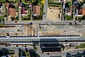
 Eggolsheim Bahnhof Baustelle Luftbild-20211002-RM-153836.jpg 5,464 × 3,386; 9.11 MB
-
 Eggolsheim Bahnhof Baustelle Luftbild-20211002-RM-153846.jpg 5,464 × 3,640; 9.91 MB
-
 Eisenbahnstrecke-Strullendorf-Hirschhaid P5022876-Pano.jpg 8,930 × 3,312; 11.04 MB
-
 Eisenbahnstrecke-Strullendorf-Hirschhaid P5022897.jpg 4,608 × 3,456; 6.64 MB
-
 Eisenbahnstrecke-Strullendorf-Hirschhaid P5022899.jpg 4,608 × 3,456; 8.81 MB
-
 Eisenbahnstrecke-Strullendorf-Hirschhaid P5022901.jpg 4,608 × 3,456; 8.86 MB
-
 Eisenbahnstrecke-Strullendorf-Hirschhaid P5022903.jpg 4,608 × 3,456; 7.01 MB
-
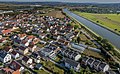
 Hirschaid 20191003-RM-033979.jpg 2,850 × 5,076; 7.11 MB
-
 Hirschaid Bahnhof Baustelle-20240428-RM-162510.jpg 2,639 × 3,524; 5.62 MB
-
 Hirschaid Bahnhof Luftbild-20211002-RM-150624.jpg 5,464 × 3,640; 11.87 MB
-
 Hirschaid Bahnhof Luftbild-20211002-RM-150636.jpg 5,464 × 3,640; 10.94 MB
-
 Hirschaid Bahnstrecke Luftbild-20211002-RM-150552.jpg 4,943 × 3,293; 7.23 MB
-
 Hirschaid Bahnstrecke Luftbild-20211002-RM-150721.jpg 5,453 × 3,633; 10.45 MB
-
 Hirschaid Bahnübergang-20170414-RM-093516.jpg 5,184 × 3,888; 8.36 MB
-
 Hirschaid Bildstock 1098.jpg 3,120 × 4,765; 7.52 MB
-
 HIRSCHAID FRIESEN nieder.png 480 × 360; 5 KB
-
 HIRSCHAID FRIESEN nieder.svg 512 × 427; 21 KB
-
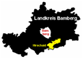
 Hirschaid im Landkreis Bamberg.png 521 × 379; 26 KB
-
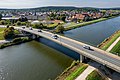 Hirschaid Kanalbrücke Luftbild-20211002-RM-151632.jpg 4,770 × 3,178; 8.45 MB
-
 Hirschaid Kanalbrücke Luftbild-20211002-RM-151702.jpg 4,851 × 3,232; 7.81 MB
-
 Hirschaid Kirche Luftbild-20211002-RM-152006.jpg 4,707 × 3,366; 7.2 MB
-
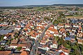 Hirschaid Luftbild-20211002-RM-151833.jpg 4,970 × 3,311; 8.82 MB
-
 Hirschaid Luftbild-20211002-RM-152139.jpg 4,760 × 3,058; 8.32 MB
-
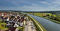 Hirschaid M-D Kanal Luftbild-20211002-RM-151610.jpg 5,464 × 2,871; 7.41 MB
-
 Hirschaid M-D Kanal Luftbild-20211002-RM-152154.jpg 4,389 × 2,689; 6.55 MB
-
 Hirschaid Pumpe 20191003-RM-033943.jpg 3,504 × 4,879; 7.57 MB
-
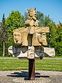 Hirschaid-SkulpturP5022886.jpg 3,320 × 4,427; 7.03 MB
-
 Hirschaid.png 336 × 244; 15 KB
-
 Hirschhaid-Skulptur-Info-P5022889.jpg 3,456 × 4,608; 7.26 MB
-
 Meadow Sunset (191156699).jpeg 2,048 × 1,356; 400 KB
-
 Reiche EbrachErlach.jpg 450 × 600; 70 KB
-
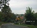 Seigendorf, Oberfranken - geo.hlipp.de - 5739.jpg 640 × 480; 67 KB
-
 Strassenunterführung-Hirschaid-P5022882.jpg 4,607 × 3,149; 5.92 MB
-
 Strullendorf-Sassanfahrt-PC110045.jpg 3,456 × 4,608; 8.15 MB
-
 Wegekreuz Hirschaid BA 25.JPG 2,160 × 3,840; 3.25 MB
-
 Wegekreuz-Koettmannsdorf.JPG 2,160 × 3,840; 3.73 MB


.jpeg)


