Category:Hintere Wartenberg
Jump to navigation
Jump to search
| Object location | | View all coordinates using: OpenStreetMap |
|---|
castle ruins on the Wartenberg in Muttenz in the canton of Basel-Landschaft, Switzerland   | |||||
| Upload media | |||||
| Instance of | |||||
|---|---|---|---|---|---|
| Part of | |||||
| Location | Muttenz, Arlesheim District, Basel-Landschaft, Switzerland | ||||
| Street address |
| ||||
| Heritage designation | |||||
 | |||||
Media in category "Hintere Wartenberg"
The following 15 files are in this category, out of 15 total.
-
 Geschichte der hinteren Burg .jpg 1,915 × 2,554; 3.56 MB
-
 Hintere Burgruine .jpg 1,459 × 1,094; 1.3 MB
-
 Hintere Burgruine mit Innenberiech.jpg 1,094 × 1,459; 1.53 MB
-
 Hintere Burgruine von aussen.jpg 821 × 1,094; 715 KB
-
 Hintere Wartenberg Aussicht.JPG 4,000 × 3,000; 4.16 MB
-
 Hintere Wartenberg Plattform.JPG 4,000 × 3,000; 3.66 MB
-
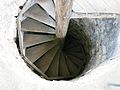 Hintere Wartenberg Treppe.JPG 4,000 × 3,000; 2.98 MB
-
 Hintere Wartenberg.JPG 3,000 × 4,000; 4.8 MB
-
 Hintere Wartenberg1.JPG 4,000 × 3,000; 4.96 MB
-
 Hintere-Wartenberg-Tor.jpg 709 × 510; 174 KB
-
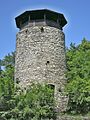
 Hintere-Wartenberg-Turm.jpg 709 × 569; 168 KB
-
 Hinteren Wartenberg.jpg 737 × 800; 192 KB
-
 Hinterer Wartbergturm 360 Panorama.jpg 10,180 × 928; 2.4 MB
-

-
 Wartenberg Mittlere Burg.jpg 5,184 × 2,920; 4.19 MB


_in_Muttenz_zum_Bruderholz_und_nach_Basel.jpg)
