Category:Hindpool
Jump to navigation
Jump to search
English: Hindpool is an area of Barrow-in-Furness, in the unparished area of Barrow-in-Furness, in the Barrow-in-Furness district, in the county of Cumbria, England.
area and ward in Barrow-in-Furness, Cumbria, United Kingdom | |||||
| Upload media | |||||
| Instance of |
| ||||
|---|---|---|---|---|---|
| Location | Barrow-in-Furness, Cumbria, North West England, England | ||||
 | |||||
Media in category "Hindpool"
The following 55 files are in this category, out of 55 total.
-

-
 A590 North Road at the Dock Museum - geograph.org.uk - 5685799.jpg 640 × 481; 46 KB
-
 BAE Systems - Devonshire Dock Hall - geograph.org.uk - 5934562.jpg 640 × 480; 49 KB
-
 BAE Systems - sign on fence - geograph.org.uk - 5977129.jpg 640 × 480; 77 KB
-
 BAE Systems - test barge - geograph.org.uk - 5969923.jpg 640 × 480; 69 KB
-
 Barrow Depot - geograph.org.uk - 6234449.jpg 4,320 × 2,430; 7.72 MB
-
 Barrow Railway Station - geograph.org.uk - 6234444.jpg 4,620 × 3,080; 7.7 MB
-
 Barrow Signal Box - geograph.org.uk - 6234446.jpg 3,914 × 2,609; 7.68 MB
-
 Barrow signal box ^ carriage sidings - geograph.org.uk - 5984294.jpg 1,280 × 720; 485 KB
-
 Barrow-in-Furness , Blake Street - geograph.org.uk - 6352646.jpg 6,000 × 4,000; 3.51 MB
-
 Barrow-in-Furness , Ironworks Road A590 - geograph.org.uk - 6352636.jpg 4,288 × 2,848; 2.62 MB
-
 Barrow-in-Furness , KFC - geograph.org.uk - 6352629.jpg 4,288 × 2,848; 2.56 MB
-
 Barrow-in-Furness , North Road A590 - geograph.org.uk - 6352631.jpg 6,000 × 4,000; 4.2 MB
-
 Barrow-in-Furness , North Road A590 - geograph.org.uk - 6352634.jpg 6,000 × 4,000; 4.32 MB
-
 Barrow-in-Furness , Walney Road A590 - geograph.org.uk - 6352626.jpg 6,000 × 4,000; 4.12 MB
-
 Barrow-in-Furness , Walney Road A590 - geograph.org.uk - 6352627.jpg 4,288 × 2,848; 2.49 MB
-
 Barrow-in-Furness , Walney Road A590 - geograph.org.uk - 6352628.jpg 4,288 × 2,848; 2.55 MB
-

-

-
 Barrow-in-Furness railway station - geograph.org.uk - 5900787.jpg 1,024 × 768; 178 KB
-
 Benchmark on Duke of Edinburgh Hotel - geograph.org.uk - 6273161.jpg 1,024 × 683; 297 KB
-
 Benchmark on Rossall House, Abbey Road - geograph.org.uk - 6273358.jpg 1,024 × 682; 253 KB
-
 Benchmark on Victoria Hall, Rawlinson Street - geograph.org.uk - 6273109.jpg 1,024 × 683; 285 KB
-
 Devonshire Dock Hall - geograph.org.uk - 6002136.jpg 640 × 480; 61 KB
-
 Dock Museum - Barrow-in-Furness - geograph.org.uk - 6022754.jpg 472 × 640; 94 KB
-
 DRS passenger train at Barrow station - geograph.org.uk - 5984295.jpg 1,280 × 875; 440 KB
-

-
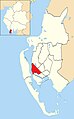 Hindpool, Barrow location map.jpg 371 × 599; 43 KB
-
 Houses on Hardy Street - geograph.org.uk - 6263565.jpg 1,600 × 900; 459 KB
-

-

-
 Ordnance Survey Cut Mark - geograph.org.uk - 5722877.jpg 640 × 458; 107 KB
-
 Ordnance Survey Cut Mark - geograph.org.uk - 5722880.jpg 640 × 380; 62 KB
-
 Ordnance Survey Cut Mark - geograph.org.uk - 5722883.jpg 640 × 497; 80 KB
-
 Ordnance Survey Cut Mark - geograph.org.uk - 5722885.jpg 640 × 355; 77 KB
-
 Ordnance Survey Cut Mark - geograph.org.uk - 5722887.jpg 640 × 502; 85 KB
-
 Ordnance Survey Cut Mark - geograph.org.uk - 5722891.jpg 640 × 457; 78 KB
-
 Ordnance Survey Cut Mark - geograph.org.uk - 5722892.jpg 640 × 474; 72 KB
-
 Ordnance Survey Cut Mark - geograph.org.uk - 5722970.jpg 404 × 640; 72 KB
-
 Ordnance Survey Cut Mark - geograph.org.uk - 5722979.jpg 640 × 506; 78 KB
-
 Ordnance Survey Cut Mark - geograph.org.uk - 5722984.jpg 640 × 613; 106 KB
-
 Ordnance Survey Cut Mark - geograph.org.uk - 5722987.jpg 640 × 493; 76 KB
-
 Ordnance Survey Cut Mark - geograph.org.uk - 5722990.jpg 502 × 640; 133 KB
-
 Ordnance Survey Cut Mark - geograph.org.uk - 5722994.jpg 640 × 503; 107 KB
-
 Ordnance Survey Cut Mark - geograph.org.uk - 5722999.jpg 640 × 554; 120 KB
-
 Ordnance Survey Cut Mark - geograph.org.uk - 5723005.jpg 640 × 400; 92 KB
-
 Ordnance Survey Cut Mark - geograph.org.uk - 6297442.jpg 693 × 1,024; 192 KB
-
 Ordnance Survey Pivot - geograph.org.uk - 5722974.jpg 388 × 640; 47 KB
-

-

-

-
 The Dock Museum - Barrow-in-Furness - geograph.org.uk - 5916680.jpg 640 × 480; 64 KB
-
 Victoria Hall, Rawlinson Street - geograph.org.uk - 6273138.jpg 1,024 × 683; 181 KB
-
 View across a reservoir - geograph.org.uk - 5811184.jpg 1,257 × 1,600; 463 KB
-
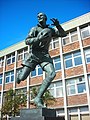 Willie Horne - geograph.org.uk - 484971.jpg 480 × 640; 109 KB


