Category:Hilton, South Staffordshire
Jump to navigation
Jump to search
English: Hilton is a civil parish in the South Staffordshire district, in the county of Staffordshire, England.
civil parish in South Staffordshire, United Kingdom | |||||
| Upload media | |||||
| Instance of | |||||
|---|---|---|---|---|---|
| Location | South Staffordshire, Staffordshire, West Midlands, England | ||||
| Population |
| ||||
 | |||||
Subcategories
This category has the following 2 subcategories, out of 2 total.
H
- Hilton Hall, Staffordshire (2 F)
- Hilton Park Services (54 F)
Media in category "Hilton, South Staffordshire"
The following 45 files are in this category, out of 45 total.
-
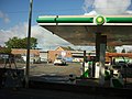 A BP garage on the A460 at Featherstone - geograph.org.uk - 2617572.jpg 800 × 600; 255 KB
-
 A farm track crosses the M54 - geograph.org.uk - 5442123.jpg 1,500 × 999; 120 KB
-
 A rare quiet moment - geograph.org.uk - 4103329.jpg 1,142 × 857; 398 KB
-
 A462 Warstone Road at Hilton Lane - geograph.org.uk - 4674132.jpg 640 × 481; 61 KB
-
-

-
 Burn's Wood - geograph.org.uk - 3637176.jpg 1,920 × 2,560; 2.15 MB
-
 Cannock Road Lights - geograph.org.uk - 3444972.jpg 800 × 600; 82 KB
-

-
 Entrance to Hilton Park Business Centre - geograph.org.uk - 2122343.jpg 617 × 451; 103 KB
-
 Entrance to Hilton Park business centre - geograph.org.uk - 5451853.jpg 1,469 × 1,102; 731 KB
-
 Entrance to Vernon Park off the A460 - geograph.org.uk - 2763491.jpg 640 × 428; 63 KB
-
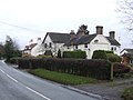 Former estate houses on Hilton Lane - geograph.org.uk - 2727849.jpg 640 × 480; 82 KB
-
 Fuel Forecourt at Hilton Park - geograph.org.uk - 2601148.jpg 640 × 480; 182 KB
-

-

-
 Hilton , M6 Motorway - geograph.org.uk - 6284931.jpg 6,000 × 4,000; 4.85 MB
-
 Hilton , M6 Motorway - geograph.org.uk - 6362893.jpg 6,000 × 4,000; 4.86 MB
-
 Hilton Lane emerges onto Warstone Road - geograph.org.uk - 5452416.jpg 1,469 × 1,102; 690 KB
-
 Hilton Park Services - geograph.org.uk - 6382428.jpg 768 × 1,024; 150 KB
-
 Hilton Park, Essington - geograph.org.uk - 3443637.jpg 640 × 418; 161 KB
-
-
 M54 Junction 1 Westbound slip road - geograph.org.uk - 2070418.jpg 640 × 480; 55 KB
-

-
 M54, eastbound - geograph.org.uk - 3112002.jpg 640 × 430; 55 KB
-
 M54, Junction 1 - geograph.org.uk - 3112001.jpg 640 × 430; 48 KB
-
 M54, junction 1 roundabout - geograph.org.uk - 4103057.jpg 1,142 × 857; 386 KB
-
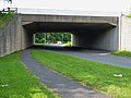
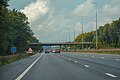
 Overbridge east of junction 1 M54 - geograph.org.uk - 4225582.jpg 640 × 413; 46 KB
-
 Pools near Hilton Park, Staffordshire - geograph.org.uk - 458633.jpg 640 × 279; 145 KB
-
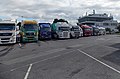
 Recovery Vehicles - geograph.org.uk - 3839729.jpg 640 × 425; 67 KB
-

-
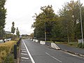
 Roundabout at Hilton Cross - geograph.org.uk - 4103338.jpg 1,142 × 857; 343 KB
-
 Saturated field - geograph.org.uk - 3839713.jpg 640 × 425; 88 KB
-
 Service road, Hilton Park Services, M6 north - geograph.org.uk - 2944789.jpg 1,500 × 1,998; 410 KB
-
 Slip road back on to the M6 - geograph.org.uk - 3839762.jpg 640 × 425; 66 KB
-
 Slip road from M6 northbound to Hilton Park services - geograph.org.uk - 6308052.jpg 1,600 × 1,099; 720 KB
-

-
 Southbound M6. Hilton Park - geograph.org.uk - 3303328.jpg 640 × 480; 490 KB
-
 Tarmac Topblock works, Hilton Main - geograph.org.uk - 4103345.jpg 1,066 × 798; 424 KB
-
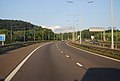
 The M54 heading east - geograph.org.uk - 5442120.jpg 1,500 × 961; 123 KB
-
 The M6 at Hilton Park Services - geograph.org.uk - 3758407.jpg 4,608 × 2,376; 1.96 MB
-
 The old Cannock Road - geograph.org.uk - 4103333.jpg 857 × 1,142; 519 KB
-
 The way back onto the M6 - geograph.org.uk - 4048834.jpg 3,872 × 2,592; 3.73 MB
-
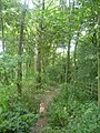
 Walkway into the woods - geograph.org.uk - 4048820.jpg 3,872 × 2,592; 5.37 MB
-
 Walkway over the M6 - geograph.org.uk - 3839748.jpg 640 × 425; 90 KB


,_Essington_-_geograph.org.uk_-_3690591.jpg)


,_Essington_-_geograph.org.uk_-_3690553.jpg)


,_Essington_-_geograph.org.uk_-_3690650.jpg)


