Category:Hiking maps of Eichsfeld
Jump to navigation
Jump to search
Media in category "Hiking maps of Eichsfeld"
The following 9 files are in this category, out of 9 total.
-
 Burg hanstein fussweg ab bhf eichenberg ds osm 06 2011.PNG 1,730 × 1,978; 1.18 MB
-
 Eibenwald2.JPG 4,320 × 3,240; 4.66 MB
-
 Grenzlandweg0.3.jpg 3,648 × 2,736; 3.9 MB
-
 Klüschen Hagis Hinweistafel.JPG 4,320 × 3,240; 5.13 MB
-
 Teistungen Stausee (8).jpg 4,178 × 3,044; 4.8 MB
-
 Wanderkarte bei Asbach.JPG 3,240 × 4,320; 4.57 MB
-
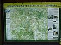 Wanderkarte Sonnenstein.JPG 4,316 × 3,234; 4.95 MB
-
 Wanderwege Seeburger See 4.JPG 4,320 × 3,240; 4.57 MB
-
 Wanderwegekarte Worbis.JPG 4,320 × 3,240; 4.86 MB


.jpg)


