Category:Hiking maps of Bavaria
Jump to navigation
Jump to search
Federal states of Germany:
Subcategories
This category has only the following subcategory.
H
Media in category "Hiking maps of Bavaria"
The following 18 files are in this category, out of 18 total.
-
2008-05-25 WallbergKarte.JPG 1,690 × 1,122; 972 KB
-
2013 Jurasteig Karte.png 553 × 523; 473 KB
-
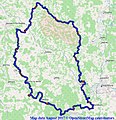
2017 Jurasteig Karte.jpg 770 × 799; 266 KB
-
350 02 Lipová, Czech Republic - panoramio (53).jpg 3,072 × 1,728; 1.23 MB
-
Altmühltal-Panoramaweg (Karte).png 942 × 358; 492 KB
-
Fränkischer Dünenweg (Karte).png 386 × 381; 178 KB
-
GER Aichach, Bahnhofstraße 001.jpg 3,865 × 2,899; 2.41 MB
-
GER Dollnstein, Bahnhof 002.jpg 4,032 × 3,024; 3.02 MB
-
GER Eichstätt, Pater-Moser-Straße 006.jpg 4,032 × 3,024; 2.91 MB
-
Grenzweg Informationstafel in Unterliezheim.jpg 4,000 × 2,252; 2.81 MB
-
Karte Schwäbische-Alb-Nordrand-Weg.png 1,625 × 1,065; 1.44 MB
-
Karte Seenländer Wanderweg.png 1,657 × 688; 975 KB
-
Sagenhaft Informationstafel in Unterliezheim.jpg 4,000 × 2,252; 3.51 MB
-
Tafel Jakobsweg Gersthofen.jpg 2,272 × 1,704; 836 KB
-
Ulrich von Königstein Weg (Karte).png 770 × 404; 319 KB
-
Wandertrilogie Allgaeu Uebersichtskarte 2015.jpg 1,200 × 1,272; 339 KB
-
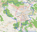
Wikiwanderung pommelsbrunn 2015.png 863 × 820; 350 KB
-
Zugenbergrunde (Karte).png 935 × 819; 864 KB


