Category:Hiking and footpath signs in the canton of Lucerne
Jump to navigation
Jump to search
Cantons of Switzerland: Aargau (AG) · Appenzell Ausserrhoden (AR) · Appenzell Innerrhoden (AI) · Basel-Stadt (BS) · Basel-Landschaft (BL) · Bern (BE) · Fribourg (FR) · Geneva (GE) · Glarus (GL) · Graubünden (GR) · Jura (JU) · Luzern (LU) · Neuchâtel (NE) · Nidwalden (NW) · Obwalden (OW) · Schaffhausen (SH) · Schwyz (SZ) · Solothurn (SO) · St. Gallen (SG) · Thurgau (TG) · Ticino (TI) · Uri (UR) · Valais (VS) · Vaud (VD) · Zug (ZG) · Zürich (ZH)

Subcategories
This category has only the following subcategory.
Media in category "Hiking and footpath signs in the canton of Lucerne"
The following 48 files are in this category, out of 48 total.
-
 20230422 Mullwil LU-1.tif 5,184 × 3,888; 115.37 MB
-
 560-LU-Seeufer.jpg 140 × 140; 17 KB
-
 566-FelsenwegB.jpg 140 × 140; 49 KB
-
 98-WaldstätterLU.jpg 600 × 600; 118 KB
-
 Die Schrattenfluh bei Sörenberg.jpg 3,456 × 2,304; 3.57 MB
-
 LU-Seeufer-WR.jpg 275 × 220; 22 KB
-
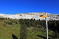
 Schibengütsch mit Wandertafel.jpg 6,684 × 3,741; 6.67 MB
-
 Wanderwegweiser Altwegbrücke 420.jpg 2,360 × 1,866; 686 KB
-
 Wanderwegweiser Balmegg 1160.jpg 1,968 × 1,148; 247 KB
-
 Wanderwegweiser Beromünster 642.jpg 4,032 × 3,024; 1.2 MB
-
 Wanderwegweiser Birbaum 1058.jpg 1,382 × 1,037; 1.02 MB
-
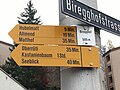 Wanderwegweiser Biregghof 505.jpg 1,024 × 768; 234 KB
-
 Wanderwegweiser Blatten 472.jpg 2,388 × 1,862; 689 KB
-
 Wanderwegweiser Blatterbrücke Linkes Ufer 476.jpg 1,986 × 2,019; 965 KB
-
 Wanderwegweiser Blatterbrücke Rechtes Ufer 476.jpg 2,197 × 2,158; 898 KB
-
 Wanderwegweiser Chlewald 539.jpg 4,032 × 3,024; 3.55 MB
-
 Wanderwegweiser Flüehütten 1220.jpg 2,206 × 2,345; 1.13 MB
-
 Wanderwegweiser Hergiswald 797.jpg 2,713 × 1,200; 1,004 KB
-
 Wanderwegweiser Hinder Ehrendingen 640.jpg 3,064 × 1,224; 1.11 MB
-
 Wanderwegweiser Hinterschönisei 1167.jpg 2,274 × 2,326; 519 KB
-
 Wanderwegweiser Höll 780.jpg 1,280 × 960; 885 KB
-
 Wanderwegweiser Krämerstein 469.jpg 2,016 × 1,512; 793 KB
-
 Wanderwegweiser Langensand 453.jpg 1,512 × 2,016; 216 KB
-
 Wanderwegweiser Neuhushof 476.jpg 3,142 × 1,858; 690 KB
-
 Wanderwegweiser Perlenbrücke 417.jpg 2,885 × 2,864; 1.5 MB
-
 Wanderwegweiser Rank 437.jpg 4,032 × 3,024; 2.55 MB
-
 Wanderwegweiser Rathausen Brücke 430.jpg 2,269 × 2,548; 1.3 MB
-
 Wanderwegweiser Rathausenbrücke 430.jpg 2,328 × 3,284; 1.03 MB
-
 Wanderwegweiser Regenflüeli 1582.JPG 1,024 × 768; 281 KB
-
 Wanderwegweiser Reistegg 1257.jpg 1,382 × 1,037; 853 KB
-
 Wanderwegweiser Rotterswil 452.jpg 4,032 × 3,024; 1,019 KB
-
 Wanderwegweiser Ruine Chastelen 651.jpg 4,032 × 3,024; 2.61 MB
-
 Wanderwegweiser Salwidili 1353.jpg 2,528 × 2,955; 837 KB
-
 Wanderwegweiser Sandblatten 592.jpg 1,210 × 907; 165 KB
-
 Wanderwegweiser Schilt 1027.jpg 2,782 × 3,903; 1.02 MB
-
 Wanderwegweiser Schneeberg 1276.jpg 2,604 × 2,646; 551 KB
-
 Wanderwegweiser Schneebärgli 1215.jpg 2,802 × 2,369; 1.36 MB
-
 Wanderwegweiser Spahau 465.jpg 3,734 × 1,915; 1.22 MB
-
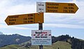
 Wanderwegweiser St. Wendel 715.jpg 3,913 × 2,163; 667 KB
-
 Wanderwegweiser St.Niklausen 444.jpg 2,016 × 1,512; 389 KB
-
 Wanderwegweiser Stegen 485.jpg 1,280 × 960; 252 KB
-
 Wanderwegweiser Steihuse 838.jpg 2,556 × 1,188; 471 KB
-
 Wanderwegweiser Sädelbrücke Süd 432.jpg 2,596 × 1,872; 986 KB
-
 Wanderwegweiser Sörenberg Parkplatz 1159.jpg 2,303 × 4,032; 1.16 MB
-
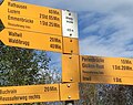
 Wanderwegweiser Thorenberg KW 456.jpg 3,885 × 2,395; 2.5 MB
-
 Wanderwegweiser Viscose 439.jpg 2,298 × 3,082; 903 KB
-
 Wanderwegweiser Wagliseiboden 1316.jpg 2,672 × 3,627; 1.55 MB
-
 Wanderwegweiser Zopf 1370.jpg 2,393 × 3,458; 1.04 MB


