Category:Hiking and footpath signs in Italy
Jump to navigation
Jump to search
Subcategories
This category has the following 16 subcategories, out of 16 total.
Media in category "Hiking and footpath signs in Italy"
The following 162 files are in this category, out of 162 total.
-

-
 2021 — Erste Julireise Mateus2019 — Batch (148).jpg 2,736 × 3,648; 3.77 MB
-
 2021 — Erste Julireise Mateus2019 — Batch (344).jpg 2,736 × 3,648; 2.93 MB
-
 Alpine chough on trail sign.jpg 3,445 × 2,082; 1.43 MB
-
 Bergtocht van Cogolo di Peio naar M.ga Levi in het Nationaal park Stelvio (Italië) 04.jpg 4,224 × 2,980; 9.31 MB
-

-

-
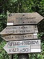
 Bivio per M.te Gemelli - panoramio.jpg 960 × 1,280; 494 KB
-

-
 C28-LDP.jpg 4,096 × 3,072; 1.52 MB
-
 CAI 015 (Cottede).jpg 3,096 × 5,504; 8.07 MB
-
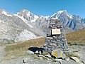 Cairn col de Chavannes.jpg 4,608 × 3,456; 7.42 MB
-
 Cartelli sentieri Alpe del Vicerè.JPG 3,072 × 4,608; 5.93 MB
-
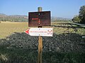
 Cartello itinerario monte Pentime.jpg 640 × 527; 437 KB
-
 Cartello Vallescia.JPG 4,000 × 2,672; 4.42 MB
-
 Casa Farinelli sign.jpg 2,912 × 4,032; 5.45 MB
-
 Colla della Navonera hiking signs.png 2,848 × 3,670; 16.71 MB
-
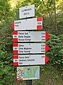
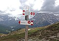
 Cortina d'Ampezzo - trail signs.jpg 3,882 × 3,648; 2.97 MB
-
 Cryoclastie Sentiero Italia @ Chantonnet.jpg 4,608 × 3,456; 8.58 MB
-
 CSA CAI 511 Vespignano Segnavia.jpg 3,864 × 5,152; 7.13 MB
-
 CSV Campo dell'Agio Segnavia.jpg 5,152 × 3,864; 5.35 MB
-
 CSV Carnaio Segnavia.jpg 5,152 × 3,864; 6.06 MB
-
 CSV Trebbo Segnavia.jpg 5,152 × 3,864; 4.18 MB
-
 Cusano Mutri (25443033964).jpg 3,435 × 2,753; 1.36 MB
-
 Deviazione ferata pizzo d'Erna.jpg 720 × 1,278; 441 KB
-
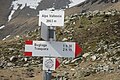
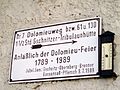 Dolomieuweg.jpg 3,072 × 2,304; 493 KB
-
 DossAltoDiNago-2014-06-23-TuristickyRozcestnik.JPG 3,456 × 4,608; 5.62 MB
-
 E - Itinerario escursionistico.png 98 × 98; 3 KB
-
 EE - Itinerario escursionistico esperti.png 100 × 99; 3 KB
-
 EEA - Itinerario esperti attrezzatura.png 100 × 100; 4 KB
-
 Fingerpost on La Stretta.jpg 3,888 × 5,184; 9.21 MB
-
 Fingerposts comune Vito d'Asio, province di Pordenone, Friuli-Giulia-Venetia, Italia.jpg 5,000 × 3,333; 5.27 MB
-

-
 Forcella del Col de Mèdo.jpg 3,222 × 2,246; 1.65 MB
-
 Forcella Faloria.jpg 5,472 × 3,648; 5.73 MB
-
 Forcella Lavaredo.jpg 4,627 × 3,648; 3.24 MB
-
 Foto 16 per il cai.jpg 4,032 × 3,024; 4.24 MB
-
 Foto 2 per il cai.jpg 4,032 × 3,024; 2.37 MB
-
 Foto 3 per il cai.jpg 3,024 × 4,032; 4.54 MB
-
 Foto 4 per il cai.jpg 3,024 × 4,032; 5.45 MB
-
 Foto 7 per il cai.jpg 4,032 × 3,024; 2.97 MB
-
 Foto 9 per il cai.jpg 4,032 × 3,024; 1.61 MB
-
 Gimillan - trail signs.jpg 4,548 × 3,445; 3.58 MB
-
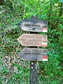
 Gtb segnavia.jpg 1,216 × 1,397; 276 KB
-
 GTE Segnavia orizzontale.svg 243 × 117; 14 KB
-
 GTE segnavia.jpg 4,320 × 3,240; 5.58 MB
-
 Hiking and footpath signs, comune Vito d'Asio, Province di Pordenone, Italia.jpg 5,000 × 3,333; 11.39 MB
-
 Hiking route 123.jpg 5,472 × 3,648; 5.66 MB
-
 IMG 0038 Vetta Monte Falco.JPG 1,944 × 2,592; 1.64 MB
-
 Incrocio 655.jpg 753 × 665; 199 KB
-
 Indicazioni per i rifigi delle dolomiti del brenta.jpg 2,048 × 1,536; 1.91 MB
-
 Indicazioni per la Chiesa di San Nicola.jpg 2,683 × 2,012; 2.19 MB
-
 Ingresso s severino.jpg 2,048 × 1,536; 1.84 MB
-
 Lago Sant'Anna 04.JPG 1,920 × 2,560; 1.01 MB
-
 Lago Sant'Anna 05.JPG 1,920 × 2,560; 1.01 MB
-
 Lami-Percorso naturalistico.jpg 3,648 × 2,736; 2.76 MB
-
 Lausitzer Weg1 cropped.jpg 1,168 × 792; 385 KB
-
 LDP A37.jpg 1,080 × 1,440; 488 KB
-

-
 Monte Lozzo, cartello sacello san Giuseppe.jpg 3,968 × 2,976; 2.7 MB
-
 Ormea-LogoBalconata.jpg 1,024 × 1,010; 759 KB
-
 PAF 04 Isola Segnavia.jpg 5,152 × 3,864; 6.07 MB
-
 PAF 04 Segnavia.jpg 3,864 × 5,152; 8.68 MB
-
 PAF 04 Serra Segnavia 01.jpg 5,152 × 3,864; 6.17 MB
-
 PAF 06 Giogarello Segnavia.jpg 5,152 × 3,864; 7.23 MB
-
 PAF 06 Serra Segnavia.jpg 5,152 × 3,864; 7.96 MB
-
 Palazzuolo 10 20 Segnavia.jpg 5,152 × 3,864; 7.26 MB
-
 Palazzuolo 10 Segnavia.jpg 5,152 × 3,864; 6.23 MB
-
 Palazzuolo 20 Segnavia 2.jpg 5,152 × 3,864; 8.44 MB
-
 Palazzuolo 20 Segnavia 3.jpg 5,152 × 3,864; 8.29 MB
-
 Palazzuolo 20 Segnavia 4.jpg 5,152 × 3,864; 3.8 MB
-
 Palazzuolo 20 Segnavia.jpg 5,152 × 3,864; 7.04 MB
-
 Palazzuolo 80 Segnavia 02.jpg 5,152 × 3,864; 7.87 MB
-
 Palazzuolo 80 Segnavia 03.jpg 5,152 × 3,864; 5.74 MB
-
 Palazzuolo 80 Segnavia 04.jpg 5,152 × 3,864; 5.18 MB
-
 Palazzuolo 80 Segnavia 05.jpg 5,152 × 3,864; 6.96 MB
-
 Palazzuolo 80 Segnavia 06.jpg 5,152 × 3,864; 5.89 MB
-
 Palazzuolo 80 Segnavia 07.jpg 3,864 × 5,152; 7.78 MB
-
 Palazzuolo 80 Segnavia.jpg 5,152 × 3,864; 7.13 MB
-
 Panneau de randonnée au Col du Grand-Saint-Bernard (côté Italie).JPG 2,736 × 3,648; 4.36 MB
-
 Passo del Cornà.png 2,663 × 3,832; 15.08 MB
-
 Petit col Ferret panneaux 01.jpg 4,608 × 3,456; 7.8 MB
-
 Petit col Ferret panneaux borne.jpg 4,608 × 3,456; 7.91 MB
-
 Petit col Ferret panneaux.jpg 4,608 × 3,456; 7.71 MB
-
 Piani Resinelli szlak 1.jpg 2,816 × 2,112; 3.35 MB
-
 Piani Resinelli szlak 2.jpg 2,816 × 2,112; 3.26 MB
-
 Piani Resinelli szlak 3.jpg 2,816 × 2,112; 3.87 MB
-
 PizzoCarbonara.jpg 978 × 1,500; 522 KB
-
 PNFC CAI 417 427 San Benedetto in Alpe Segnavia.jpg 3,864 × 5,152; 7.76 MB
-
 Punto di partenza del Sentiero, Madonna Neve, Vito d'Asio, (PN) Italia.jpg 5,000 × 3,333; 13.46 MB
-
 S.Anna di Vinadio (38).JPG 2,816 × 2,112; 2.61 MB
-
 SAS Bedetta Segnavia.jpg 5,152 × 3,864; 6.53 MB
-
 SAS Segnavia 01.jpg 5,152 × 3,864; 7.15 MB
-
 SAS Segnavia 02.jpg 5,152 × 3,864; 7.36 MB
-
 Schnalswaal3.jpg 500 × 375; 92 KB
-
 SDD Casetta Mandria Segnavia.jpg 5,152 × 3,864; 6.11 MB
-
 SDD Collina Segnavia.jpg 5,152 × 3,864; 4.97 MB
-
 SDD Lovastrina Segnavia.jpg 5,152 × 3,864; 6.61 MB
-
 SDD Monte Birra Segnavia.jpg 3,864 × 5,152; 5.67 MB
-
 SDD Sadurano Segnavia 01.jpg 3,864 × 5,152; 7.68 MB
-
 SDD Virano Segnavia.jpg 5,152 × 3,864; 5.47 MB
-
 Segnale salita impervia San Cristoforo.jpg 3,000 × 4,000; 7.2 MB
-
 Segnale Via Misericordiae.jpg 4,000 × 3,000; 5.44 MB
-
 Segnaleticaverticale Trentino Passo Rolle (1).jpg 3,264 × 2,448; 1.69 MB
-
 Segnaleticaverticale Trentino Passo Rolle (2).jpg 3,264 × 2,448; 2.02 MB
-
 Segnaleticaverticale Trentino Passo Rolle (3).jpg 3,264 × 2,448; 3.45 MB
-
 Segnaleticaverticale Trentino Passo Rolle (4).jpg 3,264 × 2,448; 3.79 MB
-
 Segnaleticaverticale Trentino Passo Rolle (5).jpg 3,264 × 2,448; 2.88 MB
-
 Segnaleticaverticale Trentino Passo Rolle.jpg 3,264 × 2,448; 1.91 MB
-
 Segnavia (1) 303A bivio 339.jpg 768 × 1,023; 189 KB
-
 Segnavia (2) 303A bivio 339.jpg 2,000 × 1,125; 405 KB
-
 Segnavia 303A Gorgolaio.jpg 768 × 1,023; 218 KB
-
 Segnavia orizzontale.svg 187 × 118; 6 KB
-
 Sentiero franchi.jpg 1,574 × 2,111; 413 KB
-
 Sentiero Versasio - Stoppani (waypoint 1).jpg 2,560 × 1,536; 1.63 MB
-
 Sentiero Versasio - Stoppani (waypoint 4, b).jpg 860 × 576; 214 KB
-
 Sentiero Versasio - Stoppani (waypoint 5).jpg 1,224 × 2,039; 969 KB
-
 Sentiero Versasio - Stoppani (waypoint 6).jpg 1,024 × 682; 316 KB
-
 Sentiero Versasio - Stoppani (waypoint 7).jpg 818 × 1,363; 332 KB
-
 Sentiero Versasio - Stoppani 20170420 141548.jpg 2,560 × 1,536; 2.46 MB
-
 Sentiero Versasio - Stoppani 20170420 144311.jpg 1,536 × 2,560; 2.61 MB
-
 Sentiero Versasio - Stoppani 20170420 152106.jpg 1,536 × 2,560; 1.76 MB
-
 Sentiero Versasio - Stoppani 20170420 152113.jpg 1,536 × 2,560; 1.64 MB
-

-
 Signpost on "sentiero del Sole" in Dalico.jpg 960 × 1,280; 161 KB
-
 Signs on the Hiking trail Chiesa della Madonna della Neve, Comune Vito d'Asio (PN) Italy.jpg 5,000 × 3,333; 7.37 MB
-
 Silène acaule Sentiero Italia @ Chantonnet.jpg 4,608 × 3,456; 9.47 MB
-
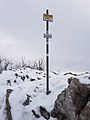 Summit sign of Monte Prasanto 1245masl - Lecco, Lombardy, Italy - 2021-02-09.jpg 2,724 × 3,631; 3.54 MB
-
 Superga Hill, Torino (6).jpg 2,837 × 2,169; 2.62 MB
-
 T - Itinerario turistico.png 99 × 98; 3 KB
-
 Tabella segnavia orizz.png 192 × 121; 6 KB
-
 Tabella segnavia vert.png 377 × 110; 24 KB
-
 Tabella segnavia verticale.svg 371 × 103; 7 KB
-
 Torbiere Sebino Iseo7.jpg 1,280 × 1,024; 326 KB
-
 Trail 6 sign.jpg 5,472 × 3,648; 3.53 MB
-
 Trail 8 in Cogne.jpg 7,173 × 3,081; 5.14 MB
-
 Trail 8 sign.jpg 3,648 × 5,472; 6.85 MB
-
 Trail signs - Breuil-Cervinia.jpg 5,472 × 3,648; 5.08 MB
-
 Trail signs in Cortina.jpg 3,376 × 3,506; 3.13 MB
-
 Trail signs in Corvara.jpg 2,421 × 2,317; 2.43 MB
-
 Trail Signs in Gran Paradiso National Park.jpg 5,472 × 3,648; 6.07 MB
-
 Trail signs in Italy 2.jpg 5,122 × 3,193; 3.65 MB
-
 Trail signs in Italy.jpg 5,722 × 3,376; 3.33 MB
-
 Trail signs in Naturpark Drei Zinnen.jpg 5,353 × 3,648; 5.99 MB
-
 Trail signs on Son Forcia.jpg 4,290 × 3,648; 4.35 MB
-
 Trails Superga Torino (1).jpg 3,121 × 4,161; 3.27 MB
-
 Trails Superga Torino (2).jpg 3,394 × 4,525; 3.22 MB
-
 Via-Francigena-sign-cut.jpg 1,542 × 493; 364 KB
-
 Via-Francigena-sign.jpg 1,600 × 1,067; 388 KB
-
 Via-Francigena-Signposts-In-Italy-2012.jpg 3,000 × 3,000; 1.77 MB
-
 ViaAlpinaGTA.jpg 1,280 × 954; 199 KB
-
 Viandante APT Lecchese.svg 2,102 × 756; 7 KB
-
 Viandante CM Lario Orientale.svg 2,102 × 756; 8 KB
-
 Viandante CM Valsassina.svg 2,102 × 756; 11 KB
-

-
 Wandeltocht rond Lago di Pian Palù (1800 m). in het Nationaal park Stelvio (Italië) 08.jpg 3,003 × 3,447; 9.27 MB
-

-
-
 Wanderschild auf Stromboli.JPG 1,600 × 1,200; 972 KB
-
 Wegmarkierung Bozen-Ritten.jpg 2,736 × 3,648; 3.84 MB
-
 Wegweiser Sesvennahütte.jpg 3,000 × 4,000; 4.54 MB
-
 Wegzeichen am Pfunderer Höhenweg.JPG 1,704 × 2,272; 900 KB
_Italia.jpg)
.jpg)
.jpg)

_04.jpg)
._Richtingsborden_01.jpg)
._Richtingsborden_02.jpg)

_Lessinia_VR_Italy_2013-04-01_photo_CTG_ACA_LESSINIA_Paolo_Villa_0072sp12.jpg)

.jpg)


.jpg)


.jpg)


_2024-07-15_Mattes.jpg)


.JPG)


_Italia.jpg)
.JPG)


.jpg)
.jpg)
.jpg)
.jpg)
.jpg)

_303A_bivio_339.jpg)
_303A_bivio_339.jpg)


.jpg)
.jpg)
.jpg)
.jpg)
.jpg)


_Italy.jpg)

_Italy.jpg)


.jpg)


.jpg)
.jpg)


,_2015,_pannello_informativo_del_Sentiero_Madonna_della_Grotta_(Chiaria).jpg)
._in_het_Nationaal_park_Stelvio_(Itali%C3%AB)_08.jpg)
._in_het_Nationaal_park_Stelvio_(Itali%C3%AB)._Ori%C3%ABntatiepunt.jpg)
_naar_Lago_del_Careser_(2603m)_33.jpg)


