Category:Hiking and footpath signs in England
Jump to navigation
Jump to search
Constituent countries of the United Kingdom: England · Northern Ireland · Scotland · Wales – British Crown dependencies: Isle of Man
Subcategories
This category has the following 27 subcategories, out of 27 total.
Media in category "Hiking and footpath signs in England"
The following 82 files are in this category, out of 82 total.
-
 183 Exakte Hinweise in Exeter.jpg 4,000 × 3,000; 1.87 MB
-
 2014 Public rights of way signage.jpg 4,608 × 3,456; 6.36 MB
-
 2km to Woodside - geograph.org.uk - 2531898.jpg 1,024 × 768; 271 KB
-
 A crossing of paths - geograph.org.uk - 1159284.jpg 640 × 562; 189 KB
-

-
 Any Which Way You Can (1464431660).jpg 2,592 × 3,872; 4.32 MB
-
 Blocked footpath^ - geograph.org.uk - 470100.jpg 480 × 640; 116 KB
-
 Bridge No. 1 Coventry Canal - geograph.org.uk - 372856.jpg 640 × 468; 97 KB
-
 Bristol MMB «C5 Clifton.jpg 2,284 × 1,499; 1.34 MB
-
 Broadbottom Warrasfold Footpath Signs0485.JPG 2,592 × 1,944; 1.16 MB
-
 Close up of waymarker for Jack Mytton Way - geograph.org.uk - 656347.jpg 640 × 480; 181 KB
-
 Close up of waymarker on Jack Mytton Way - geograph.org.uk - 655983.jpg 480 × 640; 147 KB
-
 Closing pinchpoint stile (open).JPG 4,608 × 3,456; 6.94 MB
-
 Cumbria Way signs in Ulverston.JPG 3,072 × 2,304; 2.59 MB
-

-
 Footpath crossing - geograph.org.uk - 1001468.jpg 480 × 640; 130 KB
-
 Footpath junction by play area. - geograph.org.uk - 654896.jpg 640 × 480; 89 KB
-
 Footpath near West Mill - geograph.org.uk - 245096.jpg 640 × 480; 169 KB
-
 Footpath on edge of harvested field - geograph.org.uk - 932243.jpg 640 × 485; 90 KB
-

-
 Footpath signs.jpg 2,048 × 1,536; 578 KB
-
 Footpath Through the Hops - geograph.org.uk - 151307.jpg 640 × 480; 112 KB
-
 GOC Tring 151 Public Footpath 54.jpg 2,154 × 1,621; 2.23 MB
-
 Highfield Country Park sign 1.jpg 2,086 × 1,636; 660 KB
-
 Jack Mytton Way signpost - geograph.org.uk - 702326.jpg 452 × 640; 79 KB
-
 Jurassic Way approaches Stamford - geograph.org.uk - 350895.jpg 640 × 480; 121 KB
-
 Jurassic Way near to Bringhurst - geograph.org.uk - 310881.jpg 640 × 480; 86 KB
-
 Jurassic Way sign - geograph.org.uk - 1741153.jpg 3,648 × 2,736; 2.14 MB
-
 Jurassic Way sign - geograph.org.uk - 310886.jpg 640 × 611; 69 KB
-
 Jurassic Way sign.JPG 2,304 × 3,072; 2.45 MB
-
 Marches Way Part 3 - 31.JPG 3,648 × 2,736; 2.36 MB
-
 Marker post on 'The Shropshire Way' - geograph.org.uk - 689868.jpg 640 × 480; 110 KB
-
 Marker post on The Jack Mytton Way - geograph.org.uk - 1074388.jpg 640 × 480; 121 KB
-
 Meeting of the footpaths - geograph.org.uk - 542016.jpg 640 × 480; 77 KB
-
 Monarch's Way sign.JPG 3,264 × 2,448; 1.34 MB
-
 Moor Farm Lane - geograph.org.uk - 978386.jpg 640 × 427; 59 KB
-
 Moorland Signage clutter - geograph.org.uk - 149489.jpg 640 × 427; 79 KB
-
 Offa's Dyke west of Clun - geograph.org.uk - 31230.jpg 640 × 480; 77 KB
-
 Onto the Jurassic Way... - geograph.org.uk - 444769.jpg 640 × 477; 141 KB
-
 Opening of the Jurassic Way. - geograph.org.uk - 465705.jpg 480 × 640; 91 KB
-
 Path Junction (geograph 5567138).jpg 1,280 × 960; 1.51 MB
-
 Path junction, Ashotts Lane - geograph.org.uk - 1185482.jpg 640 × 480; 191 KB
-
 Pendle Way Waymark.JPG 2,056 × 3,088; 1.79 MB
-
 Pennine Bridleway, Rake End - geograph.org.uk - 339198.jpg 640 × 472; 104 KB
-
 Pennine Way Signpost - geograph.org.uk - 3512073.jpg 640 × 481; 355 KB
-
 Pennine Way signpost, Middleton-in-Teesdale - geograph.org.uk - 4696384.jpg 1,024 × 678; 76 KB
-
 Permissive Path sign on Nine Standards Rigg.jpg 1,920 × 1,200; 1.07 MB
-

-
 Public footpath hardly visible.jpg 2,304 × 1,728; 2.3 MB
-
 Public Footpath Sign - geograph.org.uk - 202577.jpg 640 × 480; 114 KB
-

-

-
 Public footpath, Doddington Road, Lincoln, England - DSCF1512.JPG 3,000 × 4,000; 2.87 MB
-
 Public footpath, Newark Road, Lincoln, England - DSCF1437.JPG 3,000 × 4,000; 2.85 MB
-
 Public footpath, Newark Road, Lincoln, England - DSCF1438.JPG 3,000 × 4,000; 2.9 MB
-
 Rail Trail - geograph.org.uk - 827404.jpg 640 × 480; 152 KB
-
 Ridgeway National Trail signpost.JPG 4,000 × 3,000; 1.57 MB
-
 Riverside walk fingerpost in Cambridge.jpg 2,250 × 4,000; 2.75 MB
-
 Sanctuary of Ripon Waymarker.jpg 2,100 × 1,500; 1.96 MB
-
 Secondary road - geograph.org.uk - 1610927.jpg 640 × 480; 58 KB
-
 Sheffield footpath sign.jpg 400 × 171; 25 KB
-
 Signpost in Aughton, Lancashire.jpg 2,592 × 3,872; 4.28 MB
-
 Signpost on the Jack Mytton Way - geograph.org.uk - 610123.jpg 480 × 640; 299 KB
-
 Snow covered public footpath sign.JPG 3,056 × 4,592; 6.11 MB
-
 SUDC footpath sign.jpg 3,024 × 4,032; 1.57 MB
-
 The John Kyrle Walk - geograph.org.uk - 1438642.jpg 640 × 426; 86 KB
-
 The Severn Way - Footpath - geograph.org.uk - 6687.jpg 640 × 479; 87 KB
-
 The Viking Way Marker.jpg 200 × 200; 16 KB
-
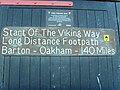 The Viking Way.jpg 3,072 × 2,304; 3.33 MB
-
 The way to go! - geograph.org.uk - 3331213.jpg 560 × 1,024; 213 KB
-
 Three ways to go - geograph.org.uk - 900797.jpg 640 × 461; 253 KB
-
 Track to Trough House - geograph.org.uk - 810354.jpg 427 × 640; 247 KB
-
 Trail arrows at Brandon Country Park.jpg 2,250 × 4,000; 2.68 MB
-
 Unhelpful sign.jpg 1,800 × 1,274; 1.77 MB
-
 Ventnor Haven 22.jpg 1,488 × 1,984; 840 KB
-

-
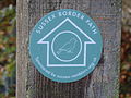 Waymark for Sussex Border Path.JPG 4,608 × 3,456; 6.91 MB
-
 Waymarker for Wey South Path.JPG 4,608 × 3,456; 6.87 MB
-
 Waymarker on the Jack Mytton Way - geograph.org.uk - 655975.jpg 640 × 480; 173 KB
-
 Waymarker post on the Long Mynd - geograph.org.uk - 1712406.jpg 640 × 480; 111 KB
-
 Waymarking and NT property sign - geograph.org.uk - 1092728.jpg 640 × 480; 80 KB
-
 Working Splatt Swing Bridge, Gloucester and Sharpness Canal. - panoramio.jpg 5,312 × 2,988; 4.57 MB


.jpg)


.JPG)


.jpg)


_-_geograph.org.uk_-_859821.jpg)


