Category:Hiking and footpath signs in Catalonia
Jump to navigation
Jump to search
Autonomous communities of Spain: Andalusia · Aragon · Asturias · Balearic Islands · Basque Autonomous Community · Canary Islands · Cantabria · Castile and León · Castilla–La Mancha · Catalonia · Extremadura · Galicia · Community of Madrid · Region of Murcia · Navarre · La Rioja · Valencian Community · Autonomous cities:
Subcategories
This category has the following 7 subcategories, out of 7 total.
Media in category "Hiking and footpath signs in Catalonia"
The following 45 files are in this category, out of 45 total.
-
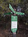
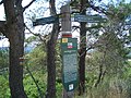
 034 Parc de Collserola, pal indicador.jpg 2,048 × 1,536; 900 KB
-
 04 Pal indicador al camí de Mas Boronat (Salomó).jpg 3,120 × 4,160; 11.6 MB
-
 057 Pal indicador al carrer del Camí de la Font de la Tartana (Matadepera).jpg 2,048 × 1,536; 615 KB
-
 085 Pal indicador vora Santa Maria de Lillet.jpg 2,272 × 1,704; 1.32 MB
-
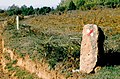
 22 Pal indicador, marge de pedra seca i vinya al camí de Bonastre (Vespella de Gaià).jpg 4,160 × 3,120; 5.23 MB
-
 50 Cruïlla entre el camí de la Cogulla i el camí de Mas Barral (la Pobla de Montornès).jpg 4,160 × 3,120; 7.34 MB
-
 Barcelona (provincia) 1995 04.jpg 968 × 652; 879 KB
-
 Barcelona (provincia) 1995 05.jpg 1,029 × 666; 881 KB
-
 Barcelona (provincia) 1995 06.jpg 665 × 1,017; 776 KB
-
 Barcelona (provincia) 1995 07.jpg 1,016 × 668; 1 MB
-
 Barcelona Sign 2016-327.jpg 5,760 × 3,840; 4.11 MB
-
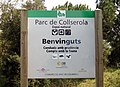 Benvinguts al Parc de Collserola.jpg 1,713 × 1,240; 1.87 MB
-
 Borgonyà - GRs.JPG 1,936 × 2,592; 2.13 MB
-
 Can Furriol P1090218.JPG 3,264 × 2,448; 3.56 MB
-
 Can Furriol P1090223.JPG 3,264 × 2,448; 3.5 MB
-
 Can Furriol P1090225.JPG 3,264 × 2,448; 3.67 MB
-
 Can Furriol P1090226.JPG 3,264 × 2,448; 3.88 MB
-
 Can Furriol P1090227.JPG 3,264 × 2,448; 3.73 MB
-
 Cartel indicador del camino. En el tramo de Gósol a Queralt, 07-11-09.jpg 2,592 × 1,944; 946 KB
-
 CAT700 2019 al Coll de la Creu de l'Eixol.jpg 3,096 × 4,128; 5.63 MB
-
 CAT700 2019 Coll de la Creu al camí vell de la Vilella Alta a Torroja del Priorat.jpg 3,096 × 4,128; 6.7 MB
-
 CAT700 2019 indicacions a Gratallops al GR 174.jpg 4,128 × 3,096; 8.3 MB
-
 Cerdaña, senderos 1991 01.jpg 930 × 651; 898 KB
-
 Cerdaña, senderos 1991 05.jpg 650 × 985; 458 KB
-
 Coma de Noucreus.jpg 2,272 × 1,704; 1.78 MB
-
 El GR 11-6 sobre la collada Fonda amb el puig Sistra al fons P1290359.jpg 3,264 × 2,448; 3.91 MB
-
 Footpath sign in Manresa (1).jpg 2,723 × 2,440; 6.41 MB
-
 GR 175 al Santuari del Tallat (detall).jpg 2,301 × 696; 308 KB
-
 GR 175 al Santuari del Tallat.jpg 2,304 × 1,728; 1.69 MB
-
 GR 92 Sender del Mediterràni Catalunya.JPG 1,920 × 2,560; 3.64 MB
-
 Gr1pallerolsderialb.JPG 2,448 × 3,264; 2.37 MB
-
 Hiking signs in Montserrat Natural Park (1).jpg 1,023 × 2,330; 1.48 MB
-
 Pal indicador al parc del Cadí-Moixeró (Castellar de n'Hug).jpg 3,456 × 2,592; 3.11 MB
-
 Parc periurbà de La Salut (Sabadell) (7).JPG 2,592 × 1,936; 2.51 MB
-
 Parc periurbà de La Salut (Sabadell) (8).JPG 2,592 × 1,936; 2.22 MB
-
 Parc periurbà de La Salut (Sabadell).JPG 2,592 × 1,936; 1.81 MB
-
 Quatre camins - panoramio.jpg 1,950 × 1,300; 775 KB
-
 Santuari de Bellmunt - P1300477.jpg 3,264 × 2,448; 3.79 MB
-
 Sender PR.jpg 2,296 × 1,034; 288 KB
-
 Serra de Galliners.jpg 5,312 × 2,988; 4.2 MB
-

-
 Sitges Spanien (11207352806).jpg 2,048 × 1,151; 823 KB
-
 Torre de Santa Margarida P1080445.jpg 3,264 × 2,448; 3.53 MB
-
 Torre del Bisbe P1080524.JPG 3,264 × 2,448; 3.63 MB
-
 Trencall (abril 2010) - panoramio.jpg 2,048 × 1,536; 1.16 MB

.jpg)
.jpg)

.jpg)
.jpg)
_1995_04.jpg)
_1995_05.jpg)
_1995_06.jpg)
_1995_07.jpg)


.jpg)


.jpg)
.jpg)
_(7).JPG)
_(8).JPG)
.JPG)


.jpg)


_-_panoramio.jpg)
.jpg)