Category:Hiking and footpath information boards in Ruhla
Jump to navigation
Jump to search
Subcategories
This category has the following 2 subcategories, out of 2 total.
G
Media in category "Hiking and footpath information boards in Ruhla"
The following 8 files are in this category, out of 8 total.
-
 Naturerlebnispfad Ruhla, Am Breitenberg 01.jpg 1,719 × 1,703; 703 KB
-
 Naturerlebnispfad Ruhla, Am Breitenberg 03.jpg 3,771 × 2,939; 3.06 MB
-
 Rastplatz Emilienruhe in Ruhla Pic1.JPG 966 × 1,288; 1.01 MB
-
 Ruhla24 Karte zum Loipengarten 1.JPG 3,200 × 3,250; 6.18 MB
-
 Ruhla24 Karte zum Loipengarten 2.JPG 2,539 × 3,778; 5.1 MB
-
 Ruhla24 Karte zum Loipengarten 3.JPG 2,917 × 1,947; 3.78 MB
-
 Ruhla24 Naturpark-Pavillon 4.JPG 2,968 × 2,920; 4.59 MB
-
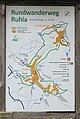 Thal24 Karte zum Rundwanderweg Ruhla.jpg 2,013 × 2,995; 1.31 MB


