Category:Hiking and footpath fingerposts in the United Kingdom
Jump to navigation
Jump to search
Countries of Europe: Austria · Belgium · Bulgaria · Czech Republic · France‡ · Germany · Hungary · Iceland · Republic of Ireland · Italy · Luxembourg · Poland · Portugal‡ · Romania · Russia‡ · Serbia · Slovakia · Slovenia · Spain‡ · Switzerland · Ukraine · United Kingdom
Limited recognition: Kosovo
‡: partly located in Europe
Limited recognition: Kosovo
‡: partly located in Europe
Media in category "Hiking and footpath fingerposts in the United Kingdom"
The following 52 files are in this category, out of 52 total.
-

-
 A60 Loughborough Road near Hoton - geograph.org.uk - 905761.jpg 640 × 447; 65 KB
-
 At a crossing of paths - geograph.org.uk - 1049374.jpg 640 × 427; 119 KB
-
 Bi-lingual Footpath Sign - geograph.org.uk - 227121.jpg 640 × 480; 146 KB
-
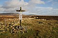
 Black Hag from the Pennine Way - geograph.org.uk - 48626.jpg 640 × 480; 105 KB
-
 Bleaklow6280.JPG 2,048 × 1,536; 745 KB
-
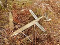 Bourne Wood fallen signpost.jpg 4,896 × 3,672; 7.97 MB
-
 Choose, Williton, Sampford Brett or Aller - geograph.org.uk - 98801.jpg 640 × 480; 156 KB
-

-

-
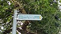 Footpath sign directing a footpath leading to Colney Heath Lane on Barley Mow Lane.jpg 4,000 × 2,250; 2.67 MB
-
 Gate stile on the Pennine Way - geograph.org.uk - 844753.jpg 640 × 480; 121 KB
-
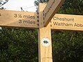
 Hertfordshire public footpath 22 fingerpost.jpg 2,250 × 4,000; 3.09 MB
-
 Jubilee Tower ruin on Moel Famau - geograph.org.uk - 1030734.jpg 640 × 480; 45 KB
-
 Jubilee Tower-Twr y Jiwbili this way - geograph.org.uk - 306362.jpg 640 × 480; 142 KB
-
 Junction of National Trails - geograph.org.uk - 990306.jpg 480 × 640; 105 KB
-
 Kelston Round Hill, signpost at sunset.jpg 3,264 × 2,448; 2.31 MB
-
 Lea Valley Walk1.JPG 2,304 × 1,728; 1.55 MB
-
 Len Valley Walk on Headcorn Road - geograph.org.uk - 1188977.jpg 481 × 640; 123 KB
-
 Limestone Way crosses Pennine Bridleway - geograph.org.uk - 1625251.jpg 640 × 480; 162 KB
-
 Fingerpost - geograph.org.uk - 383718.jpg 640 × 427; 46 KB
-
 Humber Bank Footpath - geograph.org.uk - 540714.jpg 640 × 480; 108 KB
-

-
 Public Footpath - geograph.org.uk - 284283.jpg 640 × 446; 93 KB
-
 Signpost on Holmes Lane - geograph.org.uk - 1311273.jpg 640 × 605; 171 KB
-
 Lonely fingerpost, Hergest Ridge - geograph.org.uk - 449153.jpg 640 × 480; 59 KB
-
 MoelFamauSummit(JohnSTurner)Feb2004.jpg 640 × 457; 160 KB
-
 Offa's Dyke Fingerpost in King's Wood - geograph.org.uk - 169211.jpg 640 × 480; 158 KB
-

-
 Offa's Dyke Path signpost above Brockweir - geograph.org.uk - 56244.jpg 640 × 426; 132 KB
-
 Pennine Bridleway signpost.jpg 879 × 1,018; 103 KB
-
 Pennine Way goes north - geograph.org.uk - 1567872.jpg 640 × 480; 105 KB
-
 Pennine Way hits the A66 - geograph.org.uk - 1658568.jpg 640 × 530; 105 KB
-

-
 Pennine Way signpost near The Crown Inn - geograph.org.uk - 710332.jpg 480 × 640; 133 KB
-
 Pennine Way signpost, Middleton-in-Teesdale - geograph.org.uk - 4696384.jpg 1,024 × 678; 76 KB
-
 Pennine Way, Chew Green - geograph.org.uk - 932676.jpg 640 × 428; 100 KB
-
 Public footpath fingerpost in Pockthorpe, Norfolk, England.jpg 2,250 × 4,000; 6.2 MB
-
 Public Footpath Sign.jpg 5,152 × 3,864; 8.12 MB
-
 Riverside walk fingerpost in Cambridge.jpg 2,250 × 4,000; 2.75 MB
-
 Sign near Oxwich Point (5188).jpg 4,288 × 2,848; 6.41 MB
-

-
 Signpost at a path crossing, Penistone Hill, Haworth - geograph.org.uk - 5139658.jpg 2,000 × 1,500; 1.09 MB
-
 Signpost on the Pennine Way - geograph.org.uk - 1602527.jpg 640 × 428; 100 KB
-
 Signpost to Top Withens.jpg 1,600 × 1,200; 934 KB
-

-
 The Hatches, Frimley Green 09.jpg 3,000 × 4,000; 4.9 MB
-
 The North side of St David's Head - geograph.org.uk - 700928.jpg 640 × 480; 108 KB
-
 The Pennine Way at the Snake Summit - geograph.org.uk - 481664.jpg 640 × 480; 95 KB
-

-
 Way marker on the Pennine Way - geograph.org.uk - 611064.jpg 640 × 480; 93 KB
-
 Wolds Way, Potter Brompton Wold - geograph.org.uk - 120253.jpg 640 × 480; 130 KB


Feb2004.jpg)


.jpg)


