Category:Hiking and footpath fingerposts in Rakovník District
Jump to navigation
Jump to search
Subcategories
This category has the following 3 subcategories, out of 3 total.
Media in category "Hiking and footpath fingerposts in Rakovník District"
The following 57 files are in this category, out of 57 total.
-
 Bezbarvý hrot směrovky.jpg 3,264 × 2,448; 752 KB
-
 Branov 8, odbočka na Luh.jpg 5,184 × 3,888; 7.08 MB
-
 Branov, mapka.jpg 3,888 × 5,184; 6.1 MB
-
 Detail turistické směrovky, pravý dolní roh.jpg 2,790 × 1,794; 353 KB
-
 Hlavačov (rozcestí).jpg 3,312 × 3,629; 4.74 MB
-
 Horní rozcestí u Pilské, přístřešek.jpg 3,264 × 2,448; 2.45 MB
-
 Horní rozcestí u Pilské, rozcestník.jpg 2,448 × 3,264; 2.14 MB
-
 Horní rozcestí u Pilské.jpg 3,264 × 2,448; 1.92 MB
-
 Jezdecká směrovka a značky.jpg 2,448 × 3,264; 2.17 MB
-
 Klečetné 2015-09-28 Pomník padlým.jpg 4,608 × 3,072; 5.43 MB
-
 Krakovec, rozcestník.jpg 2,448 × 3,264; 1.45 MB
-
 Křivoklát, rozcestník pod hradem.jpg 1,536 × 2,048; 596 KB
-
 Křivoklát, rozcestník u kapličky (01).jpg 1,704 × 2,272; 863 KB
-
 Křivoklát, rozcestník u kapličky.jpg 1,704 × 2,272; 784 KB
-
 Milíčov (RA), jezdecký rozcestník Machův Mlýn.jpg 3,264 × 2,448; 1.27 MB
-
 Milíčov (RA), jezdecký rozcestník u kostela.jpg 3,264 × 2,448; 642 KB
-
 Milíčov (RA), rozcestník Machův Mlýn.jpg 2,448 × 3,264; 1.77 MB
-
 Milíčov (RA), rozcestník na návsi.jpg 2,448 × 3,264; 1.52 MB
-
 Mšecké Žehrovice, zastávka.JPG 2,848 × 2,136; 3.02 MB
-
 Nezabudice, pěší rozcestník.jpg 1,536 × 2,048; 422 KB
-
 Nezabudice, V Potocích, turistické směrovky směr Gypsárna.jpg 1,536 × 2,048; 510 KB
-
 Nezabudice, V Potocích, turistické směrovky.jpg 2,048 × 1,536; 647 KB
-
 NS Kounovské řady - rozcestník u nádraží Mutějovice.jpg 3,264 × 2,448; 1.33 MB
-
 Odbočka ke kapličce svatého Eustacha.jpg 1,536 × 2,048; 503 KB
-
 Paraplíčko, směrovka.jpg 3,264 × 2,448; 1.19 MB
-
 Pilská, rozcestník.jpg 2,448 × 3,264; 1.55 MB
-
 Pod Malým Vlastcem, rozcestník.jpg 2,448 × 3,264; 2.2 MB
-
 Pustověty, rozcestník.jpg 1,536 × 2,048; 616 KB
-
 Rakovník, náměstí, rozcestník (01).jpg 2,448 × 3,264; 895 KB
-
 Rakovník, náměstí, rozcestník.jpg 2,448 × 3,264; 501 KB
-
 Rakovník, rozcestník u nádraží.jpg 3,264 × 2,448; 899 KB
-
 Rozcestník Pod Amerikou (01).jpg 2,048 × 1,536; 723 KB
-
 Rozcestník Pod Amerikou (02).jpg 2,048 × 1,536; 588 KB
-
 Rozcestník Pod Džbánem.jpg 2,448 × 3,264; 1.81 MB
-
 Rozcestník Pod Čepinou.jpg 2,048 × 1,536; 688 KB
-
 Rozcestník Pod Špičkou.jpg 1,536 × 2,048; 587 KB
-
 Rozcestník u Uhrovic Mlýna.jpg 3,264 × 2,448; 1.81 MB
-
 Roztoky u Křivoklátu, rozcestník nahoře.jpg 3,888 × 5,184; 6.49 MB
-
 Roztoky u Křivoklátu, rozcestník u mostu.jpg 2,448 × 3,264; 2.02 MB
-
 Skryje (RA), rozcestník KČT u obecního úřadu.jpg 3,888 × 5,184; 5.45 MB
-
 Skryje (RA), rozcestník u obecního úřadu.jpg 3,888 × 5,184; 6.2 MB
-
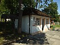
 Skryje (RA), čp. 15, obecní úřad.jpg 5,063 × 3,363; 3.19 MB
-
 Skryje, Luh, směrovka na hrad Týřov.jpg 5,184 × 3,888; 8.33 MB
-
 Skryje, mlýn Slapnice, rozcestník.jpg 5,184 × 3,888; 6.96 MB
-
 Smerova tabule ns u eremita.JPG 3,456 × 1,944; 2.43 MB
-
 Strachovice, rozcestník u zastávky.jpg 2,448 × 3,264; 1.53 MB
-
 Týřov, cedule na stromě.jpg 3,888 × 5,184; 7.38 MB
-
 Týřov, Praga V3S.jpg 5,184 × 3,888; 8.43 MB
-
 Týřov, směrovka.jpg 5,184 × 3,888; 6.37 MB
-
 Týřov, stará tabulka.jpg 5,184 × 3,888; 6.16 MB
-
 Všesulov, rozcestník u železniční zastávky.jpg 2,448 × 3,264; 2.24 MB
-
 Všesulov, rozcestník.jpg 2,448 × 3,264; 1.07 MB
-
 Zřícenina Hlavačov (2).jpg 4,416 × 3,312; 4.69 MB
-
 Šípský mlýn, asfaltka a přeložka turistické trasy.jpg 3,264 × 2,448; 2.11 MB
-
 Šípský Mlýn, rozcestník.jpg 2,448 × 3,264; 1.43 MB
-
 Šípský Mlýn, směrovka na Krakovec.jpg 3,264 × 2,448; 1.27 MB
-
 Šípský Mlýn, č. p. 56 a směrovka Všesulov.jpg 3,264 × 2,448; 2.46 MB


.jpg)


.jpg)

,_jezdeck%C3%BD_rozcestn%C3%ADk_Mach%C5%AFv_Ml%C3%BDn.jpg)
,_jezdeck%C3%BD_rozcestn%C3%ADk_u_kostela.jpg)
,_rozcestn%C3%ADk_Mach%C5%AFv_Ml%C3%BDn.jpg)
,_rozcestn%C3%ADk_na_n%C3%A1vsi.jpg)


.jpg)


.jpg)
.jpg)


,_rozcestn%C3%ADk_K%C4%8CT_u_obecn%C3%ADho_%C3%BA%C5%99adu.jpg)
,_rozcestn%C3%ADk_u_obecn%C3%ADho_%C3%BA%C5%99adu.jpg)
,_%C4%8Dp._15,_obecn%C3%AD_%C3%BA%C5%99ad.jpg)


.jpg)


