Category:Hiking and footpath fingerposts in Landkreis Nordhausen
Jump to navigation
Jump to search
Districts of Thuringia:
Media in category "Hiking and footpath fingerposts in Landkreis Nordhausen"
The following 20 files are in this category, out of 20 total.
-
 Am Schönberg (1).jpg 3,240 × 4,320; 5.17 MB
-
 Informationstafel am Poppenbergturm.jpg 2,048 × 1,536; 233 KB
-
 Informationstafel Karstwanderweg - Standort Uvala Saugasse.jpg 2,048 × 1,536; 272 KB
-
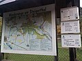 Informationstafel Wanderwege um Steigerthal und Wegweiser in Steigerthal.jpg 2,048 × 1,536; 319 KB
-
 Infotafel Alte Poststraße.jpg 2,048 × 1,536; 361 KB
-
 Wegweiser in Himmelgarten (Glockensteine 1,9 km).jpg 2,048 × 1,536; 234 KB
-
 Wegweiser in Himmelgarten (nach Nordhausen).jpg 2,048 × 1,536; 215 KB
-
 Wegweiser Karstwanderweg an den Glockensteinen (27-1).jpg 2,048 × 1,536; 225 KB
-
 Wegweiser Karstwanderweg an der Kalkhuette.jpg 1,536 × 2,048; 455 KB
-
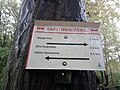
 Wegweiser Karstwanderweg zwischen Steigerthal und Kalkhuette (18-2).jpg 2,048 × 1,536; 432 KB
-
 Wegweiser Karstwanderweg zwischen Steigerthal und Kalkhuette (Ghs Kalkhuette 0,2 km).jpg 1,536 × 2,048; 360 KB
-
 Wegweiser Karstwanderweg zwischen Steigerthal und Kalkhuette (Ghs Kalkhuette 0,4 km).jpg 1,536 × 2,048; 481 KB
-
 Wegweiser Karstwanderweg zwischen Steigerthal und Kalkhuette (Ghs Kalkhuette 0,6 km).jpg 1,536 × 2,048; 302 KB
-
 Wegweiser Karstwanderweg zwischen Steigerthal und Kalkhuette (Ghs Kalkhuette 0,8 km).jpg 2,048 × 1,536; 354 KB
-
 Wegweiser Karstwanderweg zwischen Steigerthal und Kalkhuette (Ghs Kalkhuette 1,4 km).jpg 2,048 × 1,536; 341 KB
-
 Wegweiser zur Doline Sauloch.jpg 2,048 × 1,536; 193 KB
-
 Wegweiser zwischen Himmelgarten und Steigerthal (Nordhausen 2,0 km).jpg 2,048 × 1,536; 221 KB
-
 Wegweiser zwischen Hohnstein und Neustadt (SDS 70, SDS 71).jpg 1,536 × 2,048; 284 KB
-
 Wegweiser zwischen Netzkater und Neustadt (IFW 148).jpg 2,048 × 1,536; 398 KB
-
 Wegweiser zwischen Nordhausen und Himmelgarten (Stolberg 19,6 km).jpg 2,048 × 1,536; 501 KB
.jpg)


.jpg)
.jpg)
.jpg)

.jpg)
.jpg)
.jpg)
.jpg)
.jpg)
.jpg)

.jpg)
.jpg)
.jpg)
.jpg)