Category:Hiking and footpath fingerposts in Hautes-Alpes
Jump to navigation
Jump to search
Departments of Metropolitan France: Ain [01] · Aisne [02] · Alpes-de-Haute-Provence [04] · Hautes-Alpes [05] · Ariège [09] · Aude [11] · Aveyron [12] · Bouches-du-Rhône [13] · Calvados [14] · Cantal [15] · Charente [16] · Creuse [23] · Dordogne [24] · Drôme [26] · Gard [30] · Gironde [33] · Indre [36] · Isère [38] · Jura [39] · Loire [42] · Haute-Loire [43] · Loiret [45] · Lot [46] · Maine-et-Loire [49] · Haute-Marne [52] · Moselle [57] · Nièvre [58] · Nord [59] · Oise [60] · Pas-de-Calais [62] · Puy-de-Dôme [63] · Pyrénées-Atlantiques [64] · Hautes-Pyrénées [65] · departmental district of the Rhône [69] · Sarthe [72] · Savoie [73] · Haute-Savoie [74] · Seine-et-Marne [77] · Vaucluse [84]
Media in category "Hiking and footpath fingerposts in Hautes-Alpes"
The following 20 files are in this category, out of 20 total.
-
 Balise GR au Villard.jpg 500 × 473; 186 KB
-
 Balise VTT au Villard.jpg 1,050 × 769; 325 KB
-
 Balises la Guinguette.jpg 935 × 760; 321 KB
-
 Balises Les Virs.jpg 1,050 × 750; 479 KB
-
 Balises multriples au Villard.jpg 800 × 751; 342 KB
-
 Balises PR au Villard.jpg 615 × 750; 271 KB
-
 Balises Quatre-Chemins.jpg 1,000 × 749; 321 KB
-
 Clot de la Selle. (2191 m.).JPG 1,565 × 2,087; 3.36 MB
-
 Col d'Arsine (2340 m.).JPG 3,554 × 3,093; 5.67 MB
-
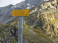
 ColleTraversette2007.jpg 1,280 × 960; 495 KB
-
 GuidepostMontclus.jpg 3,264 × 2,448; 3.58 MB
-
 Infournas-hauts-32.jpg 600 × 800; 333 KB
-
 L'Alpe de Villar-d'Arène. (2078 m.).JPG 4,051 × 3,038; 8.94 MB
-
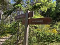
 La Tailla 1220.jpg 785 × 605; 184 KB
-
 Panneaux de direction Les Eygoires et Pierre Arnoux sur les hauteurs de Savines-le-Lac.jpg 4,032 × 3,024; 11.84 MB
-
 Pont des marrons-2022-02 panneau-1.jpg 3,000 × 4,000; 9.33 MB
-
 Pont des marrons-2022-02 panneau-2.jpg 3,000 × 4,000; 6.6 MB
-
 Pont des marrons-2022-02 panneau-3.jpg 3,000 × 4,000; 8.7 MB
-
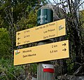
 Poteau Ste Catherine.jpg 1,110 × 785; 429 KB
-
 Pra du Naïs-2022-02 panneau.jpg 3,000 × 4,000; 7.51 MB


.JPG)
.JPG)


.JPG)


