Category:Highway 29 (Taiwan)
Jump to navigation
Jump to search
road in Taiwan _starting_point.jpg)   | |||||
| Upload media | |||||
| Instance of | |||||
|---|---|---|---|---|---|
| Location | |||||
| Transport network | |||||
| Maintained by | |||||
| Start time |
| ||||
| Length |
| ||||
| |||||
English: Provincial Highway 29 (Taiwan).
日本語:台29省道。
中文(臺灣):臺29省道。
中文(中国大陆):台29省道。
Subcategories
This category has only the following subcategory.
B
Media in category "Highway 29 (Taiwan)"
The following 26 files are in this category, out of 26 total.
-
 Beginning of Provincial Highway 29, as taken on 1st October 2020.jpg 4,000 × 3,000; 2.53 MB
-
 CPC Yibi gas station, as taken on 1st October 2020.jpg 4,000 × 3,000; 2.47 MB
-
 Dakanuwa, as taken on 1st October 2020.jpg 3,000 × 4,000; 2.54 MB
-
 Late afternoon view of CPC Yibi gas station, as taken on 1st October 2020.jpg 4,000 × 3,000; 2.63 MB
-
 Looking south-west up Daguang Lane from the T-junction at its northern end.jpg 4,000 × 3,000; 1.77 MB
-
 Masinghalan, as taken on 1st October 2020.jpg 4,000 × 3,000; 4.77 MB
-
 Mitsubishi Delica green wagon stopped at the beginning of Provincial Highway 29.jpg 3,000 × 4,000; 2.16 MB
-
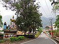
 Namasia 那瑪夏 - panoramio.jpg 5,904 × 3,936; 5.66 MB
-
 Provincial Highway 29 (Taiwan) starting point.jpg 3,504 × 4,672; 3.66 MB
-
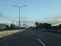
 Provincial Highway 29 begins at the junction of Daguang Lane.jpg 4,000 × 3,000; 1.84 MB
-
 Provincial Highway 29 entering Dakanuwa from north on 1st October 2020.jpg 4,000 × 3,000; 2.43 MB
-
 Provincial Highway 29 junction with Daguang Lane, as taken on 1st October 2020.jpg 4,000 × 3,000; 2.3 MB
-

-

-

-

-
 T-junction at the beginning of Provincial Highway 29, as taken on 1st October 2020.jpg 4,000 × 3,000; 1.74 MB
-
 TW PHW29 RouteMap.svg 500 × 400; 1 MB
-
 TW PHW29.svg 875 × 875; 14 KB
-
 View along the Provincial Highway 29 leading through Masinghalan, 1st October 2020.jpg 3,000 × 4,000; 3.47 MB
-
 台29線五里埔路段景觀.JPG 4,000 × 3,000; 2.22 MB
-
 高雄市大樹區 佛陀紀念館 - panoramio (1).jpg 3,264 × 2,448; 1.55 MB
-
 高雄市大樹區 佛陀紀念館 - panoramio.jpg 3,264 × 2,448; 1.59 MB
-
 高雄市大樹區 台21線 - panoramio (1).jpg 3,264 × 2,448; 1.77 MB
-
 高雄市大樹區 台21線 - panoramio (2).jpg 3,264 × 2,448; 1.21 MB
-
 高雄市大樹區 台21線 - panoramio.jpg 3,264 × 2,448; 1.4 MB


.jpg)

.jpg)
.jpg)
