Category:Hightown, Merseyside
Jump to navigation
Jump to search
village and civil parish in Merseyside, UK  | |||||
| Upload media | |||||
| Instance of | |||||
|---|---|---|---|---|---|
| Location | Sefton, Merseyside, North West England, England | ||||
| Population |
| ||||
| Said to be the same as | Hightown (Wikimedia duplicated page, civil parish) | ||||
 | |||||
Subcategories
This category has the following 6 subcategories, out of 6 total.
Media in category "Hightown, Merseyside"
The following 119 files are in this category, out of 119 total.
-
 "Pebble" - geograph.org.uk - 2296392.jpg 1,600 × 1,200; 1.38 MB
-
 A sea view by Blundellsands Sailing Club - geograph.org.uk - 4993519.jpg 4,363 × 2,904; 5.18 MB
-

-
 Across the mudflats to Formby Point - geograph.org.uk - 5498155.jpg 1,200 × 900; 283 KB
-
 Alt estuary at low tide - geograph.org.uk - 327776.jpg 640 × 457; 42 KB
-
 Alt Road - geograph.org.uk - 4991819.jpg 4,402 × 2,929; 6.62 MB
-
 Alt Road, Hightown - geograph.org.uk - 6607119.jpg 1,600 × 1,199; 669 KB
-
 Alt Road-Kerslake Way junction - geograph.org.uk - 2379695.jpg 640 × 480; 83 KB
-
 Altcar Rifle Range Entrance - geograph.org.uk - 1913352.jpg 1,600 × 900; 1.06 MB
-
 Ancient forest floor at Hightown - geograph.org.uk - 1971501.jpg 1,600 × 757; 867 KB
-
 Ancient tree stump at Hightown - geograph.org.uk - 1914196.jpg 1,600 × 1,200; 1.82 MB
-
 Ancient tree stump at Hightown - geograph.org.uk - 5498160.jpg 1,200 × 900; 570 KB
-
 Ancient tree stump near the Alt at Hightown - geograph.org.uk - 5498165.jpg 1,200 × 900; 380 KB
-
 Ancient woodland floor at Hightown - geograph.org.uk - 1914218.jpg 1,600 × 900; 1.05 MB
-
 Archaeological dig at Hightown - geograph.org.uk - 2006144.jpg 1,354 × 1,600; 1.85 MB
-
 Barn, Wood Farm - geograph.org.uk - 2681532.jpg 1,600 × 1,200; 300 KB
-

-
 Bend on the Alt at Hightown - geograph.org.uk - 1911300.jpg 1,600 × 900; 951 KB
-
 Blue hut in Hightown - geograph.org.uk - 1078195.jpg 640 × 428; 128 KB
-
 Blundellsands Sailing Club - geograph.org.uk - 5682604.jpg 1,600 × 1,200; 493 KB
-
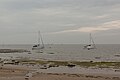
 Boats in the Alt estuary - geograph.org.uk - 1913395.jpg 1,600 × 900; 773 KB
-

-
 Bridge over River Alt, Hightown, Merseyside.jpg 4,827 × 3,218; 5.57 MB
-
 Bridge over the Alt in Altcar Rifle Range - geograph.org.uk - 4744482.jpg 1,024 × 681; 172 KB
-
 Bushes on Hightown dunes - geograph.org.uk - 5064215.jpg 1,024 × 682; 198 KB
-
 Coastal Path approaching Hightown - geograph.org.uk - 3500786.jpg 640 × 480; 81 KB
-
 Crosby Beacon, Formby Bank - geograph.org.uk - 5283810.jpg 640 × 481; 461 KB
-
 Engineered Dune Front at Hightown - geograph.org.uk - 2732000.jpg 1,024 × 685; 219 KB
-
 Entrance to Altcar Rifle Range - geograph.org.uk - 4744473.jpg 1,024 × 681; 124 KB
-
 Farm track near Hightown - geograph.org.uk - 4546030.jpg 1,024 × 682; 203 KB
-
 Farmland, Hightown - geograph.org.uk - 2681497.jpg 1,600 × 1,200; 243 KB
-

-
 Footpath to Sandy Lane, Hightown - geograph.org.uk - 2786985.jpg 480 × 640; 89 KB
-
 Formby Bank from the Alt estuary at Hightown - geograph.org.uk - 1915756.jpg 1,600 × 900; 878 KB
-
 Formby Point Dunes - geograph.org.uk - 4775541.jpg 4,608 × 3,236; 3.55 MB
-
 Former camp entrance-level crossing - geograph.org.uk - 5682612.jpg 1,600 × 1,200; 660 KB
-
 Garden open for charity - geograph.org.uk - 5780486.jpg 1,000 × 667; 259 KB
-
 Gorsey Lane - geograph.org.uk - 2681535.jpg 1,600 × 1,200; 493 KB
-
 Gorsey Lane, Hightown - geograph.org.uk - 4547684.jpg 1,024 × 682; 253 KB
-
 Dune slack on the Sefton coast - geograph.org.uk - 1351.jpg 640 × 480; 75 KB
-
 Farmland near Hightown, Sefton - geograph.org.uk - 80172.jpg 640 × 427; 46 KB
-
 Hightown - River Alt.jpg 640 × 480; 63 KB
-
 Hightown dunes - geograph.org.uk - 318003.jpg 600 × 450; 40 KB
-
 Hightown on the dunes - geograph.org.uk - 1364.jpg 640 × 480; 86 KB
-

-
 Hightown Cross.jpg 600 × 800; 176 KB
-
 Hightown dunes - geograph.org.uk - 5064211.jpg 1,024 × 682; 170 KB
-
 Hightown dunes - geograph.org.uk - 5064225.jpg 1,024 × 682; 154 KB
-
 Hightown railway station, Merseyside - geograph.org.uk - 3265747.jpg 1,024 × 768; 201 KB
-
 Hightown railway station, Merseyside - geograph.org.uk - 3265754.jpg 1,024 × 768; 188 KB
-
 Hightown signal box - geograph.org.uk - 2875273.jpg 639 × 423; 30 KB
-
 Hightown station - geograph.org.uk - 2875269.jpg 640 × 430; 55 KB
-
 Horses - geograph.org.uk - 151871.jpg 640 × 480; 141 KB
-
 Houses on Alt Road - geograph.org.uk - 2681495.jpg 1,600 × 1,200; 424 KB
-
 Houses on the edge of the dunes, Hightown - geograph.org.uk - 5064208.jpg 1,024 × 576; 184 KB
-
 Keep out sign, Altcar Firing Range - geograph.org.uk - 5650262.jpg 1,000 × 750; 145 KB
-
 Lane at Wood Farm - geograph.org.uk - 3941447.jpg 640 × 480; 40 KB
-
 Larkhill Grove, Hightown - geograph.org.uk - 2681489.jpg 1,600 × 1,200; 405 KB
-
 Liverpool war rubble at Hightown - geograph.org.uk - 5498233.jpg 1,200 × 900; 541 KB
-
 Local School Sculpture - geograph.org.uk - 747882.jpg 640 × 479; 55 KB
-
 Lookout post on Altcar Rifle Range - geograph.org.uk - 4744468.jpg 1,024 × 681; 146 KB
-
 Low Tide at River Alt Estuary - geograph.org.uk - 2699614.jpg 480 × 640; 115 KB
-
 Low tide in Hightown, Merseyside.jpg 5,091 × 3,210; 6.68 MB
-
 Marker Beacon on Formby Bank - geograph.org.uk - 1912192.jpg 1,600 × 900; 711 KB
-
 Marker beacon on Formby Bank - geograph.org.uk - 4775531.jpg 1,377 × 1,931; 549 KB
-

-
 Mersey Buoy - geograph.org.uk - 1822083.jpg 640 × 435; 75 KB
-
 More ancient wood at Hightown - geograph.org.uk - 5498207.jpg 1,200 × 900; 463 KB
-
 More ancient wood at Hightown - geograph.org.uk - 5498220.jpg 1,200 × 903; 674 KB
-
 Moss Farm, Gorsey Lane - geograph.org.uk - 2786982.jpg 640 × 480; 70 KB
-
 Moss Farm, Gorsey Lane, Hightown - geograph.org.uk - 4547676.jpg 1,024 × 681; 232 KB
-
 Moss Lane, Hightown - geograph.org.uk - 4547693.jpg 1,024 × 681; 160 KB
-
 Mudflats at Hightown - geograph.org.uk - 5498148.jpg 1,200 × 903; 370 KB
-
 Navigation Buoy C8 and Taylor's Bank - geograph.org.uk - 5283917.jpg 640 × 481; 482 KB
-
 Near the mouth of the River Alt at Hightown - geograph.org.uk - 5498131.jpg 1,600 × 1,201; 534 KB
-
 New access road - geograph.org.uk - 4373932.jpg 1,000 × 750; 322 KB
-
 New access road to a new housing estate - geograph.org.uk - 4373936.jpg 1,000 × 750; 309 KB
-
 New houses Hightown - geograph.org.uk - 5650265.jpg 1,000 × 670; 124 KB
-
 New sea defences at Hightown - geograph.org.uk - 2731991.jpg 1,024 × 685; 118 KB
-
 Not your usual beach - geograph.org.uk - 5684231.jpg 1,600 × 1,200; 620 KB
-
 Our Lady of the Victories - geograph.org.uk - 4145444.jpg 800 × 600; 110 KB
-
 Our vegetables don't grow themselves - geograph.org.uk - 4991521.jpg 4,049 × 2,759; 7.4 MB
-
 Path towards Hightown - geograph.org.uk - 2681487.jpg 1,600 × 1,200; 569 KB
-
 Platform furniture, Hightown station - geograph.org.uk - 5883319.jpg 1,600 × 900; 530 KB
-
 Pumping Station near the River Alt at Hightown - geograph.org.uk - 5498108.jpg 1,600 × 1,200; 748 KB
-
 Remains of a structure^ - geograph.org.uk - 1917340.jpg 1,600 × 1,200; 1.29 MB
-
 Remnants of an ancient woodland at Hightown - geograph.org.uk - 2731985.jpg 1,024 × 576; 180 KB
-
 Remnants of ancient woodland - geograph.org.uk - 1914184.jpg 1,600 × 900; 1.09 MB
-
 River Alt - geograph.org.uk - 1226033.jpg 640 × 480; 85 KB
-
 River Alt at Hightown - geograph.org.uk - 4744485.jpg 1,024 × 681; 149 KB
-
 River Alt estuary at Hightown - geograph.org.uk - 1915671.jpg 1,600 × 900; 947 KB
-
 River Alt, Hightown - geograph.org.uk - 1078204.jpg 640 × 428; 109 KB
-
 River Alt, Hightown - geograph.org.uk - 1078209.jpg 640 × 428; 130 KB
-
 Road from the railway station - geograph.org.uk - 5315513.jpg 4,128 × 2,322; 6.26 MB
-
 Rubble bank at Hightown - geograph.org.uk - 1914229.jpg 1,600 × 900; 997 KB
-
 Rubble covered beach - geograph.org.uk - 4775543.jpg 4,608 × 3,456; 3.58 MB
-
 Rubble on a beach - geograph.org.uk - 5684203.jpg 1,600 × 1,200; 703 KB
-
 Scrub south of Hightown - geograph.org.uk - 2681486.jpg 1,600 × 1,200; 525 KB
-

-

-
 Tank road sign - geograph.org.uk - 4373928.jpg 750 × 1,000; 238 KB
-
 The beach by Blundellsands Sailing Club - geograph.org.uk - 4991945.jpg 4,353 × 2,780; 6.49 MB
-
 The Hightown Hotel - geograph.org.uk - 3322167.jpg 640 × 480; 114 KB
-

-
 The mouth of the River Alt at Hightown - geograph.org.uk - 5498179.jpg 1,200 × 900; 293 KB
-
 The Old 'District' Bank - geograph.org.uk - 5682626.jpg 1,600 × 1,201; 513 KB
-
 The Old Bank, 12 Lower Alt Road, Hightown (September 2021).JPG 2,400 × 1,800; 1.7 MB
-
 The River Alt - geograph.org.uk - 4993577.jpg 4,259 × 2,834; 7.28 MB
-
 The road from Hightown station - geograph.org.uk - 5315504.jpg 2,322 × 4,128; 1.95 MB
-

-
 Thirlmere Road - geograph.org.uk - 747874.jpg 640 × 479; 83 KB
-
 Thirlmere Road, Hightown - geograph.org.uk - 1078215.jpg 640 × 428; 126 KB
-
 Thornbeck Avenue, Hightown - geograph.org.uk - 2681491.jpg 1,600 × 1,200; 349 KB
-
 Walking the dog at Hightown - geograph.org.uk - 5498205.jpg 1,200 × 900; 339 KB
-
 Whitedge Farm - geograph.org.uk - 5315509.jpg 4,128 × 2,322; 4.9 MB
-
 Wooden Blue Hut - geograph.org.uk - 3322155.jpg 1,024 × 768; 325 KB
-

-

-
 Formby Bank looking towards Altcar - geograph.org.uk - 36658.jpg 640 × 480; 61 KB


_beside_the_Alt_at_Hightown_-_geograph.org.uk_-_2839140.jpg)
,_Hightown_dunes_-_geograph.org.uk_-_3645480.jpg)


.JPG)


_-_geograph.org.uk_-_5792837.jpg)
_-_geograph.org.uk_-_5792840.jpg)
