Category:Highgate
Jump to navigation
Jump to search
area of North London, England  | |||||
| Upload media | |||||
| Instance of |
| ||||
|---|---|---|---|---|---|
| Part of | |||||
| Location | |||||
 | |||||
Subcategories
This category has the following 16 subcategories, out of 16 total.
Media in category "Highgate"
The following 40 files are in this category, out of 40 total.
-
 Image taken from page 408 of 'Old and New London, etc' (11190823643).jpg 1,892 × 1,568; 1.08 MB
-
 Image taken from page 432 of 'Old and New London, etc' (11189120855).jpg 1,892 × 1,596; 1.18 MB
-
 Image taken from page 433 of 'Old and New London, etc' (11191904826).jpg 1,892 × 2,817; 1.87 MB
-
 Image taken from page 439 of 'Old and New London, etc' (11192502235).jpg 1,892 × 1,578; 1.11 MB
-
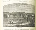 Image taken from page 462 of 'Old and New London, etc' (11186380705).jpg 1,892 × 1,582; 1.17 MB
-
 Highgate Tennis Club, Crouch End, London cooler render.jpg 4,499 × 2,999; 9.2 MB
-
 Highgate Tennis Club, Crouch End, London warmer render.jpg 4,499 × 2,999; 9.55 MB
-
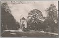
 Anon - The Garden at Highgate Grove - 1835 - 8734.jpg 2,048 × 1,619; 654 KB
-
 Anon - The Garden at Highgate Grove - 1835 - 8734a.jpg 2,250 × 1,553; 663 KB
-
 Aylmer Court on Sheldon Avenue - geograph.org.uk - 3874195.jpg 1,200 × 798; 414 KB
-
 Back point scheffauer.jpg 1,915 × 1,238; 1,015 KB
-
 Big Houses on Broadlands Road - geograph.org.uk - 4869818.jpg 3,597 × 2,993; 3.26 MB
-
 Block of flats on Hillcrest, Highgate - geograph.org.uk - 4227002.jpg 2,304 × 1,728; 1.19 MB
-
 Capital Ring - geograph.org.uk - 5194077.jpg 640 × 426; 96 KB
-
 Channing School, Highgate - geograph.org.uk - 3312578.jpg 4,288 × 3,216; 5.38 MB
-
 Cottages in Castle Yard, Highgate - geograph.org.uk - 2347388.jpg 1,024 × 768; 244 KB
-
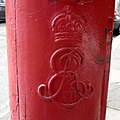 Cypher, Edward VII postbox on Broadlands Road - geograph.org.uk - 4928758.jpg 2,089 × 2,086; 783 KB
-
 Cypher, Edward VII postbox on Denewood Road - geograph.org.uk - 4928744.jpg 1,469 × 1,477; 402 KB
-
 Dartmouth Park Hill (geograph 4928184).jpg 640 × 480; 100 KB
-
 Detail, Edward VII postbox on Broadlands Road - geograph.org.uk - 4928761.jpg 1,166 × 1,744; 280 KB
-
 Detail, Edward VII postbox on Denewood Road - geograph.org.uk - 4928745.jpg 1,231 × 1,927; 296 KB
-
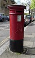 Edward VII postbox on Broadlands Road - geograph.org.uk - 4928757.jpg 1,631 × 2,702; 986 KB
-
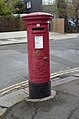 Edward VII postbox on Denewood Road - geograph.org.uk - 4928741.jpg 1,558 × 2,356; 747 KB
-
 Highgate Hill Murugan Temple 2023-12-14.jpg 4,032 × 3,024; 3.02 MB
-
 Highgate International Church - geograph.org.uk - 3526560.jpg 1,200 × 752; 1.03 MB
-
 Highgate N6.jpg 3,072 × 2,304; 1.52 MB
-
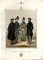 Highgate Volunteer Rifles (BM 1927,1126.1.15.2).jpg 1,792 × 2,500; 733 KB
-
 Highgate, Channing School - geograph.org.uk - 3069713.jpg 1,024 × 1,017; 251 KB
-
 Highgate, Jackson's Lane Community Centre - geograph.org.uk - 2774828.jpg 3,264 × 2,448; 3.1 MB
-
 Highgate, Jackson's Lane Community Centre - geograph.org.uk - 2774923.jpg 3,264 × 2,448; 2.31 MB
-
 House on Grange Road, Highgate - geograph.org.uk - 1919646.jpg 640 × 480; 141 KB
-
 Houses, Cholmeley Park, Highgate - geograph.org.uk - 5285784.jpg 1,336 × 1,600; 466 KB
-
 Leaning Letter Box, Southwood Lawn Road - geograph.org.uk - 4868389.jpg 3,825 × 2,807; 3.05 MB
-
 Map of "Hampstead and Highgate," London, 1915.jpg 4,608 × 3,456; 5.43 MB
-
 New house on the corner of View Close - geograph.org.uk - 3871982.jpg 2,304 × 1,728; 849 KB
-
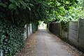
 Park House Passage - geograph.org.uk - 5197458.jpg 640 × 426; 83 KB
-
 St Michaels Primary School, Highgate.jpg 2,496 × 1,080; 1.36 MB
-
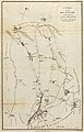 Survey of the Roads and Foot paths in the Parish of Islington.jpg 3,666 × 5,702; 3.28 MB
-
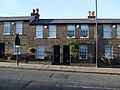
 Terraced cottages, Castle Yard, Highgate - geograph.org.uk - 4292867.jpg 1,420 × 920; 438 KB
-
 The top of Jackson's Lane, Highgate, June 2021.jpg 3,024 × 4,032; 6.32 MB
.jpg)
.jpg)
.jpg)
.jpg)
.jpg)


.jpg)


.jpg)


