Category:Higher Blackley
Jump to navigation
Jump to search
English: Higher Blackley is a ward in the City of Manchester
area of Manchester, England _2018.png) | |||||
| Upload media | |||||
| Instance of | |||||
|---|---|---|---|---|---|
| Location | Manchester, Greater Manchester, North West England, England | ||||
| Inception |
| ||||
| Different from | |||||
 | |||||
Subcategories
This category has the following 2 subcategories, out of 2 total.
F
T
Media in category "Higher Blackley"
The following 83 files are in this category, out of 83 total.
-

-
 At the junction of Victoria Avenue and Rochdale Road - geograph.org.uk - 1817621.jpg 3,713 × 2,461; 3.1 MB
-
 Blackley Community Fire Station - geograph.org.uk - 5920036.jpg 640 × 477; 78 KB
-
 Blackley Cricket Club - geograph.org.uk - 2947365.jpg 1,600 × 1,200; 412 KB
-
 Blackley Cricket Club - geograph.org.uk - 2947374.jpg 1,600 × 1,200; 332 KB
-
 Blackley Forest - geograph.org.uk - 6494215.jpg 4,032 × 3,024; 1.69 MB
-
 Boothroyden Road - geograph.org.uk - 6139963.jpg 1,280 × 960; 851 KB
-
 Brook in Heaton Park - geograph.org.uk - 6669051.jpg 6,000 × 4,000; 7.07 MB
-

-
 Chapel Lane, Manchester - geograph.org.uk - 5911261.jpg 640 × 480; 64 KB
-
 Chapel Lane, Manchester - geograph.org.uk - 5911263.jpg 640 × 480; 63 KB
-
 Chapel Lane, Manchester - geograph.org.uk - 5911265.jpg 640 × 480; 61 KB
-
 Charnwood Road, Higher Blackley - panoramio.jpg 4,000 × 3,000; 4.91 MB
-

-
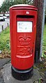
 Elizabeth II postbox on Plant Hill Road, Manchester M9 - geograph.org.uk - 5912346.jpg 1,974 × 3,335; 1.49 MB
-
 Elizabeth II postbox on Victoria Avenue, Manchester - geograph.org.uk - 5912353.jpg 2,014 × 3,630; 1.3 MB
-
 Floodlit Heaton Hall - geograph.org.uk - 6702455.jpg 6,000 × 4,000; 4.06 MB
-
 Geese on the Shore at Heaton Park Boating Lake - geograph.org.uk - 6754387.jpg 800 × 1,000; 1.6 MB
-
 Giant Butterfly at Heaton Park - geograph.org.uk - 6692100.jpg 767 × 1,024; 594 KB
-
 Giraffes at Heaton Park - geograph.org.uk - 6692224.jpg 1,024 × 768; 960 KB
-
 Grey Squirrel in the Dell at Heaton Park - geograph.org.uk - 6754381.jpg 1,024 × 768; 1.68 MB
-
 Hand Sanitiser Station - geograph.org.uk - 6699551.jpg 1,280 × 960; 1.19 MB
-
 Hands and Flowers, Lightopia at Heaton Park - geograph.org.uk - 6691986.jpg 1,024 × 769; 644 KB
-
 Heaton Hall - geograph.org.uk - 6691978.jpg 1,024 × 683; 539 KB
-
 Heaton Park - geograph.org.uk - 6506148.jpg 3,754 × 3,024; 1.68 MB
-
 Heaton Park - geograph.org.uk - 6699543.jpg 1,280 × 960; 1.18 MB
-
 Heaton Park - geograph.org.uk - 6747201.jpg 4,032 × 2,268; 2 MB
-
 Heaton Park below the Summer House - geograph.org.uk - 6667494.jpg 6,000 × 4,000; 3.6 MB
-
 Heaton Park Boating Lake - geograph.org.uk - 6541370.jpg 1,024 × 768; 700 KB
-
 Heaton Park Boating Lake - geograph.org.uk - 6781431.jpg 1,024 × 768; 1.58 MB
-
 Heaton Park Dragons - geograph.org.uk - 6691995.jpg 1,024 × 777; 755 KB
-
 Heaton Park Lake - geograph.org.uk - 6781453.jpg 1,024 × 768; 1.15 MB
-
 Heaton Park Somme Memorial - geograph.org.uk - 6692088.jpg 1,024 × 768; 762 KB
-

-
 Heaton Park, The Papal Stone - geograph.org.uk - 6506779.jpg 1,024 × 683; 546 KB
-
 Higher Blackley (Manchester City Council ward) 2018.png 2,043 × 3,776; 626 KB
-
 Higher Blackley Conservative Club - geograph.org.uk - 2761524.jpg 640 × 480; 117 KB
-
 Higher Blackley Royal British Legion Club - geograph.org.uk - 6480023.jpg 4,031 × 2,240; 1.97 MB
-
 In the Fairytale Forest - geograph.org.uk - 6692856.jpg 1,024 × 876; 711 KB
-
 Junction on Middleton Road (A576) - geograph.org.uk - 5911444.jpg 640 × 480; 64 KB
-
 Lightopia Arch, Heaton Park - geograph.org.uk - 6691981.jpg 1,024 × 768; 839 KB
-
 Lightopia Dragon, Heaton Park - geograph.org.uk - 6691990.jpg 1,024 × 769; 979 KB
-
 M60 - geograph.org.uk - 5771956.jpg 4,956 × 3,427; 1.65 MB
-
 M60 Motorway - geograph.org.uk - 5771872.jpg 4,812 × 2,940; 1.97 MB
-
 M60 Motorway - geograph.org.uk - 6516045.jpg 3,823 × 2,719; 1.75 MB
-
 M60 Motorway, Junction 20 - geograph.org.uk - 5920057.jpg 640 × 513; 66 KB
-
 Memory Tiles, Heaton Park Somme Memorial - geograph.org.uk - 6692074.jpg 1,024 × 768; 619 KB
-
 Middleton Rd - geograph.org.uk - 6786660.jpg 1,024 × 591; 127 KB
-

-
 Mountain Rescue Team - geograph.org.uk - 6198377 (cropped).jpg 2,368 × 2,212; 1.71 MB
-
 Mountain Rescue Team - geograph.org.uk - 6198377.jpg 3,824 × 2,822; 1.79 MB
-
 Mr Softee - geograph.org.uk - 6377436.jpg 1,280 × 960; 919 KB
-
 Path from the Showground at Heaton Park - geograph.org.uk - 6754389.jpg 1,024 × 768; 1.64 MB
-
 Path to Heaton Park Farm - geograph.org.uk - 6754383.jpg 1,024 × 768; 1.72 MB
-
 Petrol Filling Station - A664 Higher Blackley - geograph.org.uk - 2514587.jpg 3,944 × 2,203; 2.41 MB
-
 Plant Hill Road, Manchester M9 - geograph.org.uk - 5912350.jpg 3,648 × 2,736; 1.58 MB
-
 Police Station - geograph.org.uk - 5771955.jpg 5,039 × 2,517; 1.77 MB
-
 River Irk - geograph.org.uk - 6516039.jpg 3,981 × 2,986; 1.81 MB
-
 River Irk - geograph.org.uk - 6516050.jpg 3,835 × 2,929; 1.73 MB
-
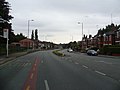
 Rochdale Road (A664) - geograph.org.uk - 5920033.jpg 640 × 478; 97 KB
-
 Rochdale Road (A664) - geograph.org.uk - 5920054.jpg 640 × 439; 95 KB
-
 Rochdale Road (A664) - geograph.org.uk - 5920060.jpg 640 × 480; 74 KB
-
 Rochdale Road - Higher Blackley - geograph.org.uk - 2514595.jpg 4,000 × 3,000; 4.13 MB
-
 Scavenger - geograph.org.uk - 6199438.jpg 800 × 601; 574 KB
-

-
 Snow Storm at Heaton Park Lake - geograph.org.uk - 6754388.jpg 1,024 × 768; 1.39 MB
-
 Somme Memorial in Heaton Park - geograph.org.uk - 6667491.jpg 6,000 × 4,000; 6.95 MB
-
 Swan Pedalo at Heaton Park - geograph.org.uk - 6541383.jpg 1,024 × 768; 810 KB
-
 The Boating Lake, Heaton Park - geograph.org.uk - 6541363.jpg 1,024 × 768; 792 KB
-
 The Lake at Heaton Park - geograph.org.uk - 6541377.jpg 1,024 × 683; 619 KB
-
 The Millstone - geograph.org.uk - 6494219.jpg 4,032 × 2,683; 1.9 MB
-
 The Old Town Hall Colonnade at Heaton Park - geograph.org.uk - 6781450.jpg 1,024 × 683; 1.4 MB
-
 The Papal Monument, Heaton Park - geograph.org.uk - 6506775.jpg 1,024 × 683; 533 KB
-
 The Somme Memorial in Heaton Park - geograph.org.uk - 6692055.jpg 1,024 × 768; 842 KB
-
 Towerblocks from Blackley New Road - geograph.org.uk - 5724389.jpg 2,612 × 1,519; 889 KB
-
 Tunnel Ventilation Covers, Heaton Park - geograph.org.uk - 6506767.jpg 1,024 × 768; 595 KB
-
 Tweedle Hill Road, Manchester - geograph.org.uk - 5911269.jpg 640 × 480; 49 KB
-
 Victoria Avenue - geograph.org.uk - 6139958.jpg 1,280 × 960; 831 KB
-
 Victoria Avenue - geograph.org.uk - 6139968.jpg 1,280 × 960; 804 KB
-
 Victoria Avenue, Manchester - geograph.org.uk - 5911278.jpg 640 × 480; 71 KB
-
 Woodland in Heaton Park - geograph.org.uk - 6668131.jpg 6,000 × 4,000; 7.37 MB
-
 Woodland in Heaton Park - geograph.org.uk - 6668140.jpg 6,000 × 4,000; 7.78 MB
-
 Woodland path in Heaton Park - geograph.org.uk - 6669031.jpg 6,000 × 4,000; 7.08 MB


,_Manchester_-_geograph.org.uk_-_5911439.jpg)


_-_geograph.org.uk_-_5911444.jpg)


_towards_Junction_19,_M60_Motorway_-_geograph.org.uk_-_5911441.jpg)
.jpg)


_-_geograph.org.uk_-_5920033.jpg)
_-_geograph.org.uk_-_5920054.jpg)
_-_geograph.org.uk_-_5920060.jpg)


,_Manchester_-_geograph.org.uk_-_5911282.jpg)


