Category:High Grange, Crook
Jump to navigation
Jump to search
English: High Grange is a hamlet in the unparished area of Crook, in the County Durham district, in the county of Durham, England.
village in County Durham, England, UK  | |||||
| Upload media | |||||
| Instance of | |||||
|---|---|---|---|---|---|
| Location | County Durham, North East England, England | ||||
 | |||||
Media in category "High Grange, Crook"
The following 20 files are in this category, out of 20 total.
-
 A689 towards Bishop Auckland - geograph.org.uk - 5515986.jpg 640 × 480; 85 KB
-
 A689 towards Bishop Auckland - geograph.org.uk - 5515989.jpg 640 × 480; 52 KB
-
 Beechburn Beck - geograph.org.uk - 2899108.jpg 4,608 × 3,456; 5.29 MB
-
 Beechburn Beck - geograph.org.uk - 3928851.jpg 640 × 480; 196 KB
-
 Beechburn crossroads - geograph.org.uk - 2899100.jpg 4,608 × 3,456; 5.61 MB
-
 Embankment on the Weardale Railway - geograph.org.uk - 3928783.jpg 640 × 480; 197 KB
-
 Entrance to Small Leazes Farm from Green Lane - geograph.org.uk - 3718436.jpg 3,416 × 2,390; 2.78 MB
-
 Farmhouse at Beechburn Farm - geograph.org.uk - 3718415.jpg 3,648 × 2,736; 2.4 MB
-

-
 Field entrance off the A689 - geograph.org.uk - 5515988.jpg 640 × 480; 64 KB
-
 Grazing and hedgerow, High Grange - geograph.org.uk - 5515987.jpg 640 × 480; 60 KB
-
 Green Lane , High Grange - geograph.org.uk - 317483.jpg 640 × 479; 122 KB
-
 Green Lane rising up from High Grange - geograph.org.uk - 3718429.jpg 3,466 × 2,474; 2.82 MB
-
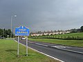 High Grange village entrance sign - geograph.org.uk - 2056690.jpg 640 × 480; 58 KB
-
 Houses in High Grange, County Durham - geograph.org.uk - 2188142.jpg 2,000 × 1,500; 2.44 MB
-
 Railway bridge over Low Lane - geograph.org.uk - 5906468.jpg 640 × 480; 104 KB
-

-
 Slotburn Bridge over Low Lane - geograph.org.uk - 3928776.jpg 640 × 480; 248 KB
-
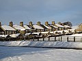
 Terraced housing at High Grange - geograph.org.uk - 3852637.jpg 1,500 × 1,000; 1.09 MB
-
 Tree planting at Beechburn Farm - geograph.org.uk - 3928843.jpg 640 × 480; 183 KB


