Category:Heyshott
Jump to navigation
Jump to search
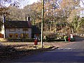
English: Heyshott is a village and civil parish in the Chichester district of West Sussex, England. It is approximately three miles south of Midhurst. Like many villages it has lost its shop but still has one pub, the Unicorn. The hamlet of Hoyle is to the north east of the village.
village in the United Kingdom  | |||||
| Upload media | |||||
| Instance of | |||||
|---|---|---|---|---|---|
| Location | Chichester, West Sussex, South East England, England | ||||
| Population |
| ||||
| Area |
| ||||
| Said to be the same as | Heyshott (Wikimedia duplicated page, civil parish) | ||||
 | |||||
Subcategories
This category has the following 3 subcategories, out of 3 total.
Media in category "Heyshott"
The following 200 files are in this category, out of 223 total.
(previous page) (next page)-
 "Long Hoyle" on Hoyle Lane - geograph.org.uk - 2274492.jpg 800 × 600; 155 KB
-
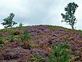 A heathery hill - geograph.org.uk - 3085058.jpg 640 × 480; 136 KB
-

-
 Above Combe Bottom - geograph.org.uk - 4590488.jpg 1,142 × 857; 392 KB
-
 Almost There - geograph.org.uk - 2886776.jpg 4,288 × 3,216; 3.57 MB
-
-
 Ancient and modern, Heyshott - geograph.org.uk - 1337877.jpg 480 × 640; 146 KB
-
 Arrival at the South Downs Way - geograph.org.uk - 3298634.jpg 800 × 600; 213 KB
-
 Barn at Legg's Farm, Heyshott - geograph.org.uk - 4528784.jpg 1,024 × 760; 119 KB
-
 Barn at Sunwool Farm - geograph.org.uk - 2838961.jpg 4,000 × 3,000; 3.58 MB
-
 Barn at Sunwool Farm from the east - geograph.org.uk - 1853145.jpg 800 × 600; 117 KB
-
 Barn, Hoyle Farm - geograph.org.uk - 338099.jpg 640 × 428; 95 KB
-
 Barns and enclosure on Hoyle Lane - geograph.org.uk - 2274495.jpg 800 × 600; 105 KB
-

-
 Bluebell Bank - geograph.org.uk - 2888826.jpg 4,288 × 3,216; 3.66 MB
-
 Bridle rink in the woods - geograph.org.uk - 3298664.jpg 800 × 600; 182 KB
-
 Bridlebridge on Heyshott Common - geograph.org.uk - 3057512.jpg 800 × 600; 183 KB
-
 Bridleway and-or stream near Heyshott Green - geograph.org.uk - 2097680.jpg 2,592 × 1,944; 2.53 MB
-
 Bridleway at the end of the spur of Heyshott access land - geograph.org.uk - 2838007.jpg 4,000 × 3,000; 3.44 MB
-
 Bridleway bridge on path to Heyshott Green - geograph.org.uk - 2097662.jpg 2,592 × 1,944; 2.48 MB
-
 Bridleway north to Heyshott - geograph.org.uk - 2837992.jpg 4,000 × 3,000; 3.4 MB
-
 Bridleway south off the South Downs Way - geograph.org.uk - 2836258.jpg 4,000 × 3,000; 3.54 MB
-
 Bridleway through Heyshott Green - geograph.org.uk - 1943047.jpg 640 × 480; 115 KB
-
 Bridleway to Heyshott - geograph.org.uk - 2886927.jpg 4,288 × 3,216; 3.69 MB
-
 Bridleway to Walkers Farm - geograph.org.uk - 2192323.jpg 800 × 600; 189 KB
-
 Bridleway, Heyshott - geograph.org.uk - 2887047.jpg 4,288 × 3,216; 3.37 MB
-
 Bridleway, Heyshott Green - geograph.org.uk - 1337106.jpg 640 × 481; 229 KB
-

-

-
 Cobdens and Farriers, Heyshott 01.jpg 4,000 × 3,000; 3.1 MB
-
 Cobdens and Farriers, Heyshott 02.jpg 4,000 × 3,000; 2.87 MB
-
 Cobdens and Farriers, Heyshott 03.jpg 4,000 × 3,000; 3.44 MB
-
 Cocking Park Drive - geograph.org.uk - 225560.jpg 479 × 640; 221 KB
-
 Concrete footpath entering Cocking - geograph.org.uk - 2098060.jpg 2,592 × 1,944; 2.13 MB
-
 Coster's Brook under the road to Dunford House - geograph.org.uk - 2097608.jpg 2,592 × 1,944; 1.82 MB
-
 Cottage at Manor Farm in Heyshott - geograph.org.uk - 2358465.jpg 800 × 600; 177 KB
-
 Cottage near Bex Mill - geograph.org.uk - 2194639.jpg 800 × 600; 186 KB
-
 Cottage on the Green, Heyshott Green - geograph.org.uk - 3085031.jpg 640 × 480; 77 KB
-
 Country road near Graffham (1) - geograph.org.uk - 2052634.jpg 640 × 384; 220 KB
-
 Country roads near South Ambersham - geograph.org.uk - 2040623.jpg 640 × 361; 180 KB
-
 Cowdray Estate cottage east of Bex Mill - geograph.org.uk - 4532657.jpg 1,024 × 768; 361 KB
-
 Cross Dyke on the South Downs - geograph.org.uk - 6440118.jpg 1,600 × 1,052; 703 KB
-
 Curving hedge, Heyshott - geograph.org.uk - 2078647.jpg 640 × 428; 82 KB
-
 Dated 1762 - geograph.org.uk - 1804953.jpg 480 × 640; 143 KB
-
 Dead tree, Heyshott Common - geograph.org.uk - 2092482.jpg 431 × 640; 274 KB
-
 Deer Above Heyshott - geograph.org.uk - 2887073.jpg 4,288 × 3,216; 3.32 MB
-
 Deer, Heyshott - geograph.org.uk - 2887084.jpg 4,288 × 3,216; 2.7 MB
-
 Direction Sign – Signpost - geograph.org.uk - 6539450.jpg 597 × 797; 185 KB
-
 Disused pit near Heyshott - geograph.org.uk - 2358477.jpg 800 × 600; 137 KB
-
 Dried-up stream alongside Mill Lane - geograph.org.uk - 1943145.jpg 1,600 × 1,200; 723 KB
-
 Ducks on Marsh Pond - geograph.org.uk - 3298655.jpg 800 × 568; 93 KB
-

-
 Entrance at Hoyle Farm - geograph.org.uk - 2274278.jpg 800 × 600; 105 KB
-
 Exuberant hedges at Cranmore House - geograph.org.uk - 1009661.jpg 640 × 389; 87 KB
-
 Farmland near Heyshott - geograph.org.uk - 2050079.jpg 480 × 640; 231 KB
-
 Farmland north of St James, Heyshott - geograph.org.uk - 1739809.jpg 640 × 480; 50 KB
-
 Field south of Heyshott - geograph.org.uk - 1852154.jpg 800 × 600; 87 KB
-
 Fields by Manor Farm - geograph.org.uk - 2886953.jpg 4,288 × 3,216; 3.44 MB
-
 Flint cottages, Hoyle Lane - geograph.org.uk - 2078640.jpg 640 × 428; 117 KB
-
 Fly Agaric by the path - geograph.org.uk - 2078807.jpg 640 × 428; 128 KB
-

-
 Foot of South Downs by Heyshott - geograph.org.uk - 2889005.jpg 4,288 × 3,216; 3.6 MB
-
 Foot of the South Downs, Heyshott - geograph.org.uk - 2887034.jpg 4,288 × 3,216; 3.53 MB
-
 Footbridge and Stream - geograph.org.uk - 4452659.jpg 1,599 × 2,399; 2.98 MB
-

-
 Footpath by Hampshire Copse - geograph.org.uk - 2889032.jpg 4,288 × 3,216; 3.69 MB
-
 Footpath in Heyshott - geograph.org.uk - 2274508.jpg 800 × 660; 142 KB
-
 Footpath near Heyshott - geograph.org.uk - 2050074.jpg 640 × 481; 206 KB
-
 Footpath on Heyshott Common - geograph.org.uk - 1943151.jpg 1,600 × 1,200; 642 KB
-
 Footpath South East of Marsh Pond - geograph.org.uk - 4452637.jpg 1,599 × 2,399; 2.94 MB
-
 Footpath to Cocking passing through Mill Hanger - geograph.org.uk - 2097754.jpg 2,592 × 1,944; 2.09 MB
-
 Footpath to Hampshire Copse - geograph.org.uk - 225545.jpg 640 × 479; 133 KB
-
 Gadd's Bottom - geograph.org.uk - 2886991.jpg 4,288 × 3,216; 3.71 MB
-
 Gallops near Hoyle Farm - geograph.org.uk - 1940755.jpg 1,600 × 1,200; 403 KB
-
 Gravestone of Irene Noel-Baker at Heyshott - geograph.org.uk - 5808520.jpg 1,200 × 1,600; 613 KB
-
 Gravestones of Philip and Irene Noel-Baker at Heyshott - geograph.org.uk - 5808528.jpg 1,600 × 1,284; 719 KB
-
 Hedge in a field near Larkin's Barn - geograph.org.uk - 2838953.jpg 4,000 × 3,000; 3.39 MB
-
 Heyshoot Pond - geograph.org.uk - 204464.jpg 640 × 480; 148 KB
-
 Heyshott - geograph.org.uk - 2888912.jpg 4,288 × 3,216; 3.57 MB
-
 Heyshott 01.jpg 4,000 × 3,000; 2.57 MB
-
 Heyshott 02.jpg 4,000 × 3,000; 2.49 MB
-
 Heyshott 03.jpg 4,000 × 3,000; 2.55 MB
-
 Heyshott 04.jpg 4,000 × 3,000; 2.47 MB
-
 Heyshott 05.jpg 4,000 × 3,000; 3.36 MB
-
 Heyshott Common (1) - geograph.org.uk - 2087244.jpg 640 × 480; 307 KB
-
 Heyshott Common (2) - geograph.org.uk - 2087251.jpg 640 × 480; 256 KB
-
 Heyshott Common (3) - geograph.org.uk - 2087281.jpg 640 × 480; 269 KB
-
 Heyshott Common (4) - geograph.org.uk - 2092450.jpg 480 × 640; 362 KB
-
 Heyshott Common (5) - geograph.org.uk - 2092457.jpg 640 × 480; 377 KB
-
 Heyshott Common (6) - geograph.org.uk - 2092469.jpg 640 × 509; 354 KB
-
 Heyshott Common (7) - geograph.org.uk - 2092474.jpg 537 × 640; 345 KB
-
 Heyshott Common (8) - geograph.org.uk - 2092479.jpg 640 × 456; 259 KB
-
 Heyshott Common - geograph.org.uk - 225611.jpg 640 × 479; 152 KB
-
 Heyshott from Heyshott Down, West Sussex - geograph.org.uk - 2045804.jpg 800 × 540; 133 KB
-
 Heyshott from the Downs - geograph.org.uk - 2886816.jpg 4,288 × 3,216; 3.47 MB
-
 Heyshott Green.JPG 1,280 × 960; 491 KB
-
 Heyshott in Spring - geograph.org.uk - 2888867.jpg 4,288 × 3,216; 3.57 MB
-
 Heyshott Village Hall - geograph.org.uk - 2888971.jpg 4,288 × 3,216; 3.59 MB
-
 Hide near Gadd's Bottom - geograph.org.uk - 2358494.jpg 800 × 600; 146 KB
-

-
 Hoyle Farm (1) - geograph.org.uk - 2274283.jpg 800 × 600; 157 KB
-
 Hoyle Farm (2) - geograph.org.uk - 2274284.jpg 800 × 600; 81 KB
-
 Hoyle Farm - geograph.org.uk - 337932.jpg 640 × 428; 102 KB
-
 Hoyle Lane approaching Heyshott from the east - geograph.org.uk - 1941133.jpg 1,600 × 1,200; 579 KB
-

-
 Hoyle Lane looking north - geograph.org.uk - 2274487.jpg 800 × 620; 99 KB
-
 Hoyle Lane north of Hoyle - geograph.org.uk - 1940769.jpg 1,600 × 1,200; 477 KB
-
 Hoyle Lane, Heyshott (1) - geograph.org.uk - 2060029.jpg 590 × 640; 224 KB
-
 Hoyle Lane, Heyshott (2) - geograph.org.uk - 2060036.jpg 640 × 380; 173 KB
-
 Ice in the woods north of Heyshott - geograph.org.uk - 3298660.jpg 800 × 600; 103 KB
-
 Information board in car park on Heyshott Common - geograph.org.uk - 1943159.jpg 1,600 × 1,200; 554 KB
-
 Kink in the South Downs Way - geograph.org.uk - 6440095.jpg 1,600 × 1,018; 517 KB
-
 Larkings Barn - geograph.org.uk - 1852193.jpg 800 × 600; 113 KB
-
 Manor Farm - geograph.org.uk - 2886936.jpg 4,288 × 3,216; 3.61 MB
-
 Manor Farm, Heyshott - geograph.org.uk - 2887095.jpg 4,288 × 3,216; 3.67 MB
-
 Marker or boundary stone on the South Downs Way - geograph.org.uk - 2836222.jpg 4,000 × 3,000; 3.46 MB
-
 Marsh Pond at Heyshott Green - geograph.org.uk - 1943025.jpg 1,600 × 1,200; 551 KB
-
 Mill Lane approaching Heyshott Common - geograph.org.uk - 1943143.jpg 1,600 × 1,200; 676 KB
-
 Mill Lane Heyshott Green - geograph.org.uk - 5372583.jpg 640 × 480; 123 KB
-
 Moor Farm on the southern end of Heyshott - geograph.org.uk - 2838056.jpg 4,000 × 3,000; 3.52 MB
-
 Nearly at the top - geograph.org.uk - 2078657.jpg 640 × 428; 148 KB
-

-
 New house nearly completed in Hoyle - geograph.org.uk - 1940808.jpg 1,600 × 1,200; 485 KB
-
 New plantation at the NE corner of Hoe Copse - geograph.org.uk - 2097724.jpg 2,592 × 1,944; 1.72 MB
-
 New Road north to South Ambersham - geograph.org.uk - 1943161.jpg 1,600 × 1,200; 670 KB
-
 Not Out of the Woods Yet - geograph.org.uk - 2887055.jpg 4,288 × 3,216; 3.63 MB
-
 Oak framed farm building alongside Austens - geograph.org.uk - 1942043.jpg 1,600 × 1,200; 605 KB
-
 Oak tree saplings on the SW corner of Hoe Copse - geograph.org.uk - 2097738.jpg 2,592 × 1,944; 1.34 MB
-
 Oaks near Heyshott (1) - geograph.org.uk - 2087209.jpg 640 × 480; 363 KB
-
 Oaks near Heyshott (2) - geograph.org.uk - 5195253.jpg 570 × 640; 384 KB
-

-

-
 Old fallen trees on the descent from Heyshott Down - geograph.org.uk - 2837983.jpg 4,000 × 3,000; 3.54 MB
-

-

-
 On the Trot, Heyshott - geograph.org.uk - 2888953.jpg 4,288 × 3,216; 3.39 MB
-
 Parting Shot, Heyshott - geograph.org.uk - 2888986.jpg 4,288 × 3,216; 3.62 MB
-
 Path junction at the edge of Goldballs Plantation - geograph.org.uk - 1943066.jpg 1,600 × 1,200; 809 KB
-
 Path up the downs - geograph.org.uk - 3085103.jpg 640 × 480; 176 KB
-
 Peace Road, Heyshott - geograph.org.uk - 2050056.jpg 510 × 640; 208 KB
-
 Pheasant checking out new plantation on Hoe Copse - geograph.org.uk - 2097703.jpg 2,592 × 1,944; 2.05 MB
-
 Pillbox on Heyshott Common.jpg 3,264 × 2,448; 4.07 MB
-
 Plank Bridge by Heyshott - geograph.org.uk - 2888996.jpg 4,288 × 3,216; 3.65 MB
-
 Postbox near Heyshott - geograph.org.uk - 1337973.jpg 480 × 640; 232 KB
-
 Private Driving, Heyshott - geograph.org.uk - 1337926.jpg 481 × 640; 211 KB
-
-
 Red Sussex Cattle - geograph.org.uk - 2886763.jpg 4,288 × 3,216; 3.47 MB
-
 Road north from St James, Heyshott - geograph.org.uk - 1739701.jpg 480 × 640; 74 KB
-

-
 Sage Barn near Cocking - geograph.org.uk - 1853148.jpg 800 × 618; 141 KB
-
 Sandy bridleway, Ambersham Common - geograph.org.uk - 2078621.jpg 428 × 640; 119 KB
-

-

-

-

-

-
 Serpent Trail SE from Dunford House - geograph.org.uk - 2097644.jpg 2,592 × 1,944; 2.1 MB
-
 Serpent Trail waymark near Midhurst - geograph.org.uk - 2194629.jpg 800 × 600; 198 KB
-
 Sharp bend in Heyshott village - geograph.org.uk - 1942010.jpg 1,600 × 1,200; 558 KB
-
 Shooting Box by Manor Farm - geograph.org.uk - 2886969.jpg 4,288 × 3,216; 3.65 MB
-
 Signpost near South Ambersham - geograph.org.uk - 2040843.jpg 640 × 422; 230 KB
-
 South Downs Way in Charlton Forest - geograph.org.uk - 2416778.jpg 4,320 × 3,240; 5.16 MB
-
 South Downs Way west to Heyshott Down - geograph.org.uk - 2142139.jpg 2,592 × 1,944; 2.04 MB
-
 South on Hoyle Lane towards Heyshott - geograph.org.uk - 1940825.jpg 1,600 × 1,200; 522 KB
-
 Springtime fields by the track to Cocking - geograph.org.uk - 2838073.jpg 4,000 × 3,000; 3.4 MB
-
 Steep bridleway on Heyshott Down - geograph.org.uk - 1852118.jpg 800 × 600; 170 KB
-
 Steep way down to Heyshott - geograph.org.uk - 3298644.jpg 800 × 600; 108 KB
-
 Sundog seen from Larkings Barn - geograph.org.uk - 4528849.jpg 1,024 × 768; 82 KB
-
 Sundogs seen from Larkings Barn - geograph.org.uk - 4528906.jpg 1,024 × 768; 59 KB
-
 Sunken Bridleway - geograph.org.uk - 2887005.jpg 4,288 × 3,216; 3.52 MB
-
 Sunwool Farm and Sage Barn - geograph.org.uk - 4528979.jpg 1,024 × 755; 138 KB
-
 Sunwool Farm, Cocking - geograph.org.uk - 3085078.jpg 640 × 480; 108 KB
-
 Sussex Weald by Heyshott - geograph.org.uk - 2886797.jpg 4,288 × 3,216; 3.45 MB
-
 Telephone Box, Heyshott.jpg 3,000 × 4,000; 2.71 MB
-
 The "Camel's Hump", Heyshott - geograph.org.uk - 2887025.jpg 4,288 × 3,216; 3.62 MB
-

-
 The builders are in - geograph.org.uk - 2078630.jpg 640 × 428; 145 KB
-
 The Cobden Club Hall 01.jpg 4,000 × 3,000; 2.38 MB
-
 The Cobden Club Hall 02.jpg 4,000 × 3,000; 2.34 MB
-
 The Cobden Club Hall at Heyshott - geograph.org.uk - 1739675.jpg 640 × 480; 84 KB
-
 The Cobden Club Hall, Heyshott - geograph.org.uk - 1942088.jpg 1,600 × 1,200; 553 KB
-
 The rectory near Heyshott church - geograph.org.uk - 1009666.jpg 640 × 429; 105 KB
-
 The Serpent Trail heading SW - geograph.org.uk - 6655169.jpg 2,267 × 2,266; 1.96 MB
-
 The South Downs Way - geograph.org.uk - 6440048.jpg 1,600 × 1,050; 633 KB
-
 The South Downs Way, Manorfarm Down - geograph.org.uk - 4529594.jpg 1,024 × 799; 196 KB
-
 Track leading off Hoyle Lane - geograph.org.uk - 1940800.jpg 1,600 × 1,200; 689 KB
-
 Track through Heyshott Common - geograph.org.uk - 1943154.jpg 1,600 × 1,200; 536 KB
-
 Tree opposite bus shelter on Hoyle Lane - geograph.org.uk - 2274501.jpg 600 × 800; 115 KB
-
 Tree with a view - geograph.org.uk - 1852122.jpg 800 × 600; 225 KB
-
 Trees at Manor Farm in Heyshott - geograph.org.uk - 2358462.jpg 800 × 600; 216 KB
-
 Trig Point on Heyshott Down - geograph.org.uk - 6440062.jpg 1,600 × 1,070; 427 KB
-
 Tumuli on the South Downs - geograph.org.uk - 6440108.jpg 1,600 × 1,006; 427 KB
-
 Un-named country lane approaching Cocking - geograph.org.uk - 2838959.jpg 4,000 × 3,000; 3.54 MB
-
 Unknown building at Heyshott Green - geograph.org.uk - 1943029.jpg 640 × 480; 123 KB
-
 View across stubble fields at Cocking - geograph.org.uk - 2098025.jpg 2,592 × 1,944; 1.21 MB
-
 View east along the South Downs Way - geograph.org.uk - 4529646.jpg 768 × 1,024; 230 KB
-
 View north from a crossing of footpaths on Heyshott Common - geograph.org.uk - 6655159.jpg 3,839 × 1,822; 2.08 MB
-
 View NW from the Serpent Trail on Heyshott Common - geograph.org.uk - 6655345.jpg 4,002 × 1,694; 1.92 MB
-
 View west along the northern escarpment of the South Downs - geograph.org.uk - 2838001.jpg 4,000 × 3,000; 3.38 MB
-
 Village scene, Heyshott - geograph.org.uk - 1337954.jpg 481 × 640; 213 KB


_-_geograph.org.uk_-_2052634.jpg)


_-_geograph.org.uk_-_2087244.jpg)
_-_geograph.org.uk_-_2087251.jpg)
_-_geograph.org.uk_-_2087281.jpg)
_-_geograph.org.uk_-_2092450.jpg)
_-_geograph.org.uk_-_2092457.jpg)
_-_geograph.org.uk_-_2092469.jpg)
_-_geograph.org.uk_-_2092474.jpg)
_-_geograph.org.uk_-_2092479.jpg)


_-_geograph.org.uk_-_2274283.jpg)
_-_geograph.org.uk_-_2274284.jpg)


_-_geograph.org.uk_-_2060029.jpg)
_-_geograph.org.uk_-_2060036.jpg)


_-_geograph.org.uk_-_2087209.jpg)
_-_geograph.org.uk_-_5195253.jpg)


_-_geograph.org.uk_-_3057490.jpg)
_-_geograph.org.uk_-_3057496.jpg)


_-_geograph.org.uk_-_5334873.jpg)
_-_geograph.org.uk_-_5334876.jpg)
_-_geograph.org.uk_-_5334879.jpg)
_-_geograph.org.uk_-_5334884.jpg)


