Category:Heydour
Jump to navigation
Jump to search
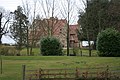
English: Heydour is a hamlet and civil parish located in the South Kesteven district of south Lincolnshire, England. It is 5 miles south west of Sleaford and 6 miles north east of Grantham. It is part of a collection of hamlets located within a mile of each other, the others being Culverthorpe, Oasby and Aisby. The nearest post office/shop is in Wilsford, 2 miles north.
village in Lincolnshire, UK  | |||||
| Upload media | |||||
| Instance of | |||||
|---|---|---|---|---|---|
| Location | Heydour, South Kesteven, Lincolnshire, East Midlands, England | ||||
 | |||||
Subcategories
This category has the following 3 subcategories, out of 3 total.
Media in category "Heydour"
The following 142 files are in this category, out of 142 total.
-
 A little valley - geograph.org.uk - 6062679.jpg 9,120 × 3,834; 7.17 MB
-
 A musician over the door - geograph.org.uk - 6103631.jpg 4,896 × 3,672; 6.67 MB
-
 A52 at Nightingale - geograph.org.uk - 4214571.jpg 640 × 480; 249 KB
-
 A52 westbound - geograph.org.uk - 5753291.jpg 640 × 480; 70 KB
-
 Accommodation at the pub - geograph.org.uk - 6070512.jpg 6,032 × 4,014; 3.89 MB
-
 Aisby signpost - geograph.org.uk - 5174208.jpg 800 × 600; 188 KB
-
 An original signpost^ - geograph.org.uk - 5174193.jpg 600 × 800; 164 KB
-
 Approaching Long Nursery - geograph.org.uk - 6348814.jpg 1,024 × 768; 194 KB
-
 Auxiliary valve cover - geograph.org.uk - 6071450.jpg 2,910 × 3,232; 2.59 MB
-
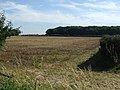
 Bean field and Dembleby Thorns - geograph.org.uk - 6494483.jpg 1,024 × 768; 229 KB
-
 Bend in the road, Heydour - geograph.org.uk - 6198752.jpg 6,032 × 4,014; 7.56 MB
-
 Between Aisby and Haceby - geograph.org.uk - 6494474.jpg 1,024 × 768; 204 KB
-
 Bluebells in Nightingale Plantation - geograph.org.uk - 6838570.jpg 2,656 × 1,768; 2.47 MB
-
 Bridleway and footpath crossing a wheat field - geograph.org.uk - 6494412.jpg 1,024 × 768; 241 KB
-
 Bridleway approaching King Street - geograph.org.uk - 6494364.jpg 1,024 × 768; 263 KB
-
 Bridleway crossing - geograph.org.uk - 6803660.jpg 2,656 × 1,768; 2.96 MB
-
 Bridleway crossing and a footpath too - geograph.org.uk - 6348829.jpg 1,024 × 768; 168 KB
-
 Bridleway south from Oasby - geograph.org.uk - 3802664.jpg 3,088 × 2,056; 3.58 MB
-
 Bridleway through oilseed rape field - geograph.org.uk - 492615.jpg 640 × 427; 116 KB
-
 Bridleway to King Street - geograph.org.uk - 6494377.jpg 1,024 × 768; 231 KB
-
 Bridleway to Long Nursery - geograph.org.uk - 4565068.jpg 1,024 × 683; 358 KB
-
 Bridleway to nowhere - geograph.org.uk - 6494362.jpg 1,024 × 768; 179 KB
-
 Bridleway to nowhere - geograph.org.uk - 6494367.jpg 1,024 × 768; 207 KB
-
 Bridleway to Oasby - geograph.org.uk - 6803673.jpg 2,656 × 1,768; 2.86 MB
-
 Broken oak with lookout - geograph.org.uk - 4912907.jpg 3,776 × 2,520; 3.92 MB
-
 Bus shelter - geograph.org.uk - 6070301.jpg 6,032 × 4,014; 6.6 MB
-
 Church Lees Farmhouse - geograph.org.uk - 6103629.jpg 6,032 × 4,014; 5.3 MB
-
 Church Lees Farmhouse - geograph.org.uk - 6311446.jpg 1,024 × 768; 250 KB
-
 Church of St Michael and All Angels, Heydour - geograph.org.uk - 6802182.jpg 2,656 × 1,768; 2.86 MB
-
 Churchyard and hills - geograph.org.uk - 6200825.jpg 6,032 × 4,014; 3.29 MB
-
 Churchyard Laurel - geograph.org.uk - 6200686.jpg 6,032 × 4,014; 3.23 MB
-
 Culvert manhole - geograph.org.uk - 6070059.jpg 6,032 × 4,014; 7.29 MB
-
 Culvert mouth - geograph.org.uk - 6070052.jpg 6,032 × 4,014; 6.57 MB
-
 Cut Mark, Heydour, Heydour Farm - geograph.org.uk - 5579259.jpg 1,280 × 960; 398 KB
-
 Cut Mark, Heydour, Heydour Farm - geograph.org.uk - 5579262.jpg 960 × 1,280; 341 KB
-
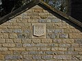 Datestone - geograph.org.uk - 6090051.jpg 4,896 × 3,672; 6.71 MB
-
 Defibrillator at the pub - geograph.org.uk - 6062742.jpg 4,014 × 6,032; 6.52 MB
-
 Driveway to Heydour Lodge Farm - geograph.org.uk - 6375184.jpg 1,024 × 768; 279 KB
-
 Electric Kissing Gate - geograph.org.uk - 6090610.jpg 6,032 × 4,014; 4.86 MB
-
 End point - geograph.org.uk - 6494386.jpg 1,024 × 768; 233 KB
-
 Entrance to Ancaster Quarries - geograph.org.uk - 6803714.jpg 2,608 × 1,737; 978 KB
-
 Fallen tree on a Restricted Byway - geograph.org.uk - 6494478.jpg 1,024 × 768; 236 KB
-
 Farm Buildings - geograph.org.uk - 6110964.jpg 6,032 × 4,014; 6.25 MB
-
 Farm buildings off King Street - geograph.org.uk - 6348809.jpg 1,024 × 768; 303 KB
-
 Farm buildings off King Street - geograph.org.uk - 6348811.jpg 1,024 × 768; 165 KB
-
 Farmland near Kelby - geograph.org.uk - 3076441.jpg 640 × 480; 70 KB
-
 Farmland near Oasby - geograph.org.uk - 3076445.jpg 640 × 480; 69 KB
-
 Farmland near the A52, Lincolnshire - geograph.org.uk - 155184.jpg 640 × 427; 94 KB
-
 Farmland off Mill Lane - geograph.org.uk - 3076448.jpg 640 × 480; 85 KB
-
 Farmland towards Welby Hazels - geograph.org.uk - 3076439.jpg 640 × 480; 92 KB
-
 Fencing - geograph.org.uk - 6090615.jpg 6,032 × 4,014; 4.21 MB
-
 Field near Oasby - geograph.org.uk - 6067807.jpg 12,500 × 3,368; 7.43 MB
-
 Field of oilseed rape and Dembleby Gorse - geograph.org.uk - 6494419.jpg 1,024 × 768; 261 KB
-
 Field of oilseed rape and Nightingale Plantation - geograph.org.uk - 6494422.jpg 1,024 × 768; 256 KB
-
 Field of oilseed rape near Oasby - geograph.org.uk - 6315873.jpg 1,024 × 768; 186 KB
-
 Field or Garden^ - geograph.org.uk - 6090681.jpg 6,032 × 4,014; 4.83 MB
-

-
 Footpath across Cow Common - from Aisby to Oasby - geograph.org.uk - 6802195.jpg 2,656 × 1,768; 2.77 MB
-
 Footpath along the stream - geograph.org.uk - 6069349.jpg 4,014 × 6,032; 7.72 MB
-
 Footpath by the stream - geograph.org.uk - 6069342.jpg 6,032 × 4,014; 7.26 MB
-
 Footpath from Aisby entering Nightingale Plantation - geograph.org.uk - 6838566.jpg 2,656 × 1,768; 1.77 MB
-
 Footpath from Aisby to Oasby - geograph.org.uk - 6315876.jpg 1,024 × 768; 189 KB
-
 Footpath off Aunsby Lane - geograph.org.uk - 6802205.jpg 2,656 × 1,768; 2.91 MB
-
 Footpath to Aisby - geograph.org.uk - 3805390.jpg 1,600 × 1,065; 498 KB
-
 Footpath to Heydour Lodge Farm - geograph.org.uk - 6494370.jpg 1,024 × 768; 207 KB
-
 Footpath to Long Nursery - geograph.org.uk - 3802660.jpg 3,088 × 2,056; 2.96 MB
-
 Footpath to Long Nursery - geograph.org.uk - 4545506.jpg 1,024 × 683; 357 KB
-
 Footpath to Oasby - geograph.org.uk - 6348823.jpg 1,024 × 768; 176 KB
-
 Footpath to Oasby - geograph.org.uk - 6494374.jpg 1,024 × 768; 250 KB
-
 Footpath to the Long Nursery - geograph.org.uk - 6069394.jpg 6,032 × 4,014; 5.13 MB
-
 Footpath with Tree - geograph.org.uk - 6070631.jpg 3,924 × 8,583; 7.34 MB
-
 Glebe Farm - geograph.org.uk - 1888807.jpg 426 × 640; 102 KB
-

-
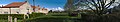
 Heydour - geograph.org.uk - 6089625.jpg 10,824 × 2,792; 7.43 MB
-
 Heydour cemetery, church and house - geograph.org.uk - 2900005.jpg 4,608 × 3,456; 3.26 MB
-
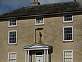
 Heydour House - geograph.org.uk - 139860.jpg 640 × 427; 109 KB
-
 Heydour Lodge bridleway - geograph.org.uk - 4565078.jpg 1,024 × 683; 331 KB
-
-
 Hydrant - geograph.org.uk - 6198756.jpg 5,656 × 2,929; 5.06 MB
-
 Hydrant and SV signs - geograph.org.uk - 6070298.jpg 6,032 × 4,014; 6.7 MB
-
 Hydrant Sign - geograph.org.uk - 6123272.jpg 6,032 × 4,014; 7.52 MB
-
 Is that an Amprhora^ - geograph.org.uk - 6069347.jpg 6,032 × 4,014; 3.64 MB
-
 Junction on Mere Lane, Aisby - geograph.org.uk - 3802681.jpg 3,088 × 2,056; 3.64 MB
-
 King Street - geograph.org.uk - 1888815.jpg 640 × 426; 131 KB
-
 King Street approaching Mill Lane - geograph.org.uk - 6803682.jpg 2,656 × 1,768; 2.87 MB
-
 Kissing gate - geograph.org.uk - 6090606.jpg 6,032 × 4,014; 6.93 MB
-

-
 Mill Lane Crossroads - geograph.org.uk - 1404429.jpg 640 × 480; 38 KB
-
 Mill Lane towards Welby - geograph.org.uk - 3076451.jpg 640 × 480; 44 KB
-
 Millennium Green and cottages, Aisby - geograph.org.uk - 6315875.jpg 1,024 × 768; 147 KB
-
 Millennium Green, Aisby - geograph.org.uk - 6802199.jpg 2,656 × 1,768; 2.95 MB
-
 Muddy bridleway to Aisby - geograph.org.uk - 4912894.jpg 3,776 × 2,520; 4.03 MB
-
 Near Heydour - geograph.org.uk - 6062677.jpg 11,910 × 3,974; 7.63 MB
-

-
 No sign of the footpath - geograph.org.uk - 6315877.jpg 1,024 × 768; 205 KB
-
 Not King Street - geograph.org.uk - 6803700.jpg 2,656 × 1,768; 2.97 MB
-

-

-
 Pair of houses - geograph.org.uk - 6090048.jpg 6,032 × 4,014; 4.44 MB
-
 Plaque - geograph.org.uk - 6070648.jpg 6,032 × 4,014; 3.37 MB
-
 Pole transformer - geograph.org.uk - 6200651.jpg 6,032 × 4,014; 5.73 MB
-
 Pub Outbuilding - geograph.org.uk - 6062737.jpg 6,032 × 4,014; 4.61 MB
-
 Puddles at Church Lees junction - geograph.org.uk - 3804362.jpg 2,789 × 1,895; 3.31 MB
-
 Rectory or Farmhouse - geograph.org.uk - 6090690.jpg 6,032 × 4,014; 5.31 MB
-

-

-
 Road junction and grass triangle - geograph.org.uk - 5174166.jpg 800 × 600; 174 KB
-
 Road junction and grass triangle - geograph.org.uk - 5174214.jpg 800 × 600; 178 KB
-
 Road junction and grass triangle - geograph.org.uk - 5174223.jpg 800 × 600; 183 KB
-
 Road junction at Magpie Cottages - geograph.org.uk - 6803706.jpg 2,656 × 1,768; 2.77 MB
-
-
 Road near Glebe Farm - geograph.org.uk - 1404417.jpg 640 × 480; 28 KB
-
 Road to Heydour Lodge Farm - geograph.org.uk - 3802731.jpg 3,088 × 2,056; 3.31 MB
-
 Road to Welby - geograph.org.uk - 3802709.jpg 3,088 × 2,056; 4.43 MB
-
 Roadway to Heydour Southings - geograph.org.uk - 6494415.jpg 1,024 × 768; 179 KB
-
 Roman road near Mill Farm Cottage - geograph.org.uk - 1404422.jpg 640 × 480; 50 KB
-
 Service valve and Fire Hydrant - geograph.org.uk - 6070292.jpg 6,032 × 4,014; 5.35 MB
-
 Service Valve cover - geograph.org.uk - 6198754.jpg 2,210 × 1,470; 3.25 MB
-
 Sewage cover - geograph.org.uk - 6069336.jpg 6,032 × 4,014; 5.22 MB
-
 Stream and path - geograph.org.uk - 6070513.jpg 6,032 × 4,014; 6.86 MB
-
 Stubble field by King Street - geograph.org.uk - 6348692.jpg 1,024 × 768; 201 KB
-
 Stubble field with Red Kite above - geograph.org.uk - 6348821.jpg 1,024 × 768; 53 KB
-
 The Houblon Arms, Oasby - geograph.org.uk - 6802190.jpg 2,656 × 1,768; 2.85 MB
-
 The Memorial Bench - geograph.org.uk - 6070639.jpg 6,032 × 4,014; 6.55 MB
-
 The Millennium Green - geograph.org.uk - 6090599.jpg 13,341 × 2,500; 7.25 MB
-
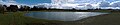 The Pond - geograph.org.uk - 6090603.jpg 13,000 × 2,695; 7.02 MB
-
 Three Ways - geograph.org.uk - 1159781.jpg 426 × 640; 26 KB
-
 Torrent by Long Nursery - geograph.org.uk - 6348701.jpg 1,024 × 768; 270 KB
-
 Track to Nightingale Plantation - geograph.org.uk - 3179764.jpg 3,088 × 2,056; 1.91 MB
-
 Track towards Ancaster Quarries - geograph.org.uk - 3804325.jpg 3,088 × 2,056; 2.93 MB
-
 View to Long Nursery - geograph.org.uk - 1159775.jpg 640 × 426; 48 KB
-
-
 View towards Heydour Lodge Farm - geograph.org.uk - 6494407.jpg 1,024 × 768; 215 KB
-
 Walls and roofs - geograph.org.uk - 6070655.jpg 6,032 × 4,014; 5.24 MB
-
 Water infrastructure - geograph.org.uk - 6069323.jpg 4,014 × 6,032; 7.24 MB
-
 Waterlogged field alongside Long Nursery - geograph.org.uk - 6348695.jpg 1,024 × 768; 191 KB
-
 Westbound A52 - geograph.org.uk - 4214652.jpg 640 × 480; 261 KB
-
 Where's the bridge^ - geograph.org.uk - 6348817.jpg 1,024 × 768; 343 KB
-
 Winter tree - geograph.org.uk - 6070636.jpg 10,176 × 5,845; 7.99 MB
-
 Farmland off Roman Road - geograph.org.uk - 1404470.jpg 640 × 480; 71 KB
-
 Footpath between young hedges - geograph.org.uk - 405761.jpg 640 × 480; 60 KB
-
 View towards Nightingale Plantation - geograph.org.uk - 403470.jpg 640 × 480; 69 KB


