Category:Hexhamshire (civil parish)
Jump to navigation
Jump to search


civil parish in Northumberland, England  | |||||
| Upload media | |||||
| Instance of |
| ||||
|---|---|---|---|---|---|
| Named after | |||||
| Location |
| ||||
| Population |
| ||||
 | |||||
Nederlands: Hexhamshire is een plaats en civil parish in het bestuurlijke gebied Northumberland, in het Engelse graafschap Northumberland. (→Hexhamshire)
Subcategories
This category has the following 9 subcategories, out of 9 total.
C
- Crabtree Ford (6 F)
D
- Dalton, Hexhamshire (1 F)
- Dotland Park Farmhouse (2 F)
H
- Hexhamshire Common (33 F)
L
- Linnels Bridge (8 F)
R
- Riddlehamhope (40 F)
W
Media in category "Hexhamshire (civil parish)"
The following 200 files are in this category, out of 2,207 total.
(previous page) (next page)-
 'Fairy Lights' - geograph.org.uk - 3248419.jpg 1,024 × 771; 429 KB
-

-
 (Part of) Newbiggin Fell - geograph.org.uk - 5571921.jpg 640 × 480; 67 KB
-

-

-
 2nd currick on Hill 402 - geograph.org.uk - 4432830.jpg 640 × 480; 85 KB
-
 A boggy patch in Anchey Sike - geograph.org.uk - 3300330.jpg 640 × 480; 97 KB
-

-

-
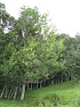
 A line of ancient trees - geograph.org.uk - 5791817.jpg 640 × 480; 389 KB
-
 A sculptural tree trunk at Lamb Shield - geograph.org.uk - 5859172.jpg 640 × 480; 457 KB
-
 A vast vista - geograph.org.uk - 4963825.jpg 640 × 480; 272 KB
-
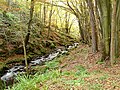
 A walk in Letah Wood - geograph.org.uk - 5637407.jpg 640 × 480; 402 KB
-

-
 Abandoned and ruined features near to tree - geograph.org.uk - 5493405.jpg 1,500 × 1,059; 1.63 MB
-
 Above the trees along Devil's Water - geograph.org.uk - 6553119.jpg 1,024 × 639; 640 KB
-
 Access road for The Heigh - geograph.org.uk - 5494174.jpg 1,500 × 1,125; 1.81 MB
-
 Accommodation for pigs - geograph.org.uk - 6560098.jpg 640 × 480; 87 KB
-
 Adder south of Harwood Shield - geograph.org.uk - 5789062.jpg 480 × 640; 124 KB
-

-

-

-

-

-
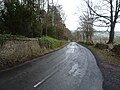
 Allendale to Hexham Road - geograph.org.uk - 2699165.jpg 640 × 480; 73 KB
-
 Anchey Sike - geograph.org.uk - 2132369.jpg 600 × 450; 269 KB
-
 Anchey Sike - geograph.org.uk - 3300344.jpg 640 × 480; 101 KB
-
 Anchey Sike - geograph.org.uk - 5767275.jpg 640 × 480; 126 KB
-
 Animal pen, Burntshield Haugh Farm - geograph.org.uk - 4963827.jpg 640 × 480; 343 KB
-
 Ant hills, Rawgreen Wood - geograph.org.uk - 3246020.jpg 1,024 × 768; 439 KB
-
 Apperley Burn from Dukesfield Fell - geograph.org.uk - 1972709.jpg 600 × 450; 238 KB
-
 Approaching squall - geograph.org.uk - 3798780.jpg 640 × 480; 34 KB
-

-

-

-
 Ash tree near the Long Drag - geograph.org.uk - 937850.jpg 480 × 640; 112 KB
-

-
-
 Autumn colours at Letah Wood - geograph.org.uk - 5601562.jpg 480 × 640; 463 KB
-
 Autumn colours at Letah Wood - geograph.org.uk - 5601563.jpg 480 × 640; 413 KB
-
 Autumn colours at Letah Wood - geograph.org.uk - 5601565.jpg 640 × 480; 447 KB
-
 Autumn colours at Letah Wood - geograph.org.uk - 5601566.jpg 640 × 480; 422 KB
-
 Autumn colours at Letah Wood - geograph.org.uk - 5601568.jpg 480 × 640; 448 KB
-
 Autumn colours at Letah Wood - geograph.org.uk - 5601569.jpg 480 × 640; 439 KB
-
 Autumn colours at Letah Wood - geograph.org.uk - 5601570.jpg 480 × 640; 450 KB
-
 Autumn colours at Letah Wood - geograph.org.uk - 5601571.jpg 480 × 640; 474 KB
-
 Autumn colours at Letah Wood - geograph.org.uk - 5601573.jpg 480 × 640; 480 KB
-
 Aydon Shields - geograph.org.uk - 2116430.jpg 640 × 480; 81 KB
-
 B6306 towards Blanchland - geograph.org.uk - 4892014.jpg 640 × 480; 87 KB
-
 Backstone Cleugh (7) - geograph.org.uk - 2376017.jpg 640 × 480; 85 KB
-
 Backstone Cleugh (8) - geograph.org.uk - 3850687.jpg 640 × 480; 95 KB
-
 Backstone Cleugh - geograph.org.uk - 2996774.jpg 600 × 450; 163 KB
-
 Backstone Cleugh - geograph.org.uk - 2996780.jpg 600 × 450; 133 KB
-
 Backstone Cleugh - geograph.org.uk - 5808306.jpg 1,024 × 770; 320 KB
-
 Bales and barn at Low Eshells Farm - geograph.org.uk - 6513468.jpg 640 × 480; 62 KB
-
 Bales at Burntridge - geograph.org.uk - 4802822.jpg 640 × 480; 286 KB
-
 Bales beside barn at High Staples - geograph.org.uk - 6215135.jpg 1,600 × 902; 456 KB
-
 Bales beside the bridleway - geograph.org.uk - 6452275.jpg 640 × 480; 71 KB
-
 Bantam rooster at Redlead Mill - geograph.org.uk - 5480016.jpg 640 × 480; 337 KB
-
 Barn at Dalton - geograph.org.uk - 6022494.jpg 640 × 480; 230 KB
-
 Barn at Harwood Shield - geograph.org.uk - 4426941.jpg 640 × 480; 113 KB
-
 Barn at Riddlehamhope (2) - geograph.org.uk - 5789356.jpg 640 × 480; 95 KB
-
 Barn at Riddlehamhope (4) - geograph.org.uk - 1921090.jpg 640 × 480; 96 KB
-
 Barn at Riddlehamhope - geograph.org.uk - 5366313.jpg 640 × 480; 98 KB
-
 Barn at Riddlehamhope - geograph.org.uk - 5789345.jpg 640 × 480; 98 KB
-
 Barn at Wester Byers - geograph.org.uk - 3252449.jpg 1,024 × 768; 367 KB
-
 Barn conversion at High Dalton Farm - geograph.org.uk - 6513474.jpg 640 × 480; 76 KB
-
 Barn near Moss House - geograph.org.uk - 6552135.jpg 1,024 × 681; 365 KB
-
 Beaters on Lambs Rigg - geograph.org.uk - 2101166.jpg 640 × 480; 65 KB
-
 Beaters on Lambs Rigg - geograph.org.uk - 2101167.jpg 640 × 480; 64 KB
-
 Beautiful Hexhamshire (2) - geograph.org.uk - 1136895.jpg 640 × 480; 89 KB
-
 Beautiful Hexhamshire (3) - geograph.org.uk - 1136898.jpg 640 × 480; 91 KB
-
 Beautiful Hexhamshire (4) - geograph.org.uk - 1136906.jpg 640 × 480; 86 KB
-
 Beautiful Hexhamshire - geograph.org.uk - 1136892.jpg 640 × 480; 93 KB
-
 Beech tree below Ordley - geograph.org.uk - 6323457.jpg 480 × 640; 143 KB
-
 Beldon Burn - geograph.org.uk - 1933869.jpg 1,499 × 842; 1.8 MB
-
 Beldon Burn - geograph.org.uk - 3469297.jpg 640 × 480; 156 KB
-
 Beldon Burn - geograph.org.uk - 3622892.jpg 640 × 480; 130 KB
-

-
 Beldon Burn below Heathery Burn (2) - geograph.org.uk - 5361335.jpg 640 × 480; 91 KB
-
 Beldon Burn below Heathery Burn - geograph.org.uk - 5361319.jpg 640 × 480; 87 KB
-
 Beldon Burn below Heatheryburn (2) - geograph.org.uk - 3622883.jpg 640 × 480; 97 KB
-
 Beldon Burn below Heatheryburn - geograph.org.uk - 2292844.jpg 640 × 480; 101 KB
-
 Beldon Cleugh (2) - geograph.org.uk - 2331580.jpg 640 × 480; 82 KB
-
 Beldon Cleugh (3) - geograph.org.uk - 3137695.jpg 640 × 480; 84 KB
-
 Beldon Cleugh (4) - geograph.org.uk - 4438172.jpg 640 × 480; 71 KB
-
 Beldon Cleugh (5) - geograph.org.uk - 3814608.jpg 640 × 480; 109 KB
-
 Beldon Cleugh (6) - geograph.org.uk - 3814610.jpg 640 × 480; 71 KB
-
 Beldon Cleugh - geograph.org.uk - 2683672.jpg 640 × 480; 95 KB
-
 Beldon Cleugh - geograph.org.uk - 4438228.jpg 640 × 480; 104 KB
-
 Beldon Cleugh - geograph.org.uk - 4440059.jpg 640 × 480; 113 KB
-
 Beldon Cleugh - geograph.org.uk - 5366424.jpg 640 × 480; 84 KB
-
 Beldon Cleugh - geograph.org.uk - 6223834.jpg 1,024 × 768; 289 KB
-

-

-
 Beldon End Plantation - geograph.org.uk - 5242846.jpg 5,312 × 2,988; 5.06 MB
-

-
 Bench in Letah Wood - geograph.org.uk - 6505424.jpg 480 × 640; 152 KB
-
 Bench mark on a stone in Dipton Woods - geograph.org.uk - 2144296.jpg 480 × 640; 150 KB
-
 Bend in the road at Jingling Gate - geograph.org.uk - 5361898.jpg 5,312 × 2,988; 6.72 MB
-
 Betony near Devil's Water - geograph.org.uk - 3581272.jpg 480 × 640; 64 KB
-
 Birkey Wood - geograph.org.uk - 2730738.jpg 640 × 480; 96 KB
-
 Birkside Fell - geograph.org.uk - 2683795.jpg 640 × 480; 104 KB
-
 Black Hall Mill - geograph.org.uk - 1193287.jpg 640 × 480; 155 KB
-
 Blackburn Head Hut - geograph.org.uk - 6378356.jpg 2,000 × 1,197; 1.7 MB
-
 Blackburn Head Shooting Box (geograph 5648434).jpg 1,024 × 768; 179 KB
-
 Blackhall Mill - geograph.org.uk - 3259120.jpg 1,024 × 768; 284 KB
-
 Blackhall Mill, Juniper - geograph.org.uk - 2940791.jpg 600 × 450; 129 KB
-
 Blackhall Mill, Juniper - geograph.org.uk - 3258475.jpg 1,024 × 768; 345 KB
-
 Blaeberry Cleugh - geograph.org.uk - 1396856.jpg 640 × 480; 128 KB
-
 Blaeberry Cleugh - geograph.org.uk - 4099493.jpg 640 × 480; 81 KB
-
 Blaeberry Cleugh - geograph.org.uk - 6487386.jpg 1,024 × 768; 203 KB
-

-
 Blue-wrapped silage bales at Low Eshells - geograph.org.uk - 5493052.jpg 1,500 × 795; 926 KB
-
 Board walk in Letah Wood - geograph.org.uk - 5637405.jpg 480 × 640; 407 KB
-

-
 Bottom of track to Rowley Head - geograph.org.uk - 3286566.jpg 1,024 × 768; 249 KB
-
 Boundary stone and Long Rigg - geograph.org.uk - 5330640.jpg 640 × 480; 100 KB
-

-
 Boundary stone beside fence on heather moor - geograph.org.uk - 2191880.jpg 2,000 × 1,500; 3 MB
-
 Boundary Stone on edge of Embley Fell - geograph.org.uk - 6552972.jpg 1,024 × 683; 493 KB
-
 Boundary stone south of Harwood Carrs - geograph.org.uk - 5444147.jpg 480 × 640; 138 KB
-

-
 Boundary stone south of Harwood Carrs - geograph.org.uk - 5647548.jpg 640 × 480; 102 KB
-

-
 Boundary stone south of Harwood Carrs - geograph.org.uk - 5647558.jpg 640 × 480; 109 KB
-
 Boundary Stone, Eshells Moor - geograph.org.uk - 2720565.jpg 600 × 450; 327 KB
-
 Boxing hares at Lamb Shield - geograph.org.uk - 5859165.jpg 480 × 640; 408 KB
-
 Bracken and heather on ridge above Beldon Cleugh - geograph.org.uk - 5502461.jpg 1,500 × 1,014; 1.75 MB
-

-
 Bridge and Weir at Dye House - geograph.org.uk - 5429053.jpg 4,470 × 3,275; 2.77 MB
-
 Bridge at Dalton - geograph.org.uk - 876721.jpg 640 × 480; 101 KB
-
 Bridge at Dye House - geograph.org.uk - 5429057.jpg 4,608 × 3,456; 3.6 MB
-
 Bridge over Devil's Water - geograph.org.uk - 3581256.jpg 640 × 480; 121 KB
-

-

-

-
 Bridge over Rowley Burn at Dye House - geograph.org.uk - 2729928.jpg 640 × 480; 140 KB
-
 Bridge over Thief Sike - geograph.org.uk - 4802079.jpg 640 × 480; 308 KB
-
 Bridge south of Harwood Shield - geograph.org.uk - 2196599.jpg 2,000 × 1,299; 2.29 MB
-
 Bridleway above High Eshells - geograph.org.uk - 2101175.jpg 640 × 480; 102 KB
-
 Bridleway above Westburnhope - geograph.org.uk - 4802049.jpg 640 × 480; 294 KB
-

-

-
 Bridleway and Rowantree Cleugh - geograph.org.uk - 1966129.jpg 600 × 450; 243 KB
-

-
 Bridleway by Rowley Wood - geograph.org.uk - 6452268.jpg 640 × 480; 90 KB
-
 Bridleway crossing on Hangman Hill - geograph.org.uk - 882153.jpg 640 × 480; 74 KB
-

-

-

-

-
 Bridleway marker on moorland - geograph.org.uk - 5271599.jpg 1,500 × 735; 839 KB
-
 Bridleway near Anchery Rigg - geograph.org.uk - 2131133.jpg 600 × 450; 269 KB
-
 Bridleway near Burntridge Plantation - geograph.org.uk - 4802075.jpg 640 × 480; 293 KB
-
 Bridleway near Rowley Wood - geograph.org.uk - 875947.jpg 640 × 480; 72 KB
-
 Bridleway near Wester Byers - geograph.org.uk - 3252443.jpg 966 × 1,024; 641 KB
-
 Bridleway on Anchey Rigg - geograph.org.uk - 1704509.jpg 640 × 480; 111 KB
-
 Bridleway on Anchey Rigg - geograph.org.uk - 1704512.jpg 640 × 480; 105 KB
-
 Bridleway on Anchey Rigg - geograph.org.uk - 1704514.jpg 640 × 480; 118 KB
-
 Bridleway on Anchey Rigg - geograph.org.uk - 1704516.jpg 640 × 480; 107 KB
-
 Bridleway on Anchey Rigg - geograph.org.uk - 2131138.jpg 600 × 450; 276 KB
-
 Bridleway on Eshells Moor - geograph.org.uk - 2101170.jpg 640 × 480; 99 KB
-
 Bridleway on Eshells Moor - geograph.org.uk - 2101172.jpg 640 × 480; 87 KB
-
 Bridleway on Eshells Moor - geograph.org.uk - 2720571.jpg 600 × 450; 231 KB
-
 Bridleway on Hexhamshire Common known as the Broadway - geograph.org.uk - 6133795.jpg 4,608 × 3,456; 6.21 MB
-
 Bridleway on Hexhamshire Common known as the Broadway - geograph.org.uk - 6133799.jpg 4,608 × 3,456; 6.56 MB
-
 Bridleway on north side of Lawsley Sike or Whapweasel Burn - geograph.org.uk - 5493015.jpg 1,500 × 1,125; 1.53 MB
-
 Bridleway over Burntridge Moor - geograph.org.uk - 6452249.jpg 640 × 480; 90 KB
-
 Bridleway reaching gate at Burntridge Plantation. - geograph.org.uk - 5494209.jpg 1,500 × 1,125; 1.57 MB
-
 Bridleway to Eshells Moor - geograph.org.uk - 6513464.jpg 640 × 480; 75 KB
-
 Bridleway to West Greenridge - geograph.org.uk - 1135753.jpg 640 × 480; 80 KB
-
 Bridleway to West Greenridge - geograph.org.uk - 3300360.jpg 640 × 480; 79 KB
-
 Bridleway to West Greenridge - geograph.org.uk - 3300367.jpg 640 × 480; 93 KB
-
 Bridleway to West Greenridge - geograph.org.uk - 3300371.jpg 640 × 480; 93 KB
-
 Bridleway towards Anchey Sike - geograph.org.uk - 2132398.jpg 600 × 450; 258 KB
-
 Bridleway towards Dukesfield Fell - geograph.org.uk - 1972722.jpg 600 × 450; 239 KB
-
 Bridleway towards Fell Plantation - geograph.org.uk - 2132374.jpg 600 × 450; 307 KB
-
 Bridleway towards Jingling Gate - geograph.org.uk - 2132363.jpg 600 × 450; 264 KB
-
 Bridleway towards Rowley Wood - geograph.org.uk - 2950464.jpg 600 × 450; 83 KB
-
 Bridleway waymarker on Coldcoats Rigg - geograph.org.uk - 3300320.jpg 640 × 480; 101 KB
-
 Bridleway west of Steel Hall Farm - geograph.org.uk - 3252608.jpg 1,024 × 770; 357 KB
-
 Bridleway, Burntridge Moor - geograph.org.uk - 2950465.jpg 600 × 450; 87 KB
-
 Broad Mere (2) - geograph.org.uk - 6481143.jpg 1,024 × 768; 253 KB
-
 Broad Mere (2) - geograph.org.uk - 6483286.jpg 1,024 × 768; 255 KB
-
 Broad Mere (3) - geograph.org.uk - 6483213.jpg 1,024 × 768; 261 KB
-
 Broad Mere (3) - geograph.org.uk - 6483293.jpg 1,024 × 768; 227 KB
-
 Broad Mere - geograph.org.uk - 4099520.jpg 640 × 480; 83 KB
-
 Broad Mere - geograph.org.uk - 6474495.jpg 1,024 × 768; 240 KB
-
 Broad Mere - geograph.org.uk - 6481136.jpg 1,024 × 768; 242 KB
-
 Broad Mere - geograph.org.uk - 6483217.jpg 1,024 × 768; 227 KB
-
 Broad Mere - geograph.org.uk - 6483228.jpg 1,024 × 768; 256 KB
-
 Broad Way - geograph.org.uk - 6217001.jpg 1,600 × 1,068; 478 KB
-
 Broad Way, Hexhamshire Common - geograph.org.uk - 1966118.jpg 600 × 450; 264 KB
-
 Broadwell House - geograph.org.uk - 1966164.jpg 600 × 450; 247 KB
-
 Broadwell House - geograph.org.uk - 6215276.jpg 1,600 × 1,068; 628 KB
-
 Brockey Plantation - geograph.org.uk - 6553319.jpg 1,024 × 683; 507 KB
-
 Buckets for goalposts^ - geograph.org.uk - 2771124.jpg 2,592 × 1,944; 830 KB
-
 Building with ruin above Devil's Water - geograph.org.uk - 5756674.jpg 2,000 × 1,333; 2.21 MB
-
 Bungalow at Newbiggin - geograph.org.uk - 876730.jpg 640 × 480; 79 KB

_ford_on_a_minor_road_west_of_Shield_Green_-_geograph.org.uk_-_2143602.jpg)
_Newbiggin_Fell_-_geograph.org.uk_-_5571921.jpg)
_the_front_wall_of_Riddlehamhope_-_geograph.org.uk_-_5789360.jpg)


_-_geograph.org.uk_-_6222256.jpg)
_-_geograph.org.uk_-_6222259.jpg)
_-_geograph.org.uk_-_6222264.jpg)
_-_geograph.org.uk_-_6223352.jpg)


_-_geograph.org.uk_-_2376017.jpg)
_-_geograph.org.uk_-_3850687.jpg)


_-_geograph.org.uk_-_5789356.jpg)
_-_geograph.org.uk_-_1921090.jpg)


_-_geograph.org.uk_-_1136895.jpg)
_-_geograph.org.uk_-_1136898.jpg)
_-_geograph.org.uk_-_1136906.jpg)


_-_geograph.org.uk_-_5361335.jpg)

_-_geograph.org.uk_-_3622883.jpg)

_-_geograph.org.uk_-_2331580.jpg)
_-_geograph.org.uk_-_3137695.jpg)
_-_geograph.org.uk_-_4438172.jpg)
_-_geograph.org.uk_-_3814608.jpg)
_-_geograph.org.uk_-_3814610.jpg)


_-_geograph.org.uk_-_4438144.jpg)


.jpg)


_-_geograph.org.uk_-_6481143.jpg)
_-_geograph.org.uk_-_6483286.jpg)
_-_geograph.org.uk_-_6483213.jpg)
_-_geograph.org.uk_-_6483293.jpg)


&filefrom=Burntridge+Moor+%282%29+-+geograph.org.uk+-+4115402.jpg#mw-category-media)