Category:Hetton-cum-Bordley
Jump to navigation
Jump to search
civil parish in Craven, North Yorkshire, England | |||||
| Upload media | |||||
| Instance of | |||||
|---|---|---|---|---|---|
| Location | Craven, North Yorkshire, Yorkshire and the Humber, England | ||||
 | |||||
English: Hetton-cum-Bordley is a civil parish in the Craven district, in the county of North Yorkshire, England.
Subcategories
This category has the following 2 subcategories, out of 2 total.
B
H
Media in category "Hetton-cum-Bordley"
The following 200 files are in this category, out of 211 total.
(previous page) (next page)-

-
 A mini bridge with a large cairn beyond - geograph.org.uk - 2070585.jpg 4,592 × 3,056; 4.37 MB
-
 A scatter of stones on Bordley Hall Pasture - geograph.org.uk - 2070941.jpg 4,592 × 3,056; 4.33 MB
-
 A small quarry at Kealcup Laithe - geograph.org.uk - 2071796.jpg 4,592 × 3,056; 5.19 MB
-
 Abandoned Water Tank East of Lineseed Head - geograph.org.uk - 2570863.jpg 4,320 × 3,240; 3.21 MB
-
 Across to Kealcup Plantation - geograph.org.uk - 6188712.jpg 1,024 × 683; 428 KB
-
 Almost the end of Malham Moor Lane - geograph.org.uk - 2937057.jpg 3,072 × 2,304; 1.01 MB
-
 Along Mastiles Lane - geograph.org.uk - 6188714.jpg 1,024 × 683; 461 KB
-
 Approaching Bordley from the south - geograph.org.uk - 3268506.jpg 640 × 480; 79 KB
-
 Approaching Hetton - geograph.org.uk - 6376305.jpg 5,184 × 3,456; 5.17 MB
-
 Approaching Laingber House - geograph.org.uk - 873964.jpg 640 × 480; 84 KB
-

-
 Benchmark on boulder on High Long Ridge - geograph.org.uk - 3531777.jpg 683 × 1,024; 302 KB
-
 Benchmark on farm building at Skeld Gate - geograph.org.uk - 6186591.jpg 650 × 1,024; 274 KB
-

-
 Benchmark on Hetton Lodge - geograph.org.uk - 6186566.jpg 1,024 × 647; 292 KB
-
 Bleak Bank - geograph.org.uk - 5751142.jpg 1,600 × 1,200; 590 KB
-
 Bordley - general view from the west - geograph.org.uk - 3343573.jpg 2,048 × 1,536; 551 KB
-
 Bordley Green Farm - geograph.org.uk - 2174818.jpg 640 × 419; 136 KB
-
 Bordley Hall Farm - geograph.org.uk - 5751148.jpg 1,600 × 1,200; 517 KB
-
 Bordley House Farm - geograph.org.uk - 2071772.jpg 4,592 × 3,056; 2.59 MB
-
 Bordley on gathering day - geograph.org.uk - 2567704.jpg 640 × 426; 364 KB
-
 Boulder in grass at Mastiles - geograph.org.uk - 4230352.jpg 1,500 × 1,125; 2.02 MB
-
 Boulder, High Mark - geograph.org.uk - 4456331.jpg 640 × 480; 79 KB
-
 Boulder, Lee Gate High Mark - geograph.org.uk - 4453517.jpg 640 × 480; 80 KB
-
 Boulder, Proctor High Pasture - geograph.org.uk - 4456320.jpg 640 × 480; 95 KB
-
 Boulders beside track over High Long Ridge - geograph.org.uk - 3531804.jpg 1,024 × 683; 173 KB
-
 Bridge over Hetton Common Beck - geograph.org.uk - 2525642.jpg 640 × 426; 425 KB
-
 Bridge over Hetton Common Beck - geograph.org.uk - 5751130.jpg 1,600 × 1,200; 673 KB
-
 Bridleway above Winterburn Reservoir - geograph.org.uk - 6371994.jpg 5,184 × 3,456; 6.19 MB
-
 Bridleway at Kealcup Laithe - geograph.org.uk - 3343579.jpg 2,048 × 1,536; 649 KB
-
 Bridleway crossing Lainger Beck - geograph.org.uk - 5751160.jpg 1,600 × 1,200; 575 KB
-
 Bridleway crossing Ray Gill - geograph.org.uk - 5751139.jpg 1,600 × 1,200; 698 KB
-

-
 Bridleway from Hetton to malham - geograph.org.uk - 2525652.jpg 640 × 426; 303 KB
-
 Bridleway heading down to Hetton Common Beck - geograph.org.uk - 6371997.jpg 5,184 × 3,422; 6.2 MB
-
 Bridleway in Alans Plantation - geograph.org.uk - 5751126.jpg 1,600 × 1,200; 644 KB
-
 Bridleway junction north of Bordley - geograph.org.uk - 3343556.jpg 2,048 × 1,536; 565 KB
-
 Bridleway leading to Mastiles Lane - geograph.org.uk - 6188061.jpg 1,024 × 683; 445 KB
-
 Bridleway near Clapham High Mark - geograph.org.uk - 3561626.jpg 1,600 × 1,200; 454 KB
-
 Bridleway near High Moss - geograph.org.uk - 2937115.jpg 3,072 × 2,304; 1.19 MB
-
 Bridleway near Tommy Low Pasture - geograph.org.uk - 3343567.jpg 2,048 × 1,536; 682 KB
-
 Bridleway on Hetton Common - geograph.org.uk - 2025306.jpg 1,600 × 1,200; 445 KB
-
 Bridleway on Hetton Common - geograph.org.uk - 5751137.jpg 1,600 × 1,200; 496 KB
-
 Bridleway to Mastiles Gate - geograph.org.uk - 6187864.jpg 1,024 × 683; 488 KB
-
 Bridleway towards Owslin Laithe - geograph.org.uk - 5751115.jpg 1,600 × 1,200; 566 KB
-
 Bull Lane, Hetton - geograph.org.uk - 5617876.jpg 1,024 × 768; 335 KB
-
 Cairn on Proctor High Mark - geograph.org.uk - 2071184.jpg 4,592 × 3,056; 3.02 MB
-
 Cairn, Proctor High Mark - geograph.org.uk - 1777778.jpg 1,280 × 960; 265 KB
-
 Cattle alongside Mastiles Lane - geograph.org.uk - 6188727.jpg 1,024 × 683; 452 KB
-
 Cattle country - geograph.org.uk - 3989470.jpg 3,296 × 2,472; 1.86 MB
-
 Cattle grid near Horner Close Barn - geograph.org.uk - 2567722.jpg 640 × 426; 288 KB
-
 Cattle near Mastiles Lane - geograph.org.uk - 6188718.jpg 1,024 × 683; 445 KB
-
 Cattle on Malham Moor - geograph.org.uk - 6188719.jpg 1,024 × 683; 423 KB
-
 Cow Gill Cote - geograph.org.uk - 2071811.jpg 4,592 × 3,056; 3.7 MB
-
 Cross Lane - geograph.org.uk - 6374357.jpg 5,184 × 3,456; 6.67 MB
-
 Date stone, Park House, Bordley - geograph.org.uk - 3268481.jpg 640 × 483; 157 KB
-

-

-
 Empty pasture near Mastiles - geograph.org.uk - 5507602.jpg 640 × 480; 54 KB
-
 End of the road - geograph.org.uk - 2567695.jpg 640 × 426; 360 KB
-
 Farm buildings at Owslin - geograph.org.uk - 2525665.jpg 640 × 426; 280 KB
-
 Farm buildings at Skeld Gate - geograph.org.uk - 6186599.jpg 1,024 × 674; 179 KB
-
 Farmland beyond Malham Moor Lane - geograph.org.uk - 6188060.jpg 1,024 × 683; 434 KB
-
 Farmland near Hetton - geograph.org.uk - 2464941.jpg 1,600 × 1,200; 595 KB
-
 Farmstead at Bordley - geograph.org.uk - 6168301.jpg 640 × 463; 78 KB
-
 Fleets Lane - geograph.org.uk - 2007237.jpg 640 × 480; 165 KB
-
 Footpath Across Buttercup Meadow - geograph.org.uk - 3573862.jpg 640 × 480; 437 KB
-
 Footpath by Hetton Beck - geograph.org.uk - 2937248.jpg 3,072 × 2,304; 1.08 MB
-
 Footpath off Mastiles Lane - geograph.org.uk - 6188697.jpg 1,024 × 683; 463 KB
-
 Footpath to Bordley - geograph.org.uk - 4456289.jpg 640 × 480; 112 KB
-
 Frozen Pasture off Moor Lane - geograph.org.uk - 6374359.jpg 5,170 × 3,422; 5.95 MB
-
 Gate at Bridleway Junction - geograph.org.uk - 2658325.jpg 2,592 × 1,944; 1.22 MB
-
 Gate leading to Smearbottom Lane from Mastiles Lane - geograph.org.uk - 2334913.jpg 4,000 × 3,000; 2.87 MB
-
 Gate near Clapham High Mark - geograph.org.uk - 2951394.jpg 3,872 × 2,592; 4.69 MB
-
 Gate on Kilnsey Moor - geograph.org.uk - 3986883.jpg 3,296 × 2,472; 1.71 MB
-
 Gateway on NW side of road to Hetton - geograph.org.uk - 6179616.jpg 1,024 × 683; 258 KB
-
 Gateway on SE side of road SW of Hetton - geograph.org.uk - 6186554.jpg 1,024 × 683; 215 KB
-
 Grassland rising to High Mark - geograph.org.uk - 4230364.jpg 1,500 × 1,125; 1.82 MB
-
 Green lane - geograph.org.uk - 6188715.jpg 1,024 × 683; 431 KB
-
 Green Lane on Threshfield Moor Revisited - geograph.org.uk - 6133168.jpg 5,170 × 3,388; 4.96 MB
-
 Grimes Gill Laithe, near Hetton - geograph.org.uk - 5751102.jpg 1,600 × 1,200; 435 KB
-
 Hagg Laithe across Bordley Beck - geograph.org.uk - 5751154.jpg 1,600 × 1,200; 566 KB
-
 Hetton Common Beck - geograph.org.uk - 5079664.jpg 4,000 × 3,000; 4.05 MB
-
 Hetton Common Head - geograph.org.uk - 2987390.jpg 3,872 × 2,592; 4.8 MB
-
 Hetton Lodge and Marriott's Barn - geograph.org.uk - 6186569.jpg 1,024 × 662; 172 KB
-
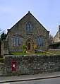
 Hetton Methodist Church - geograph.org.uk - 5619360.jpg 768 × 1,024; 135 KB
-
 Hetton Methodist Church - geograph.org.uk - 6367068.jpg 1,706 × 2,395; 1.11 MB
-
 Hetton Methodist Church - geograph.org.uk - 6374481.jpg 5,184 × 3,456; 3.83 MB
-
 High Lineseed Head - geograph.org.uk - 2951212.jpg 3,872 × 2,592; 4.27 MB
-
 High Long Ridge - geograph.org.uk - 1009526.jpg 640 × 480; 113 KB
-
 High Long Ridge - geograph.org.uk - 4229157.jpg 1,500 × 885; 1.19 MB
-
 High plains country - geograph.org.uk - 3989406.jpg 3,296 × 1,648; 962 KB
-
 Junction north of Hetton - geograph.org.uk - 5620184.jpg 1,024 × 768; 153 KB
-
 Junction of Moor lane and Cross Lane - geograph.org.uk - 2525670.jpg 640 × 426; 258 KB
-
 Kealcup Plantation above Bordley - geograph.org.uk - 3268037.jpg 800 × 600; 127 KB
-
 Know Bank Farm - geograph.org.uk - 2567731.jpg 640 × 426; 322 KB
-
 Lainger House - geograph.org.uk - 2567674.jpg 640 × 426; 355 KB
-
 Lainger House - geograph.org.uk - 3330665.jpg 640 × 481; 98 KB
-
 Lane Head - geograph.org.uk - 2937137.jpg 3,072 × 2,304; 1.09 MB
-
 Lane on Malham Moor - geograph.org.uk - 6188717.jpg 1,024 × 683; 469 KB
-
 Last Gate before Bordley Hall - geograph.org.uk - 4512685.jpg 640 × 480; 94 KB
-
 Lead mining remains on Kilnsey Moor - geograph.org.uk - 3986857.jpg 2,472 × 3,296; 1.58 MB
-
 Limestone battlements on Proctor High Mark - geograph.org.uk - 2071166.jpg 4,485 × 2,984; 3.84 MB
-
 Looking back from Long Hill Farm - geograph.org.uk - 1005623.jpg 640 × 480; 76 KB
-
 Looking towards Malham Moor Lane - geograph.org.uk - 6188059.jpg 1,024 × 683; 472 KB
-
 Looking towards Proctor High Mark - geograph.org.uk - 2070819.jpg 4,592 × 3,056; 4.34 MB
-
 Low Laithe - geograph.org.uk - 2327039.jpg 4,320 × 3,240; 4.76 MB
-
 Low Laithe - geograph.org.uk - 5751145.jpg 1,600 × 1,200; 449 KB
-
 Low Laithe form Gate Cliff Brow (road) - geograph.org.uk - 2967545.jpg 800 × 600; 167 KB
-
 Malham Moor - geograph.org.uk - 6187859.jpg 1,024 × 683; 506 KB
-
 Malham Moor Lane at Malham Moor - geograph.org.uk - 3759426.jpg 1,024 × 681; 247 KB
-
 Malham Moor, Yorkshire - geograph.org.uk - 3759434.jpg 1,024 × 647; 234 KB
-
 Mastiles Gate - geograph.org.uk - 3986833.jpg 3,296 × 2,472; 1.77 MB
-
 Mastiles Gate and Lane - geograph.org.uk - 2567679.jpg 640 × 426; 318 KB
-
 Mastiles Lane - geograph.org.uk - 2070607.jpg 4,592 × 3,056; 3.64 MB
-
 Mastiles Lane - geograph.org.uk - 2174626.jpg 640 × 445; 110 KB
-
 Mastiles Lane - geograph.org.uk - 2174632.jpg 640 × 459; 118 KB
-
 Mastiles Lane - geograph.org.uk - 4229138.jpg 1,500 × 904; 1.39 MB
-
 Mastiles Lane - geograph.org.uk - 4229190.jpg 1,500 × 882; 1.28 MB
-
 Mastiles Lane - geograph.org.uk - 4453507.jpg 640 × 480; 67 KB
-
 Mastiles Lane - geograph.org.uk - 6188713.jpg 1,024 × 683; 473 KB
-
 Mastiles Lane bridleway - geograph.org.uk - 6188722.jpg 1,024 × 683; 443 KB
-
 Mastiles Lane from the junction - geograph.org.uk - 6188066.jpg 1,024 × 683; 449 KB
-
 Mine spoil heap, Proctor High Mark - geograph.org.uk - 1777788.jpg 640 × 480; 91 KB
-
 Minor road towards Hetton - geograph.org.uk - 2464944.jpg 1,600 × 1,200; 535 KB
-
 Mist over Tattersal Pasture - geograph.org.uk - 3986844.jpg 3,296 × 2,472; 1.41 MB
-
 Moor Lane - geograph.org.uk - 2254066.jpg 4,139 × 3,234; 2.82 MB
-
 Moor Lane - geograph.org.uk - 5079649.jpg 4,000 × 3,000; 4.58 MB
-
 Moor Lane - geograph.org.uk - 5708024.jpg 1,280 × 850; 643 KB
-
 Moor Lane Bridleway - geograph.org.uk - 2525679.jpg 640 × 426; 237 KB
-
 Narrow stile by Flasby Beck - geograph.org.uk - 2392197.jpg 3,872 × 2,592; 7.51 MB
-
 Near Bordley Hall - geograph.org.uk - 4512675.jpg 640 × 480; 89 KB
-
 Nettle filled sheep creep - geograph.org.uk - 3710944.jpg 2,992 × 4,000; 3.59 MB
-
 New Laithe on Cross Lane - geograph.org.uk - 6372227.jpg 5,184 × 3,456; 5.41 MB
-
 New Laithe, Cross Track - geograph.org.uk - 2525673.jpg 640 × 426; 256 KB
-
 New plantation above Flasby Beck - geograph.org.uk - 2392135.jpg 3,872 × 2,592; 5.72 MB
-
 No motor vehicles - geograph.org.uk - 6188064.jpg 1,024 × 683; 491 KB
-
 Now that's what I call gateposts - geograph.org.uk - 3560547.jpg 1,600 × 1,200; 628 KB
-
 On Mastiles Lane - geograph.org.uk - 2312130.jpg 4,320 × 3,240; 5.41 MB
-
 On Mastiles Lane - geograph.org.uk - 2567683.jpg 640 × 426; 307 KB
-
 On Moor Lane - geograph.org.uk - 6372200.jpg 5,184 × 3,456; 5.6 MB
-
 On the footpath above Bordley Hall - geograph.org.uk - 3268011.jpg 640 × 480; 63 KB
-

-
 Ordnance Survey Cut Mark - geograph.org.uk - 4022865.jpg 2,560 × 1,920; 2.52 MB
-
 Ordnance Survey Cut Mark with Rivet - geograph.org.uk - 4022884.jpg 2,560 × 1,920; 2.72 MB
-
 Owslin Laithe - geograph.org.uk - 4911341.jpg 4,661 × 2,336; 1.51 MB
-
 Owslin Laithe - geograph.org.uk - 6374361.jpg 5,184 × 3,456; 6.25 MB
-
 Park House - geograph.org.uk - 3268472.jpg 640 × 480; 88 KB
-
 Park House Farm - geograph.org.uk - 2567750.jpg 640 × 426; 305 KB
-
 Park House, from the West - geograph.org.uk - 3573892.jpg 640 × 480; 437 KB
-
 Path across the fields from Hetton - geograph.org.uk - 2391786.jpg 3,872 × 2,592; 4.03 MB
-
 Path by Hetton Beck - geograph.org.uk - 2392085.jpg 3,872 × 2,592; 3.62 MB
-
 Path near High Mark - geograph.org.uk - 2678523.jpg 640 × 480; 54 KB
-
 Path near Lee Gate High Mark - geograph.org.uk - 2951228.jpg 3,872 × 2,592; 4.21 MB
-
 Proctor High Mark - geograph.org.uk - 4074473.jpg 2,560 × 1,920; 3.76 MB
-
 Proctor High Pasture - geograph.org.uk - 2070945.jpg 4,592 × 3,056; 4.99 MB
-
 Ray Gill Laithe - geograph.org.uk - 2025321.jpg 1,600 × 1,200; 397 KB
-
 Recycled stone, Moor Lane - geograph.org.uk - 5708048.jpg 1,280 × 850; 614 KB
-
 Remains of Carlisle Laithe - geograph.org.uk - 5751123.jpg 1,600 × 1,200; 490 KB
-
 Remnants of Carlisle Laithe - geograph.org.uk - 6372195.jpg 5,164 × 3,415; 7.04 MB
-
 Rivet benchmark on a wall near High Moss - geograph.org.uk - 2937120.jpg 3,072 × 2,304; 1.21 MB
-
 Road on Malham Moor - geograph.org.uk - 6187863.jpg 1,024 × 683; 483 KB
-
 Rural Crossroads - geograph.org.uk - 1481353.jpg 640 × 480; 102 KB
-

-
 Sheep near Mastiles Lane - geograph.org.uk - 6188062.jpg 1,024 × 683; 447 KB
-
 Silage store at Bordley Hall - geograph.org.uk - 3268496.jpg 640 × 480; 79 KB
-
 Site of the former Hetton Tip - geograph.org.uk - 5751118.jpg 1,600 × 1,200; 752 KB
-
 Skirse Gill Bridge - geograph.org.uk - 3094674.jpg 1,878 × 1,408; 1.13 MB
-
 Spring in Hetton - geograph.org.uk - 6367072.jpg 2,592 × 1,944; 1.7 MB
-
 Stone 'square' north west of Bordley - geograph.org.uk - 3269012.jpg 800 × 254; 55 KB
-
 Tattersall Pasture - geograph.org.uk - 2071705.jpg 4,592 × 3,056; 3.56 MB
-
 The Angel - geograph.org.uk - 4912448.jpg 5,471 × 3,189; 1.92 MB
-
 The approach to Proctor High Mark - geograph.org.uk - 2071003.jpg 4,592 × 1,958; 2.65 MB
-
 The bridleway beside High Long Ridge - geograph.org.uk - 2071722.jpg 4,592 × 3,056; 3.95 MB
-
 The Druid's Altar (Bordley stone circle) - geograph.org.uk - 6338034.jpg 4,707 × 3,050; 4.6 MB
-
 The northern end of Winterburn Reservoir - geograph.org.uk - 2658311.jpg 2,592 × 1,944; 1.25 MB
-
 The path up to Lee Gate High Mark - geograph.org.uk - 1909720.jpg 4,592 × 3,056; 4.88 MB
-

-
 The view south from Bordley Hall Pasture - geograph.org.uk - 2070971.jpg 4,592 × 3,056; 4.73 MB
-
 The view to the East across Barstow's Kilnsey Moor - geograph.org.uk - 2071491.jpg 4,592 × 3,056; 4.32 MB
-
 The view to the North East over Hutton's Kilnsey Moor - geograph.org.uk - 2071520.jpg 4,592 × 3,056; 5.68 MB
-
 The view West - geograph.org.uk - 2071605.jpg 4,592 × 3,056; 4.11 MB
-
 Tommy High Pasture (1) - geograph.org.uk - 189225.jpg 640 × 480; 70 KB
-
 Tommy High Pasture (2) - geograph.org.uk - 189227.jpg 640 × 480; 74 KB
-
 Tommy High Pasture - geograph.org.uk - 2567736.jpg 640 × 426; 299 KB
-
 Track from Lane Head, Threshfield Moor - geograph.org.uk - 3237850.jpg 3,072 × 2,304; 529 KB
-
 Track junction above Bordley hall - geograph.org.uk - 2567709.jpg 640 × 426; 396 KB
-
 Track to Flasby Moor Side - geograph.org.uk - 2525659.jpg 640 × 426; 252 KB
-
 Track to Hetton from Bordley - geograph.org.uk - 2567699.jpg 640 × 426; 434 KB
-
 Track to Know Bank - geograph.org.uk - 2567757.jpg 640 × 426; 307 KB
-
 Track towards Malham Tarn - geograph.org.uk - 6188726.jpg 1,024 × 683; 497 KB
-
 Trotting down the lane from Weets Cross - geograph.org.uk - 4523437.jpg 1,024 × 768; 143 KB
-
 View towards Barden Moor - geograph.org.uk - 6372218.jpg 5,184 × 3,456; 6.38 MB
-
 View towards Hetton Common Head - geograph.org.uk - 4524821.jpg 1,024 × 768; 162 KB
-
 View towards Sharp Haw - geograph.org.uk - 6280987.jpg 1,024 × 768; 98 KB
-
 Walking the plank across Heber Beck - geograph.org.uk - 3267857.jpg 640 × 480; 94 KB
-
 Wall - geograph.org.uk - 4456307.jpg 640 × 480; 93 KB
-
 Wall and Kealcup Plantation - geograph.org.uk - 6188067.jpg 1,024 × 683; 439 KB
-
 Wall at north end of Lee Gate High Pasture - geograph.org.uk - 4230358.jpg 1,500 × 1,125; 1.66 MB


_-_geograph.org.uk_-_2967545.jpg)


_-_geograph.org.uk_-_6338034.jpg)


_-_geograph.org.uk_-_189225.jpg)
_-_geograph.org.uk_-_189227.jpg)


