Category:Hetch Hetchy
Jump to navigation
Jump to search
valley, reservoir, and aqueduct in California, USA  | |||||
| Upload media | |||||
| Instance of | |||||
|---|---|---|---|---|---|
| Located in protected area | |||||
| Location | Tuolumne County, California, Pacific States Region | ||||
| Located in or next to body of water | |||||
| Mountain range | |||||
 | |||||
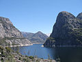
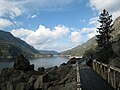
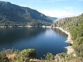
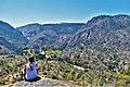
English: The former Hetch Hetchy Valley (pre-1923), and the Hetch Hetchy Reservoir now filling it, in the Sierra Nevada. The valley is located in northwestern Yosemite National Park, within Tuolumne County, California After much debate and politics, O'Shaughnessy Dam (California) across the Tuolumne River was completed in 1923 at the foot the valley, submerging it under the new reservoir to feed the Hetch Hetchy Aqueduct to the San Francisco and the Bay Area.
Subcategories
This category has the following 8 subcategories, out of 8 total.
H
I
K
- Kolana Rock (14 F)
O
- O'Shaughnessy Dam (California) (65 F)
P
- Pulgas Water Temple (34 F)
T
- Tueeulala Falls (2 F)
Media in category "Hetch Hetchy"
The following 76 files are in this category, out of 76 total.
-
-
-

-
 BeautifulHetchHetchy.jpg 720 × 540; 104 KB
-
 California - Dark Hole; Big Dalton Dam through Davis - NARA - 23934241.jpg 4,391 × 3,416; 7.96 MB
-
 Campsites at Rancheria Falls above Hetch Hetchy. - panoramio.jpg 3,072 × 2,304; 4.8 MB
-

-

-
 Falls Creek at outflow of Lake Vernon. Next stop downstream, Wapama Falls - panoramio.jpg 2,304 × 3,072; 3.31 MB
-
-
 Footbridge below Wapama Falls looking west towards O'Shaughnessy Dam - panoramio.jpg 3,072 × 2,304; 3.78 MB
-

-

-
 Hetch Hetchy (4077941972).jpg 1,654 × 944; 868 KB
-
 Hetch Hetchy Aqueduct east of Moccasin, May 2022.JPG 4,606 × 3,457; 7.81 MB
-
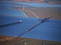
 Hetch Hetchy Aqueduct in San Mateo County.jpg 7,559 × 2,474; 5.69 MB
-
 Hetch Hetchy Dam DSCF3284 (28049773985).jpg 4,896 × 3,264; 4.99 MB
-
 Hetch Hetchy Dam DSCF3337 (27972424041).jpg 4,896 × 3,264; 4.95 MB
-
 Hetch Hetchy Dam DSCF3376 (27972435201).jpg 4,896 × 3,264; 4.54 MB
-
 Hetch Hetchy IMG 0618 (3696710734).jpg 480 × 640; 166 KB
-
 Hetch Hetchy IMG 4590 (14821784402).jpg 3,264 × 2,448; 2.34 MB
-
 Hetch Hetchy May 2011 001.jpg 4,368 × 2,912; 6.3 MB
-
 Hetch Hetchy May 2011 002.jpg 4,200 × 2,400; 4.68 MB
-
 Hetch Hetchy May 2011 003.jpg 2,600 × 3,900; 5.49 MB
-
 Hetch Hetchy May 2011 004.jpg 3,840 × 2,880; 7.29 MB
-
 Hetch Hetchy Panorama (4749028933).jpg 13,224 × 2,309; 7.18 MB
-
 Hetch Hetchy Power (5895300271).jpg 2,560 × 1,920; 1.7 MB
-
 Hetch Hetchy Releases (5910591819).jpg 3,005 × 2,000; 1.86 MB
-
 Hetch Hetchy Reservoir - Pzwsk.jpg 4,032 × 3,024; 4.87 MB
-
 Hetch Hetchy Reservoir 01.JPG 6,016 × 4,000; 10.18 MB
-
 Hetch Hetchy Reservoir 02.JPG 6,016 × 4,000; 11.09 MB
-
 Hetch Hetchy Reservoir 03.JPG 6,016 × 4,000; 10.43 MB
-
 Hetch Hetchy Reservoir 04.JPG 6,016 × 4,000; 11.7 MB
-
 Hetch Hetchy Reservoir 05.JPG 6,016 × 4,000; 11.18 MB
-
 Hetch Hetchy Reservoir, Yosemite National Park, California (21384815190).jpg 4,000 × 3,000; 3.38 MB
-
 Hetch Hetchy Reservoir, Yosemite National Park, California (21385017938).jpg 4,000 × 3,000; 8.34 MB
-
 Hetch Hetchy Reservoir, Yosemite National Park, California (21385946959).jpg 4,000 × 2,290; 2.17 MB
-
 Hetch Hetchy Reservoir, Yosemite National Park, California (21546718026).jpg 4,000 × 3,000; 2.93 MB
-
 Hetch Hetchy Reservoir, Yosemite National Park, California (21572917035).jpg 4,000 × 3,000; 2.83 MB
-
 Hetch Hetchy Reservoir.jpg 2,548 × 640; 238 KB
-
 Hetch Hetchy to Lake Vernon (Topo Map).png 876 × 903; 423 KB
-
 Hetch Hetchy Valley in Yosemite NP-1200px.jpg 1,200 × 352; 85 KB
-
 Hetch-Hetchy-Valley-1.jpg 7,178 × 3,465; 3.59 MB
-
 HetchHetchyBW01.jpg 1,152 × 683; 312 KB
-
 Hetchhetchyprojmap.jpg 1,352 × 623; 414 KB
-

-
 Invisible valley (16183389870).jpg 4,896 × 3,672; 4.87 MB
-

-
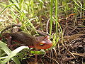
 Lampropeltis zonata multicincta.jpg 741 × 936; 285 KB
-
 Leaving Hetch Hetchy (4640765636).jpg 5,383 × 3,589; 10.21 MB
-

-
 Massive deadfall blocking the Rancheria Falls - Tiltill Valley trail - panoramio.jpg 3,072 × 2,304; 3.97 MB
-
 Mosquitoville along Rancheria Falls - Tiltill Valley trail - panoramio.jpg 3,072 × 2,304; 4.42 MB
-
 On the trail to Rancheria Falls, looking west back at lower Wapama Falls - panoramio.jpg 2,304 × 3,072; 3.27 MB
-
 Palo Alto–Los Altos bike path sign.jpg 4,032 × 2,801; 3.61 MB
-
 Rapids below Rancheria Falls - panoramio.jpg 3,072 × 2,304; 3.87 MB
-

-

-
 SanAndreas.jpg 3,581 × 1,727; 425 KB
-

-
 Springvalley-lg2.gif 1,200 × 866; 640 KB
-
 Sunset in Hetch Hetchy (4614652908).jpg 4,288 × 2,737; 9.44 MB
-
 Taricha torosa sierrae.jpg 3,072 × 2,304; 2.88 MB
-
 The view looking east and down towards Tiltill Valley - panoramio.jpg 2,304 × 3,072; 4.32 MB
-

-

-

-

-
 Trail to Wapama Falls along Hetch Hetchy Reservoir - panoramio.jpg 1,200 × 1,600; 1.5 MB
-
 View east across Hetch Hetchy Reservoir towards Kolana Rock - panoramio.jpg 3,072 × 2,304; 3.49 MB
-
 View east-northeast from Lake Vernon towards canyon leading to Branigan Lake - panoramio.jpg 3,072 × 2,304; 2.87 MB
-
 View west along Hetch Hetchy towards O'Shaughnessy Dam - panoramio.jpg 3,072 × 2,304; 3.67 MB
-
 View-at-Hetch-Hetchy-California.jpg 2,048 × 1,362; 740 KB
-
 Welcome trickle of a stream on the hot slope north of Hetch Hetchy. - panoramio.jpg 3,072 × 2,304; 4.85 MB
-
 Zamites mariposana.jpg 450 × 301; 21 KB
-
 Zeppelin-ride-020100925-076 (5029293682).jpg 4,000 × 3,000; 3.39 MB


.jpg)

.jpg)
.jpg)
.jpg)
.jpg)
.jpg)


.jpg)
.jpg)


.jpg)
.jpg)
.jpg)
.jpg)
.jpg)
.png)


.jpg)


.jpg)


.jpg)


.jpg)
.jpg)