Category:Het Looks (Lier)
Jump to navigation
Jump to search
English: Former working-class district in the east of the City of Lier, Belgium.
Nederlands: Voormalige volkswijk in het oosten van de Stad Lier.
| Object location | | View all coordinates using: OpenStreetMap |
|---|
Media in category "Het Looks (Lier)"
The following 10 files are in this category, out of 10 total.
-
 Hazenstraat 10-20.jpg 4,000 × 6,000; 6.92 MB
-
 Hazenstraat 32-4.jpg 6,000 × 4,000; 7.3 MB
-
 Lookstraat 48-32.jpg 6,000 × 4,000; 6.58 MB
-
 Lookstraat 62-32.jpg 6,000 × 4,000; 6.91 MB
-
 Peperstraat 19-1.jpg 6,000 × 4,000; 6.73 MB
-
 Regenboogstraat 5 (1).jpg 4,000 × 6,000; 6.78 MB
-
 Regenboogstraat 5 (2).jpg 6,000 × 4,000; 5.24 MB
-
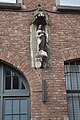 Regenboogstraat 5A Heilig Hart.jpg 4,000 × 6,000; 5.78 MB
-
 Strijpensveld 2.jpg 6,000 × 4,000; 7.12 MB
-
 Strijpensveld.jpg 6,000 × 4,000; 7.54 MB


.jpg)
.jpg)


