Category:Hespe
Jump to navigation
Jump to search
Landkreis Schaumburg  Ahnsen · Apelern · Auetal · Auhagen · Bad Eilsen · Bad Nenndorf · Beckedorf · Buchholz · Bückeburg · Hagenburg · Haste · Heeßen · Helpsen · Hespe · Heuerßen · Hohnhorst · Hülsede · Lauenau · Lauenhagen · Lindhorst · Lüdersfeld · Luhden · Meerbeck · Messenkamp · Niedernwöhren · Nienstädt · Nordsehl · Obernkirchen · Pohle · Pollhagen · Rinteln · Rodenberg · Sachsenhagen · Seggebruch · Stadthagen · Suthfeld · Wiedensahl · Wölpinghausen ·
municipality in Germany    | |||||
| Upload media | |||||
| Instance of |
| ||||
|---|---|---|---|---|---|
| Location |
| ||||
| Population |
| ||||
| Area |
| ||||
| Elevation above sea level |
| ||||
| official website | |||||
 | |||||
Media in category "Hespe"
The following 4 files are in this category, out of 4 total.
-
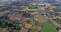 Flug -Nordholz-Hammelburg 2015 by-RaBoe 0455 - Hespe.jpg 3,666 × 1,966; 1.16 MB
-
 Hespe in SHG.svg 1,308 × 1,317; 728 KB
-
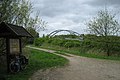 Mittellandkanal. Km 116,1 bridge Diekstraße (Hespe - Hiddensen) - panoramio.jpg 1,800 × 1,203; 931 KB
-
 Stemmen, Hespe, Germany - panoramio.jpg 3,648 × 2,736; 3.92 MB
_-_panoramio.jpg)
