Category:Heskin
Jump to navigation
Jump to search
English: Heskin is a small village and civil parish of the Borough of Chorley in Lancashire, England. According to the United Kingdom Census 2001 it has a population of 883. (→Heskin)
Nederlands: Heskin is een plaats en civil parish in het bestuurlijke gebied Chorley, in het Engelse graafschap Lancashire met 883 inwoners. (→Heskin)
Polski: Heskin – wieś w Anglii, w hrabstwie Lancashire, w dystrykcie Chorley. Leży 39 km na północny zachód od miasta Manchester i 295 km na północny zachód od Londynu. W 2001 miejscowość liczyła 883 mieszkańców. (→Heskin)
village in the United Kingdom  | |||||
| Upload media | |||||
| Instance of | |||||
|---|---|---|---|---|---|
| Location | Chorley, Lancashire, North West England, England | ||||
| Population |
| ||||
 | |||||
Subcategories
This category has the following 2 subcategories, out of 2 total.
2
H
Media in category "Heskin"
The following 102 files are in this category, out of 102 total.
-
 A bend in Town Lane - geograph.org.uk - 4218756.jpg 640 × 480; 87 KB
-
 A tree arch in Halfpenny Lane - geograph.org.uk - 2708158.jpg 3,566 × 2,388; 7.91 MB
-
 Anderson's School House, Heskin.jpg 3,664 × 2,437; 4.26 MB
-
 B5250 near Heskin Green - geograph.org.uk - 4068102.jpg 1,600 × 1,200; 403 KB
-
 B5250 near Heskin Green - geograph.org.uk - 4068129.jpg 1,600 × 1,200; 353 KB
-
 Bannister Green at Halfpenny Lane - geograph.org.uk - 4495687.jpg 2,000 × 1,327; 931 KB
-
 Barmskin Hall Farm - geograph.org.uk - 3886933.jpg 4,476 × 3,081; 5.46 MB
-
 Barmskin Lane - geograph.org.uk - 2711753.jpg 640 × 480; 75 KB
-
 Barmskin Lane is joined by Bentley Lane - geograph.org.uk - 2110134.jpg 1,600 × 1,198; 583 KB
-
 Bridge over Pye Brook on Town Lane, Heskin - geograph.org.uk - 5931034.jpg 1,024 × 770; 404 KB
-
 BT phonebox on Withington Lane, Heskin - geograph.org.uk - 4374520.jpg 1,024 × 821; 310 KB
-
 Chisnall Brow and Whittle Mill Farm - geograph.org.uk - 5930142.jpg 1,024 × 768; 488 KB
-
 Chisnall Lane - geograph.org.uk - 3843639.jpg 640 × 480; 389 KB
-
 Chisnall Lane - geograph.org.uk - 4218742.jpg 640 × 480; 122 KB
-
 Chisnall Lane - geograph.org.uk - 4218744.jpg 640 × 480; 110 KB
-

-
 Crest-Fallen Barn - Hurst House Farm - geograph.org.uk - 3886924.jpg 4,608 × 3,456; 7.21 MB
-
 Delph Diver Training Centre - geograph.org.uk - 4495703.jpg 2,000 × 1,327; 346 KB
-
 Delph Diver Training Centre - geograph.org.uk - 4495713.jpg 2,000 × 1,327; 592 KB
-
 Delph Diver Training Centre - geograph.org.uk - 4496655.jpg 2,000 × 1,327; 679 KB
-
 Delph Diver Training Centre - geograph.org.uk - 4496658.jpg 2,000 × 1,327; 470 KB
-
 Eleven miles to Preston - geograph.org.uk - 4374551.jpg 1,024 × 768; 375 KB
-
 Entrance to Heskin Hall Estate off Wood Lane - geograph.org.uk - 2121612.jpg 1,600 × 1,198; 415 KB
-
 Entrance to Heskin Old Hall Farm - geograph.org.uk - 4496661.jpg 2,000 × 1,327; 491 KB
-
 Farm buildings at Kingsley House, Heskin - geograph.org.uk - 4375955.jpg 1,024 × 768; 266 KB
-
 Farmer's Arms at Heskin - geograph.org.uk - 3848224.jpg 3,689 × 2,985; 3.88 MB
-
 Farmers Arms, Heskin - geograph.org.uk - 1918625.jpg 640 × 480; 89 KB
-
 Farmers Arms, Heskin Green - geograph.org.uk - 2010139.jpg 638 × 457; 118 KB
-
 Footbridge over drain near Barlow's Farm, Heskin - geograph.org.uk - 4377256.jpg 1,024 × 819; 624 KB
-

-
 Footpath across Pye Brook, Heskin - geograph.org.uk - 4375463.jpg 1,024 × 769; 606 KB
-

-
 Footpath between Town Lane and Wood Lane, Heskin - geograph.org.uk - 4375876.jpg 1,024 × 768; 478 KB
-
 Footpath between Town Lane and Wood Lane, Heskin - geograph.org.uk - 4375935.jpg 1,024 × 768; 607 KB
-

-

-
 Footpath from Chisnall Lane to Park Hall Road - geograph.org.uk - 5929789.jpg 1,024 × 768; 397 KB
-
-
 Grazing east of Town Lane - geograph.org.uk - 4218759.jpg 640 × 480; 61 KB
-
 Grazing off Chisnall Lane - geograph.org.uk - 4218739.jpg 640 × 480; 61 KB
-
 Grazing off Town Lane - geograph.org.uk - 4218753.jpg 640 × 480; 59 KB
-
 Halfpenny Lane - geograph.org.uk - 6215557.jpg 800 × 600; 600 KB
-
 Heskin Green, Chisnall Lane - geograph.org.uk - 3843642.jpg 640 × 480; 420 KB
-
 Heskin Green, Wood Lane - geograph.org.uk - 3843650.jpg 640 × 480; 266 KB
-
 Heskin Hall - geograph.org.uk - 2708132.jpg 4,578 × 3,047; 6.99 MB
-
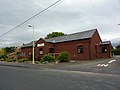
 Heskin Methodist Church - geograph.org.uk - 2010131.jpg 640 × 480; 129 KB
-
 Heskin Methodist Church, Withington Lane - geograph.org.uk - 3843646.jpg 640 × 480; 310 KB
-
 Heskin Old Hall Farm - geograph.org.uk - 6215556.jpg 800 × 533; 283 KB
-
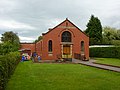
 Heskin Village Hall - geograph.org.uk - 2708219.jpg 4,592 × 3,056; 5.25 MB
-
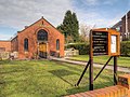
 Heskin Village Hall, Heskin Green - geograph.org.uk - 2010121.jpg 640 × 480; 107 KB
-
 Highland Cattle in Lowland Lancashire - geograph.org.uk - 3886937.jpg 4,318 × 2,203; 5.03 MB
-
-
 House near Heskin Gorse - geograph.org.uk - 3848229.jpg 3,573 × 2,840; 4.3 MB
-
 Houses on Wood Lane, Heskin Green - geograph.org.uk - 4218750.jpg 640 × 480; 39 KB
-
 Howe Brook - geograph.org.uk - 4918008.jpg 641 × 800; 223 KB
-
 Howe Brook, Heskin - geograph.org.uk - 4375535.jpg 1,024 × 768; 399 KB
-

-

-
-

-
 Lodge House - Heskin Hall Estate - geograph.org.uk - 3848222.jpg 4,261 × 2,619; 4.74 MB
-

-
 Milestone, Heskin Green - geograph.org.uk - 3082665.jpg 586 × 640; 260 KB
-
 Mill Lane, Nettle Bank Wood - geograph.org.uk - 3843636.jpg 640 × 480; 393 KB
-
 Nature Trail Nursery, Heskin - geograph.org.uk - 5929793.jpg 1,024 × 768; 297 KB
-
 Nisa local, Heskin Green - geograph.org.uk - 2010133.jpg 640 × 477; 131 KB
-

-
 Path Between Park Hall Road and Chisnall Lane - geograph.org.uk - 5929192.jpg 1,024 × 768; 363 KB
-
 Pond between Town Lane and Barmskin Lane, Heskin - geograph.org.uk - 4375527.jpg 1,024 × 768; 397 KB
-
 Pond between Town Lane and Barmskin Lane, Heskin - geograph.org.uk - 4375530.jpg 1,024 × 768; 523 KB
-

-
-

-
 Postbox and bench on Barmskin Lane, Heskin - geograph.org.uk - 4375574.jpg 1,024 × 768; 518 KB
-
 Protest against housing development at Camelot - geograph.org.uk - 4374537.jpg 1,024 × 768; 399 KB
-
 Pye Brook at Town Lane, Heskin - geograph.org.uk - 5930150.jpg 819 × 1,024; 384 KB
-
 Pyebrook Hall, off Town Lane, Heskin - geograph.org.uk - 4375470.jpg 1,024 × 769; 252 KB
-

-

-

-

-
-
 Stile on Wood Lane, Heskin - geograph.org.uk - 4375452.jpg 1,024 × 768; 369 KB
-
 Stocks Court, Heskin Green - geograph.org.uk - 2010127.jpg 640 × 480; 104 KB
-
 Suitable transport for Town Lane - geograph.org.uk - 2485578.jpg 3,911 × 2,653; 5.57 MB
-
 Syd Brook at Welch Whittle Bottoms - geograph.org.uk - 5929185.jpg 1,024 × 768; 359 KB
-
 The Brook House - geograph.org.uk - 2708195.jpg 4,404 × 2,936; 6.89 MB
-
 The Brook House on Barmskin Road - geograph.org.uk - 2110109.jpg 1,600 × 1,198; 414 KB
-
 The Farmers Arms - geograph.org.uk - 1617884.jpg 640 × 298; 70 KB
-
 The Farmers Arms at Heskin - geograph.org.uk - 3843654.jpg 640 × 481; 282 KB
-
 Town Lane - geograph.org.uk - 4218755.jpg 640 × 480; 134 KB
-
 Town Lane - geograph.org.uk - 4218760.jpg 640 × 480; 90 KB
-
 Town Lane joins Barmskin Lane at Andertons Mill - geograph.org.uk - 2110832.jpg 1,600 × 1,198; 459 KB
-
 Town Lane, Heskin - geograph.org.uk - 4375520.jpg 824 × 1,024; 321 KB
-
 Track to Town Lane past Pyebrook Hall - geograph.org.uk - 4375486.jpg 1,024 × 771; 617 KB
-
 Withington Lane, Heskin Green - geograph.org.uk - 5929785.jpg 1,024 × 768; 304 KB
-
 Wood Lane - geograph.org.uk - 2711820.jpg 640 × 480; 61 KB
-
 Wood Lane - geograph.org.uk - 3843658.jpg 640 × 481; 296 KB
-
 Wood Lane looking north - geograph.org.uk - 2711796.jpg 640 × 480; 79 KB
-
 Wood Lane, Heskin Green (B5250) - geograph.org.uk - 4218751.jpg 640 × 480; 75 KB
-
 Wood Lane, Heskin Hall Lodge - geograph.org.uk - 3843656.jpg 640 × 481; 298 KB
-
 Wood Lane-Park Hall Road junction - geograph.org.uk - 2711810.jpg 640 × 480; 78 KB


_-_geograph.org.uk_-_4218751.jpg)

