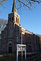
Category:Hervormde kerk (Heerhugowaard)
Jump to navigation
Jump to search
| Object location | | View all coordinates using: OpenStreetMap |
|---|
|
This is a category about a municipal monument in Heerhugowaard with number WN015 |
| Address |
|
Media in category "Hervormde kerk (Heerhugowaard)"
The following 5 files are in this category, out of 5 total.
-
 Hervormde kerk, Heerhugowaard 01.jpg 2,592 × 3,888; 3.57 MB
-
 Hervormde kerk, Heerhugowaard 02.jpg 2,592 × 3,888; 3.29 MB
-
 Interieur naar het oosten - Heerhugowaard - 20106163 - RCE.jpg 1,200 × 948; 198 KB
-
 Interieur naar het westen - Heerhugowaard - 20106162 - RCE.jpg 1,200 × 963; 215 KB
-
 Zuid-west gevel - Heerhugowaard - 20106160 - RCE.jpg 956 × 1,200; 256 KB


