Category:Hervormde Kerk (Hierden)
Jump to navigation
Jump to search
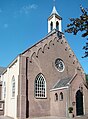
Nederlands: Hierden, Zuiderzeestraatweg 149 - Hervormde Kerk - anno 1851
| Object location | | View all coordinates using: OpenStreetMap |
|---|
Media in category "Hervormde Kerk (Hierden)"
The following 8 files are in this category, out of 8 total.
-
 Hierden - Hervormde kerk - 2014 - 001.jpg 2,848 × 4,272; 2.14 MB
-
 Hierden - Hervormde kerk - 2014 -002.jpg 2,848 × 4,272; 530 KB
-
 Hierden - Hervormde kerk - 2014 -003.jpg 2,848 × 4,272; 1.22 MB
-
 Hierden - Hervormde kerk - 2014 -004.jpg 4,272 × 2,848; 1.62 MB
-
 Hierden - Hervormde kerk - 2014 -005.jpg 2,848 × 4,272; 1.68 MB
-
 Hierden - Hervormde kerk - 2014 -006.jpg 4,272 × 2,848; 1.56 MB
-
 Hierden - Hervormde kerk - 2014 -007.jpg 2,848 × 4,272; 1.52 MB
-
 Hierden 01600.JPG 1,408 × 1,909; 752 KB


