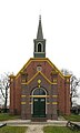
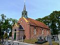
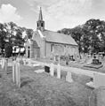
Category:Hervormde Kerk, Nuis
Jump to navigation
Jump to search
| Object location | | View all coordinates using: OpenStreetMap |
|---|
church building in Westerkwartier, Netherlands  | |||||
| Upload media | |||||
| Instance of | |||||
|---|---|---|---|---|---|
| Location | Nuis, Westerkwartier, Groningen, Netherlands | ||||
| Street address |
| ||||
| Located on street |
| ||||
| Architectural style | |||||
| Heritage designation | |||||
| official website | |||||
 | |||||
Nederlands: Hervormde kerk Nuis
|
This is a category about rijksmonument number 28294
|
| Address |
|
Media in category "Hervormde Kerk, Nuis"
The following 39 files are in this category, out of 39 total.
-
 (1) Hervormde Kerk, Nieuweweg 29, Nuis.JPG 4,032 × 3,024; 2.6 MB
-
 (2) Hervormde Kerk, Nieuweweg 29, Nuis.JPG 4,032 × 3,024; 2.92 MB
-
 (3) Hervormde Kerk, Nieuweweg 29, Nuis.JPG 3,024 × 4,032; 2.34 MB
-
 20120303 Hervormde Kerk Nuis Gn NL.jpg 2,700 × 4,500; 2.62 MB
-
 20160615 Hervormde kerk Nuis Gn NL (1).jpg 4,000 × 4,000; 7.96 MB
-
 20160615 Hervormde kerk Nuis Gn NL (2).jpg 5,200 × 3,900; 10.17 MB
-
 20160615 Hervormde kerk Nuis Gn NL (3).jpg 6,500 × 3,900; 13.44 MB
-
 20160615 Hervormde kerk Nuis Gn NL (3)cut.jpg 3,800 × 2,951; 8.57 MB
-
 20160615 Hervormde kerk Nuis Gn NL (detail) (1).jpg 2,398 × 4,000; 5.45 MB
-
 20160615 Hervormde kerk Nuis Gn NL (detail) (2).jpg 2,400 × 4,000; 4.32 MB
-
 20160615 Hervormde kerk Nuis Gn NL (detail) (3).jpg 2,398 × 4,000; 3.45 MB
-
 Aanzicht vanuit het noord-oosten - Nuis - 20170220 - RCE.jpg 887 × 1,200; 284 KB
-
 Avondmaalsbekers - Nuis - 20170227 - RCE.jpg 1,200 × 822; 123 KB
-
 Hervormde kerk Nuis.jpg 2,592 × 1,944; 751 KB
-
 Interieur naar het oosten - Nuis - 20170225 - RCE.jpg 1,200 × 892; 133 KB
-
 Interieur naar het oosten - Nuis - 20170232 - RCE.jpg 1,200 × 944; 173 KB
-
 Interieur naar het westen - Nuis - 20170233 - RCE.jpg 1,200 × 951; 183 KB
-
 Interieur, aanzicht orgel, orgelnummer 1104 of 2014 - Nuis - 20417539 - RCE.jpg 842 × 1,200; 119 KB
-
 Inwendig naar het oosten - Nuis - 20170226 - RCE.jpg 1,200 × 841; 139 KB
-
 Kerk vanuit het zuiden - Nuis - 20170222 - RCE.jpg 1,200 × 907; 235 KB
-
 Kerk vanuit het zuiden en vanuit het noord-oosten - Nuis - 20170223 - RCE.jpg 1,200 × 827; 278 KB
-
 Kerk vanuit het zuiden en vanuit het noord-oosten - Nuis - 20170224 - RCE.jpg 1,200 × 834; 275 KB
-
 Noord zijgevel - Nuis - 20170217 - RCE.jpg 1,200 × 880; 239 KB
-
 Noord-west aanzicht - Nuis - 20170219 - RCE.jpg 884 × 1,200; 176 KB
-
 Noordgevel - Nuis - 20170231 - RCE.jpg 1,200 × 939; 361 KB
-
 Nuis - hervormde kerk - achteraanzicht.jpg 3,533 × 2,650; 3.39 MB
-
 Nuis - hervormde kerk - vooraanzicht.jpg 3,057 × 2,293; 2.5 MB
-
 Nuis - hervormde kerk.jpg 4,000 × 3,000; 3.99 MB
-
 Nuis, Nederland May 21, 2021 06-23-18 PM.jpeg 4,032 × 3,024; 2.52 MB
-
 Nuis, Nederland May 21, 2021 06-24-02 PM.jpeg 4,032 × 3,024; 2.83 MB
-
 Nuis, Nederland May 21, 2021 06-25-24 PM.jpeg 4,032 × 3,024; 3.71 MB
-
 Oost-gevel vanuit het zuid-oosten - Nuis - 20170221 - RCE.jpg 891 × 1,200; 259 KB
-
 Overzicht zuidwestgevel met kerkhof - Nuis - 20364151 - RCE.jpg 1,178 × 1,200; 381 KB
-
 Preekstoel - Nuis - 20170234 - RCE.jpg 963 × 1,200; 173 KB
-
 Rouwbord Saco Fockens.jpg 1,704 × 2,272; 2.35 MB
-
 Westgevel - Nuis - 20170228 - RCE.jpg 1,200 × 960; 233 KB
-
 Zuid zijgevel - Nuis - 20170218 - RCE.jpg 1,200 × 882; 252 KB
-
 Zuid-oostgevel - Nuis - 20170230 - RCE.jpg 1,200 × 963; 278 KB
-
 Zuidgevel - Nuis - 20170229 - RCE.jpg 1,200 × 953; 282 KB
_Hervormde_Kerk,_Nieuweweg_29,_Nuis.JPG)
_Hervormde_Kerk,_Nieuweweg_29,_Nuis.JPG)
_Hervormde_Kerk,_Nieuweweg_29,_Nuis.JPG)

.jpg)
.jpg)
.jpg)
cut.jpg)
_(1).jpg)
_(2).jpg)
_(3).jpg)


