Category:Hermitage, Dorset
Jump to navigation
Jump to search
English: Hermitage is a hamlet in Dorset, England, situated in the Blackmore Vale under the scarp of the Dorset Downs, six miles south of Sherborne. The village has a population of 101 .
hamlet and civil parish in Dorset, United Kingdom  | |||||
| Upload media | |||||
| Instance of | |||||
|---|---|---|---|---|---|
| Location |
| ||||
| Population |
| ||||
 | |||||
Subcategories
This category has the following 3 subcategories, out of 3 total.
H
M
V
Media in category "Hermitage, Dorset"
The following 35 files are in this category, out of 35 total.
-
 Bartlett's Corner, Hermitage - geograph.org.uk - 5650928.jpg 640 × 427; 71 KB
-

-

-
 Buck Cottage, Hermitage - geograph.org.uk - 2300358.jpg 640 × 480; 83 KB
-
 Countryside near Higher Holnest - geograph.org.uk - 1318433.jpg 640 × 480; 102 KB
-
 Development Site, Hermitage - geograph.org.uk - 2300380.jpg 640 × 444; 70 KB
-
 Disused Chapel, Hermitage - geograph.org.uk - 1318436.jpg 640 × 480; 91 KB
-
 Entrance to Prince's Wood, Hermitage - geograph.org.uk - 5650993.jpg 640 × 427; 99 KB
-
 Hermitage Lane - geograph.org.uk - 5417183.jpg 640 × 480; 141 KB
-
 Hermitage Village Green - geograph.org.uk - 1318434.jpg 640 × 480; 79 KB
-
 Hermitage, gated woodland track and bridleway - geograph.org.uk - 2349083.jpg 1,280 × 960; 616 KB
-
 Hermitage, postbox № DT2 198 - geograph.org.uk - 1876370.jpg 640 × 480; 80 KB
-
 Hilfield Manor - geograph.org.uk - 489774.jpg 640 × 480; 162 KB
-
 Lane bend, Higher Holnest - geograph.org.uk - 5417193.jpg 640 × 480; 126 KB
-
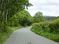
 Lane north from Hermitage - geograph.org.uk - 5417189.jpg 640 × 428; 134 KB
-
 Leys Cottage, Hermitage - geograph.org.uk - 2300352.jpg 640 × 480; 99 KB
-
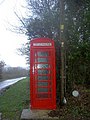
 Library in Phone Box, Hermitage - geograph.org.uk - 5650991.jpg 427 × 640; 87 KB
-
 Old Chapel, Hermitage - geograph.org.uk - 1318435.jpg 480 × 640; 88 KB
-
 Old Mission Hall, Hermitage - geograph.org.uk - 5650994.jpg 640 × 427; 41 KB
-
 Power Lines Williford Lane - geograph.org.uk - 2300371.jpg 640 × 465; 64 KB
-
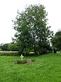
 Saint James, Hermitage, churchyard (1) - geograph.org.uk - 3171350.jpg 640 × 480; 120 KB
-
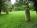
 Saint James, Hermitage, churchyard (2) - geograph.org.uk - 3171353.jpg 640 × 480; 121 KB
-
 Saint James, Hermitage, churchyard (3) - geograph.org.uk - 3171354.jpg 640 × 480; 120 KB
-

-
-

-
 Saint James, Hermitage, churchyard (8) - geograph.org.uk - 3171364.jpg 640 × 480; 117 KB
-
 Saint James, Hermitage, churchyard (9) - geograph.org.uk - 3171369.jpg 640 × 480; 123 KB
-
-
 Williford Lane, Hermitage - geograph.org.uk - 2300365.jpg 640 × 480; 117 KB
-
 Hermitage, pastureland - geograph.org.uk - 565081.jpg 640 × 480; 96 KB
-
 Hermitage, pastureland - geograph.org.uk - 565085.jpg 640 × 480; 99 KB
-

-
 Holnest, pastureland - geograph.org.uk - 565076.jpg 640 × 480; 142 KB
-


_-_geograph.org.uk_-_3171350.jpg)
_-_geograph.org.uk_-_3171353.jpg)
_-_geograph.org.uk_-_3171354.jpg)
_-_geograph.org.uk_-_3171357.jpg)
_-_geograph.org.uk_-_3171360.jpg)
_-_geograph.org.uk_-_3171363.jpg)
_-_geograph.org.uk_-_3171364.jpg)
_-_geograph.org.uk_-_3171369.jpg)


