Category:Herenstraat 38, Utrecht
Jump to navigation
Jump to search
| Object location | | View all coordinates using: OpenStreetMap |
|---|
 | |||||
| Upload media | |||||
| Instance of | |||||
|---|---|---|---|---|---|
| Location | Utrecht, Netherlands | ||||
| Street address |
| ||||
| Heritage designation |
| ||||
 | |||||
|
This is a category about rijksmonument number 36135
|
| Address |
|
Media in category "Herenstraat 38, Utrecht"
The following 5 files are in this category, out of 5 total.
-
 Herenstraat.38.Utrecht.jpg 3,000 × 4,000; 4.38 MB
-
 Overzicht voorgevels - Utrecht - 20235715 - RCE.jpg 1,200 × 960; 236 KB
-
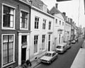
 Utrecht - 2015 - panoramio (5).jpg 4,928 × 3,264; 6.45 MB
-
 Voorgevel - Utrecht - 20235718 - RCE.jpg 806 × 1,200; 179 KB
-
 Voorgevel - Utrecht - 20235721 - RCE.jpg 803 × 1,200; 165 KB

.jpg)

