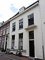
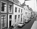
Category:Herenstraat 34, Utrecht
Jump to navigation
Jump to search
| Object location | | View all coordinates using: OpenStreetMap |
|---|
 | |||||
| Upload media | |||||
| Instance of |
| ||||
|---|---|---|---|---|---|
| Location | Utrecht, Netherlands | ||||
| Street address |
| ||||
| Heritage designation |
| ||||
 | |||||
|
This is a category about rijksmonument number 36134
|
| Address |
|
Media in category "Herenstraat 34, Utrecht"
The following 5 files are in this category, out of 5 total.
-
 Achtergevel - Utrecht - 20235717 - RCE.jpg 2,323 × 2,880; 1.42 MB
-
 Herenstraat.34.Utrecht.jpg 2,937 × 3,916; 4.09 MB
-
 Overzicht voorgevels - Utrecht - 20235715 - RCE.jpg 1,200 × 960; 236 KB
-
 Voorgevel - Utrecht - 20235714 - RCE.jpg 802 × 1,200; 154 KB
-
 Voorgevel - Utrecht - 20235716 - RCE.jpg 958 × 1,200; 241 KB


