Category:Herefordshire Trail
Jump to navigation
Jump to search
English: The Herefordshire Trail is a long distance footpath forming a circular walk in the English county of Herefordshire.

 | |||||
| Upload media | |||||
| Instance of |
| ||||
|---|---|---|---|---|---|
| Location | Herefordshire, West Midlands, England | ||||
| Length |
| ||||
| Terminus | |||||
 | |||||
Media in category "Herefordshire Trail"
The following 56 files are in this category, out of 56 total.
-
 A ford in Snodhill - geograph.org.uk - 390763.jpg 640 × 426; 143 KB
-
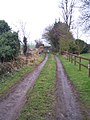
 Brampton Bryan Park - geograph.org.uk - 60068.jpg 640 × 480; 151 KB
-
 Bridleway, Bringewood. - geograph.org.uk - 53380.jpg 640 × 480; 137 KB
-

-
 Fenced off stiles - geograph.org.uk - 1342628.jpg 640 × 480; 101 KB
-
 Fenced off stiles - geograph.org.uk - 1342636.jpg 640 × 480; 128 KB
-
 Footbridge over Wells Brook - geograph.org.uk - 1169606.jpg 640 × 480; 182 KB
-
 Green Lane to the west of Wobage Farm - geograph.org.uk - 166629.jpg 426 × 640; 132 KB
-
 Hereford cattle at Turnastone - geograph.org.uk - 626159.jpg 640 × 426; 79 KB
-
 Herefordshire Trail and Eaton Park - geograph.org.uk - 166631.jpg 640 × 426; 126 KB
-
-
 Herefordshire Trail near Brilley - geograph.org.uk - 193392.jpg 640 × 426; 176 KB
-
 Herefordshire Trail near Wilton Castle - geograph.org.uk - 1169592.jpg 640 × 480; 144 KB
-

-
 Herefordshire Trail west of Hatfield - geograph.org.uk - 1512570.jpg 640 × 480; 91 KB
-
-
 Public footpath near Eyton Hall - geograph.org.uk - 1289388.jpg 640 × 480; 152 KB
-
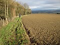
 Public footpath west of Luston - geograph.org.uk - 1286637.jpg 640 × 480; 172 KB
-
 Small path on Ewyas Harold Common - geograph.org.uk - 1066414.jpg 640 × 427; 138 KB
-
 Stile on the Herefordshire Trail - geograph.org.uk - 1080295.jpg 640 × 480; 149 KB
-

-
 Stone Barn, Yatton - geograph.org.uk - 167240.jpg 640 × 426; 136 KB
-

-
 The Herefordshire Trail at Burrington - geograph.org.uk - 1321086.jpg 640 × 480; 169 KB
-

-
 The Herefordshire Trail near Bosbury - geograph.org.uk - 964403.jpg 640 × 426; 114 KB
-
 To Bridstow from Poolmill - geograph.org.uk - 956572.jpg 640 × 480; 144 KB
-
 View across to King's Caple - geograph.org.uk - 150849.jpg 640 × 426; 103 KB
-
 Wapley Hill Wood - Herefordshire Trail - geograph.org.uk - 60228.jpg 640 × 480; 155 KB
-

-
 Yatton Wood - geograph.org.uk - 166625.jpg 426 × 640; 177 KB
-
 Hedge near Peterchurch - geograph.org.uk - 392203.jpg 426 × 640; 131 KB
-
 Herefordshire Trail - geograph.org.uk - 715426.jpg 640 × 480; 83 KB
-
 Herefordshire Trail - geograph.org.uk - 715435.jpg 640 × 480; 79 KB
-
 Herefordshire Trail - Iron Gate - geograph.org.uk - 399663.jpg 640 × 480; 100 KB
-

-

-

-
 Herefordshire Trail N of Crow Hill - geograph.org.uk - 513549.jpg 640 × 532; 434 KB
-
 Herefordshire Trail near The Singing Stud - geograph.org.uk - 650566.jpg 640 × 480; 147 KB
-

-

-

-
 Herefordshire Trail towards May Hill - geograph.org.uk - 513554.jpg 640 × 480; 385 KB
-
 Herefordshire Trail, north of Crow Hill - geograph.org.uk - 650657.jpg 640 × 480; 162 KB
-
 Hope End Parkland near Oyster Hill - geograph.org.uk - 287669.jpg 640 × 427; 244 KB
-
 Junction of Paths on Marcle Hill - geograph.org.uk - 339691.jpg 640 × 427; 319 KB
-
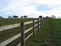
 Mended fences - geograph.org.uk - 650416.jpg 640 × 480; 215 KB
-
 Stile on the footpath - geograph.org.uk - 513544.jpg 480 × 640; 560 KB
-
 The Herefordshire Trail - Bringwyn Hill - geograph.org.uk - 399672.jpg 640 × 480; 134 KB
-

-
 The Herefordshire Trail at Snodhill - geograph.org.uk - 390755.jpg 640 × 426; 135 KB
-

-
 The Herefordshire Trail near Grosmont - geograph.org.uk - 101852.jpg 640 × 426; 164 KB
-
 The Herefordshire Trail on Ridge Hill - geograph.org.uk - 167138.jpg 640 × 426; 119 KB
-


