Category:Heptonstall
Jump to navigation
Jump to search
village in Calderdale, West Yorkshire, England, United Kingdom  | |||||
| Upload media | |||||
| Instance of | |||||
|---|---|---|---|---|---|
| Location | Calderdale, West Yorkshire, Yorkshire and the Humber, England | ||||
| Population |
| ||||
 | |||||
Heptonstall is a village and a civil parish in Calderdale, West Yorkshire, England.
Subcategories
This category has the following 15 subcategories, out of 15 total.
B
- Blake Dean Railway (9 F)
C
- Colden, West Yorkshire (10 F)
F
- Foster Mill Bridge (3 F)
G
- Gorple Cottages (10 F)
- Gorple Lower Reservoir (33 F)
- Gorple Upper Reservoir (23 F)
- Grave of Sylvia Plath (7 F)
H
- Heptonstall Pinfold (2 F)
S
W
- Widdop Reservoir (61 F)
Media in category "Heptonstall"
The following 200 files are in this category, out of 871 total.
(previous page) (next page)-
 "Fork right and climb up" - geograph.org.uk - 6794246.jpg 1,600 × 1,199; 671 KB
-
 "Join a tarmac track higher up the woods" - geograph.org.uk - 6794258.jpg 1,600 × 1,200; 505 KB
-
 "The track descends to join another track" - geograph.org.uk - 6794275.jpg 1,831 × 1,375; 850 KB
-
 'King' David Hartleys grave - geograph.org.uk - 1516644.jpg 480 × 640; 113 KB
-
 16th century gateway - geograph.org.uk - 1516640.jpg 480 × 640; 90 KB
-
 A Carpet of Cotton Grass - geograph.org.uk - 3543754.jpg 4,320 × 3,240; 4.32 MB
-
 A house near Heptonstall - geograph.org.uk - 2681435.jpg 3,872 × 2,592; 5.67 MB
-
 A Sea of Cotton Grass - geograph.org.uk - 3543749.jpg 4,320 × 3,240; 4.29 MB
-
 A side valley near Gibson mill at Hardcastle Crags - geograph.org.uk - 2446850.jpg 1,500 × 2,000; 1.1 MB
-
 A Slacking Camel^ - geograph.org.uk - 6017980.jpg 1,600 × 977; 482 KB
-
 A tricky section of the Calderdale Way - geograph.org.uk - 5325196.jpg 3,240 × 4,320; 5.37 MB
-
 A6033 near Limers Gate - geograph.org.uk - 102895.jpg 1,600 × 1,200; 896 KB
-
 Above Long Edges - geograph.org.uk - 5325182.jpg 4,320 × 2,804; 3.67 MB
-
 Access Track above Reaps Water - geograph.org.uk - 5006035.jpg 1,600 × 1,067; 517 KB
-
 Access Track leading towards Gorple Upper Reservoir - geograph.org.uk - 5006029.jpg 1,600 × 1,067; 521 KB
-
 Alder Carr wet woodland near Gibson Mill - geograph.org.uk - 835004.jpg 640 × 426; 131 KB
-
 Alleyway by St Thomas's Church, Heptonstall - geograph.org.uk - 6335934.jpg 2,920 × 5,184; 3.94 MB
-
 Allotments next to the riverside footpath, Heptonstall - geograph.org.uk - 5410479.jpg 2,000 × 1,500; 1.56 MB
-
 Another Moorland Scene in Upper Noah Dale - geograph.org.uk - 5731042.jpg 5,184 × 3,456; 4.57 MB
-
 Anthill besides the footpath - geograph.org.uk - 3060429.jpg 2,000 × 1,500; 1.3 MB
-
 Approaching Gorple Lower Reservoir - geograph.org.uk - 3295581.jpg 640 × 387; 55 KB
-
 Autumn colours in Colden Clough - geograph.org.uk - 2681331.jpg 3,872 × 2,592; 4.99 MB
-
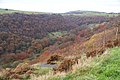
 Autumn colours in Hebden Dale - geograph.org.uk - 2682230.jpg 3,872 × 2,592; 5.21 MB
-
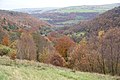 Autumn in Colden Clough - geograph.org.uk - 2682177.jpg 3,872 × 2,592; 5.15 MB
-
 Autumn leaves by Hebden Water - geograph.org.uk - 2682242.jpg 3,872 × 2,592; 7.43 MB
-
 Barn beside National Cycle Route 68 - geograph.org.uk - 6130720.jpg 800 × 532; 97 KB
-

-
 Bench mark, Shuttleworth Moor - geograph.org.uk - 2307907.jpg 640 × 578; 432 KB
-
 Benchmark at Hebden Dale, Low Moor - geograph.org.uk - 6704620.jpg 2,448 × 3,264; 4.23 MB
-

-

-
-

-

-

-

-
-
 Benchmark on wall in front of No. 1 Slack Bottom - geograph.org.uk - 6546967.jpg 1,024 × 655; 239 KB
-
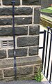
 Benchmark on wall on NE side of Heptonstall Road - geograph.org.uk - 6544014.jpg 1,024 × 677; 297 KB
-
 Benchmark on ^2 Town Gate - geograph.org.uk - 5574963.jpg 664 × 1,024; 226 KB
-
 Black Dean - geograph.org.uk - 714880.jpg 640 × 427; 82 KB
-
 Black Dean, Wadsworth - geograph.org.uk - 4944980.jpg 2,000 × 1,500; 1.1 MB
-
 Black Moor to the north of Gorple Upper Reservoir - geograph.org.uk - 271067.jpg 1,280 × 960; 481 KB
-
 Blake Dean - geograph.org.uk - 6700147.jpg 1,024 × 576; 210 KB
-
 Blake Dean - geograph.org.uk - 6700161.jpg 1,024 × 576; 260 KB
-
 Blake Dean, Heptonstall - geograph.org.uk - 4944891.jpg 2,000 × 1,500; 1.2 MB
-

-
 Bog Eggs Edge - geograph.org.uk - 202104.jpg 640 × 421; 121 KB
-
 Boggy stretch of the Burnley Way - geograph.org.uk - 2203309.jpg 3,872 × 2,592; 6 MB
-

-
-

-
 Boundary stone - geograph.org.uk - 1286402.jpg 428 × 640; 109 KB
-
 Bowling green below Lee Mill Bridge - geograph.org.uk - 1166077.jpg 640 × 480; 99 KB
-
 Branch of Hepstonstall FP53 - geograph.org.uk - 5410536.jpg 1,500 × 2,000; 1.42 MB
-
 Bridge across Hebden water, Midgehole - geograph.org.uk - 1836428.jpg 1,024 × 768; 324 KB
-
 Bridleway - Northgate - geograph.org.uk - 1861945.jpg 640 × 480; 126 KB
-
 Bridleway north of Old Road, Crimsworth Dean - geograph.org.uk - 102928.jpg 1,200 × 1,600; 1.18 MB
-
 Bridleway sign to Lumb Bank - geograph.org.uk - 1044986.jpg 640 × 468; 76 KB
-
 Bridleway, Coppy - geograph.org.uk - 32442.jpg 715 × 536; 151 KB
-
 Bridleway, Lady Royd Farm - geograph.org.uk - 32439.jpg 715 × 536; 106 KB
-
 Broad track leading to the open moor - geograph.org.uk - 615945.jpg 640 × 480; 92 KB
-
 Bus shelter, Draper Lane, Slack, Heptonstall - geograph.org.uk - 4946228.jpg 2,000 × 1,500; 984 KB
-

-
 Bus stop on Smithwell Lane - geograph.org.uk - 2969585.jpg 451 × 640; 109 KB
-
 Buttercup meadow by Heptonstall - geograph.org.uk - 4524188.jpg 6,000 × 4,000; 4.47 MB
-
 Calder valley hebden bridge.jpg 2,816 × 2,112; 807 KB
-
 Calderdale UK parish map highlighting Heptonstall.svg 1,425 × 1,238; 2.84 MB
-
 Calderdale Way above Colden Clough - geograph.org.uk - 5729627.jpg 5,184 × 3,456; 4.7 MB
-
 Calderdale Way above Foster Wood - geograph.org.uk - 5729630.jpg 5,184 × 3,456; 5.74 MB
-
 Calderdale Way approaching New Bridge, Midgehole - geograph.org.uk - 5511712.jpg 5,184 × 3,456; 4.11 MB
-
 Car park, Heptonstall - geograph.org.uk - 1044961.jpg 640 × 458; 85 KB
-
 Carr Bridge - geograph.org.uk - 103017.jpg 1,600 × 1,200; 317 KB
-
 Cattle grid and track to Clough House Farm - geograph.org.uk - 5596457.jpg 4,880 × 3,554; 4.12 MB
-
 Cemetery in Top Slack - geograph.org.uk - 5804975.jpg 1,024 × 683; 191 KB
-
 Chimney of Upper Lumb Mill, Colden Valley - geograph.org.uk - 4377680.jpg 3,456 × 4,608; 3.39 MB
-
 Church & West Laithe Lane.jpg 3,456 × 5,184; 15.27 MB
-
 Church Lane, Heptonstall - geograph.org.uk - 1016133.jpg 480 × 640; 207 KB
-
 Church Lane, Heptonstall - geograph.org.uk - 1044948.jpg 640 × 465; 115 KB
-
 Churchyard Bottom - geograph.org.uk - 1861833.jpg 640 × 480; 72 KB
-
 Churchyard of St Thomas, Heptonstall - geograph.org.uk - 4524196.jpg 6,000 × 4,000; 3.52 MB
-
 Clegg Foot - geograph.org.uk - 1156641.jpg 640 × 427; 85 KB
-
 Clegg Foot - geograph.org.uk - 2767991.jpg 3,072 × 2,304; 1.06 MB
-
 Climbing at Heptonstall Quarry - geograph.org.uk - 915084.jpg 640 × 469; 193 KB
-
 Close up, Elizabeth II postbox on Slack Top, Slack - geograph.org.uk - 6128760.jpg 1,923 × 2,964; 1.4 MB
-
 Clough Head - geograph.org.uk - 5325146.jpg 4,320 × 3,240; 4.77 MB
-
 Clough Head and Clough Head Hill - geograph.org.uk - 1491134.jpg 640 × 480; 102 KB
-
 Clough Head Hill - geograph.org.uk - 1748678.jpg 2,272 × 1,712; 1.09 MB
-
 Clough Hole Bridge - geograph.org.uk - 6130721.jpg 800 × 600; 150 KB
-
 Clough House Farm - geograph.org.uk - 6017272.jpg 4,336 × 2,774; 1.76 MB
-

-
 Cludders Stack - geograph.org.uk - 4415630.jpg 5,157 × 2,858; 1.96 MB
-
 Coal Clough Windfarm, aerial 2014 - geograph.org.uk - 4114312.jpg 1,024 × 683; 107 KB
-
 Colden Clough and Lumb Bank - geograph.org.uk - 6090342.jpg 5,152 × 3,864; 7.56 MB
-
 Colden Clough from Heptonstall.jpg 3,024 × 3,024; 7.85 MB
-
 Colden Valley from Lumb Bank - geograph.org.uk - 2393373.jpg 640 × 480; 79 KB
-
 Colden Water at Hebble Hole - geograph.org.uk - 617548.jpg 640 × 480; 112 KB
-

-
 Concrete bus shelter at Draper Corner - geograph.org.uk - 5566982.jpg 5,184 × 3,888; 3.97 MB
-

-

-
 Coppy. - geograph.org.uk - 396991.jpg 640 × 480; 77 KB
-
 Cottages and stone barn on Widdop Road - geograph.org.uk - 6128536.jpg 800 × 600; 126 KB
-
 Cotton grass in flower - geograph.org.uk - 2748393.jpg 2,000 × 1,500; 1.53 MB
-
 Crossroads below Lee Bank - geograph.org.uk - 2682397.jpg 3,872 × 2,592; 6.79 MB
-
 Crow Nest Road (footpath), Hebden Bridge - geograph.org.uk - 103010.jpg 1,600 × 1,200; 1.33 MB
-
 Culvert for Colden Water under the former Upper Lumb Mill - geograph.org.uk - 2393402.jpg 2,761 × 2,570; 1.69 MB
-

-
 Cut benchmark on a wall above Gorple - geograph.org.uk - 2823714.jpg 640 × 480; 58 KB
-

-
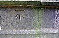
 Cut benchmark on the derelict Lane Side Farm - geograph.org.uk - 2793652.jpg 3,072 × 2,304; 1.62 MB
-
 Cut Mark at Heptonstall, Opposite 3 Town Gate.jpg 1,280 × 853; 464 KB
-
-
 Cut Mark Gatepost Clough Head Farm - geograph.org.uk - 4881559.jpg 640 × 480; 98 KB
-
 Cut Mark New High Laithe Farm - geograph.org.uk - 4881540.jpg 640 × 480; 146 KB
-
 Dam (disused?) on the Gorple Upper conduit - geograph.org.uk - 2767981.jpg 3,072 × 2,304; 1.4 MB
-
 Dark Lane (footpath) near Land Farm - geograph.org.uk - 275309.jpg 640 × 480; 155 KB
-

-
 Dean Gate - geograph.org.uk - 57415.jpg 640 × 480; 164 KB
-
 Derelict building, King Common - geograph.org.uk - 41057.jpg 640 × 427; 117 KB
-
 Derelict farm at Colden Water - geograph.org.uk - 2767845.jpg 3,072 × 2,304; 1.4 MB
-
 Derelict farm at Pad Laithe - geograph.org.uk - 2767854.jpg 3,072 × 2,304; 1.5 MB
-
 Derelict fields - geograph.org.uk - 99719.jpg 1,160 × 851; 880 KB
-
 Descending off Black Hameldon - geograph.org.uk - 3543782.jpg 4,320 × 3,240; 3.78 MB
-
 Dicken Rocks - geograph.org.uk - 1156665.jpg 640 × 427; 60 KB
-

-
 Dill Scout's Wood - geograph.org.uk - 6090336.jpg 5,152 × 3,864; 7.75 MB
-

-
 Disused dam in Noah Dale - geograph.org.uk - 1270669.jpg 640 × 480; 104 KB
-
 Disused sluice on the Gorple Upper conduit - geograph.org.uk - 2767974.jpg 3,072 × 2,304; 1.2 MB
-
 Doorway at Heptonstall Methodist Chapel - geograph.org.uk - 6341565.jpg 2,736 × 3,648; 1.9 MB
-
 Down the clough from Clough Head - geograph.org.uk - 4523548.jpg 6,000 × 4,000; 3.99 MB
-
 Draper Lane - Smithwell Lane - geograph.org.uk - 1861860.jpg 640 × 480; 57 KB
-
 Draper Lane, Heptonstall- panorama.jpg 16,262 × 3,842; 40.49 MB
-
 Drive to Clough House Farm - geograph.org.uk - 2130259.jpg 2,000 × 1,423; 593 KB
-
 Driveway to Hebden Hey Scout Centre - geograph.org.uk - 3060463.jpg 2,000 × 1,500; 1.05 MB
-
 Drystone Walls at Coppy. - geograph.org.uk - 396983.jpg 640 × 480; 103 KB
-
 Dukes Cut (geograph 5732422).jpg 5,184 × 3,456; 6.61 MB
-
 Eastern dam, Widdop Reservoir - geograph.org.uk - 6128480.jpg 800 × 600; 100 KB
-
 Eaves Wood and Colden Clough - geograph.org.uk - 2681322.jpg 3,872 × 2,592; 5.6 MB
-
 Eaves Wood and Colden Clough - geograph.org.uk - 5325213.jpg 3,240 × 4,320; 4.1 MB
-
 Eaves Wood, Heptonstall - geograph.org.uk - 724813.jpg 640 × 427; 338 KB
-
 Edge Lane - geograph.org.uk - 5006155.jpg 1,600 × 1,067; 513 KB
-
 Egypt in the snow - geograph.org.uk - 4336255.jpg 1,600 × 1,062; 379 KB
-
 Elizabeth II postbox on Slack Top, Slack - geograph.org.uk - 6128757.jpg 3,999 × 2,844; 3.26 MB
-
 Elizabeth II postbox, Heptonstall Post Office - geograph.org.uk - 6128796.jpg 1,817 × 3,071; 1.53 MB
-
 Empty farmhouse at Clough Head - geograph.org.uk - 4523547.jpg 6,000 × 4,000; 3.51 MB
-

-

-
 Entrance to Gorple Lower Reservoir - geograph.org.uk - 1360894.jpg 640 × 480; 251 KB
-
 Entrance to Ogden Delph - geograph.org.uk - 1385894.jpg 480 × 640; 156 KB
-
 Erratic Boulder on Shuttleworth Moor - geograph.org.uk - 2892805.jpg 640 × 480; 81 KB
-
 Etched markings, Winny Stone - geograph.org.uk - 32552.jpg 640 × 427; 168 KB
-
 Farm Track to Walshaw. - geograph.org.uk - 396109.jpg 640 × 480; 84 KB
-
 Farmland Overlooking Hebden Dale - geograph.org.uk - 1491147.jpg 640 × 480; 65 KB
-
 Field entrance, High Greenwood farm - geograph.org.uk - 5566969.jpg 5,184 × 3,888; 4.63 MB
-
 Field gateway from NE side of Heptonstall Road - geograph.org.uk - 6545005.jpg 1,024 × 683; 238 KB
-
 Field gateway on SE side of Draper Lane - geograph.org.uk - 6548038.jpg 1,024 × 683; 143 KB
-
 Field of sheep near Midgehole - geograph.org.uk - 2682293.jpg 3,872 × 2,592; 5.18 MB
-
 Fields above Hebden Dale - geograph.org.uk - 4523516.jpg 6,000 × 4,000; 4.42 MB
-
 Fingerpost on Pennine Way at Gorple Cottages - geograph.org.uk - 6335916.jpg 2,920 × 5,184; 5.96 MB
-
 Fit for nowt else - geograph.org.uk - 1044971.jpg 480 × 640; 150 KB
-

-
 Footbridge across Hebden Water - geograph.org.uk - 1836538.jpg 776 × 1,024; 221 KB
-
 Footbridge over a catchwater conduit. Heptonstall - geograph.org.uk - 4986712.jpg 2,000 × 1,500; 1.21 MB
-
 Footbridge over Hebden Water - geograph.org.uk - 2447084.jpg 2,000 × 1,500; 1.22 MB
-
 Footbridge over Hebden Water - geograph.org.uk - 5325107.jpg 4,320 × 3,240; 4.56 MB
-
 Footpath - Heptonstall Road - geograph.org.uk - 1862665.jpg 480 × 640; 112 KB
-
 Footpath - Heptonstall Road - geograph.org.uk - 1862670.jpg 480 × 640; 126 KB
-
 Footpath - Northgate - geograph.org.uk - 1861952.jpg 480 × 640; 97 KB
-
 Footpath - Smithwell Lane - geograph.org.uk - 1861924.jpg 480 × 640; 79 KB
-
 Footpath above High Greenwood Farm - geograph.org.uk - 4523502.jpg 6,000 × 4,000; 3.87 MB
-
 Footpath alongside a ruined wall, Heptonstall - geograph.org.uk - 4986678.jpg 3,072 × 2,304; 2.33 MB
-
 Footpath at the top of Hebden Wood - geograph.org.uk - 3060426.jpg 2,000 × 1,500; 1.59 MB
-
 Footpath at the top of Hebden Wood - geograph.org.uk - 3060434.jpg 2,000 × 1,500; 1.24 MB
-
 Footpath down to the stepping stones - geograph.org.uk - 4418461.jpg 1,500 × 2,000; 1.6 MB
-

-

-
 Footpath in Hebden Dale - geograph.org.uk - 3252897.jpg 794 × 595; 223 KB
-
 Footpath junction west of Hebden Hey - geograph.org.uk - 3060376.jpg 2,000 × 1,500; 1.25 MB
-
 Footpath off driveway to Hebden Hey - geograph.org.uk - 3060456.jpg 2,000 × 1,500; 1.38 MB
-
 Footpath off the driveway to Hebden Hey - geograph.org.uk - 3060449.jpg 2,000 × 1,453; 1.28 MB
-
 Footpath on driveway to Old Royd Farm, Heptonstall - geograph.org.uk - 4984161.jpg 2,000 × 1,500; 1.02 MB
-
 Footpath steps near Lower Lee, Heptonstall - geograph.org.uk - 5410526.jpg 1,500 × 2,000; 1.33 MB
-
 Footpath through Eaves Wood - geograph.org.uk - 2393358.jpg 640 × 480; 119 KB
-
 Footpath through woods, Colden Clough - geograph.org.uk - 268198.jpg 640 × 480; 200 KB
-
 Footpath to Hardcastle Crags and Gibson Mill - geograph.org.uk - 5006556.jpg 1,600 × 1,067; 622 KB
-
 Footpath towards Clough Head - geograph.org.uk - 4706573.jpg 1,600 × 1,200; 542 KB
-
 Footpath towards Hebden Wood - geograph.org.uk - 1377419.jpg 640 × 480; 176 KB
-
 Footpath up to Clough Head Hill, Heptonstall - geograph.org.uk - 4986717.jpg 2,000 × 1,500; 1.04 MB
-
 Former entrance to Heptonstall Methodist Chapel - geograph.org.uk - 6341570.jpg 2,736 × 3,648; 5.14 MB
-
 Former Mill access track through Bob Wood - geograph.org.uk - 4377824.jpg 4,608 × 3,456; 3.24 MB
-
 Former pastures below Gorple Farm - geograph.org.uk - 2202305.jpg 3,872 × 2,592; 1.61 MB
-
 From Back Lane to St Thomas the Apostle - geograph.org.uk - 6089411.jpg 5,152 × 3,864; 7.8 MB
-
 From Northgate to Chiserley - geograph.org.uk - 6089427.jpg 3,560 × 2,670; 1.74 MB
-
 From Northwell Lane across the valley - geograph.org.uk - 6089438.jpg 5,152 × 3,864; 7.26 MB
-
 From the Gorple Road - geograph.org.uk - 924727.jpg 640 × 480; 90 KB
-
 Gallery at Heptonstall Methodist Chapel - geograph.org.uk - 6341568.jpg 3,648 × 2,736; 2 MB
-
 Gate in the Wall - geograph.org.uk - 6019243.jpg 4,784 × 3,646; 3.07 MB
-
 Gate on Pennine Way above Graining Water - geograph.org.uk - 271203.jpg 1,280 × 960; 876 KB


,_Hebden_Bridge_-_geograph.org.uk_-_103010.jpg)


_on_the_Gorple_Upper_conduit_-_geograph.org.uk_-_2767981.jpg)
_near_Land_Farm_-_geograph.org.uk_-_275309.jpg)


.jpg)


