Category:Hentland
Jump to navigation
Jump to search
village in Herefordshire, England, UK | |||||
| Upload media | |||||
| Instance of | |||||
|---|---|---|---|---|---|
| Location | Herefordshire, West Midlands, England | ||||
| Population |
| ||||
 | |||||
English: Hentland is a hamlet and civil parish about north-west of Ross-on-Wye in Herefordshire, England (→Hentland)
Nederlands: Hentland is een plaats en civil parish in het bestuurlijke gebied Herefordshire, in het Engelse graafschap Herefordshire met 443 inwoners. (→Hentland)

Subcategories
This category has the following 5 subcategories, out of 5 total.
Media in category "Hentland"
The following 151 files are in this category, out of 151 total.
-

-

-
-

-
 A4137 at Great Treaddow - geograph.org.uk - 4139933.jpg 640 × 481; 80 KB
-
 A4137 at St Owens Cross boundary - geograph.org.uk - 4139936.jpg 640 × 481; 56 KB
-
 A4137 nears the A49 - geograph.org.uk - 4139937.jpg 640 × 481; 62 KB
-
 A4137 south of St Owen's Cross - geograph.org.uk - 4297394.jpg 800 × 510; 95 KB
-
 A4137 turn off the A49 at Tuft Wood - geograph.org.uk - 3608005.jpg 1,024 × 768; 149 KB
-
 A4137, looking north - geograph.org.uk - 3727248.jpg 800 × 600; 262 KB
-

-
 Across the fields - geograph.org.uk - 6369052.jpg 1,600 × 1,200; 943 KB
-
 Arable field - geograph.org.uk - 6729656.jpg 1,600 × 900; 386 KB
-
 Arable land at Harewood End - geograph.org.uk - 2759334.jpg 1,024 × 680; 228 KB
-
 Arable land at Harewood End - geograph.org.uk - 2759341.jpg 1,024 × 680; 274 KB
-
 Aramstone Cottages - geograph.org.uk - 6509650.jpg 4,896 × 3,264; 5.69 MB
-
 Armorial Bearings of the WILLIAMS of Pengethly, Hentland, Herefordshire.png 1,200 × 1,200; 527 KB
-
 B4521 east of Tretire - geograph.org.uk - 6178624.jpg 1,024 × 770; 114 KB
-
 Barn at The Oaks - geograph.org.uk - 1455983.jpg 640 × 480; 256 KB
-
 Bridleway at Harewood End - geograph.org.uk - 2759190.jpg 1,024 × 680; 287 KB
-
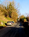
 Car on the B4521 near St Owen's Cross - geograph.org.uk - 4651318.jpg 640 × 480; 129 KB
-
 Church House - geograph.org.uk - 2267502.jpg 1,024 × 768; 241 KB
-
 Church Lane, Hentland - geograph.org.uk - 895055.jpg 640 × 480; 105 KB
-
 Distances from St Owen's Cross - geograph.org.uk - 4297471.jpg 800 × 707; 143 KB
-
 Diversion - no explanation - geograph.org.uk - 2022635.jpg 1,024 × 768; 544 KB
-
 Edge of a barley field near Kynaston - geograph.org.uk - 2022062.jpg 1,024 × 768; 372 KB
-
 Farm buildings and a car - geograph.org.uk - 4651338.jpg 640 × 480; 149 KB
-
 Farmland east of Hentland - geograph.org.uk - 895051.jpg 640 × 388; 72 KB
-
 Farmland sloping down to the Wye - geograph.org.uk - 2022047.jpg 1,024 × 768; 373 KB
-
 Fields and woodland by A49 south of Harewood End - geograph.org.uk - 3607971.jpg 1,024 × 768; 177 KB
-
 Former tollhouse, Hoarwithy Bridge - geograph.org.uk - 2759386.jpg 680 × 1,024; 169 KB
-
 Former tollhouse, Hoarwithy Bridge - geograph.org.uk - 4551442.jpg 800 × 793; 159 KB
-
 Garden of Brae Cottage - geograph.org.uk - 6599453.jpg 640 × 480; 99 KB
-
 Gillow Manor - Hentland, Herefordshire - geograph.org.uk - 5971002.jpg 1,024 × 607; 165 KB
-
 Half-harvested - geograph.org.uk - 960225.jpg 640 × 480; 143 KB
-
 Harvest in near Dason Court - geograph.org.uk - 960218.jpg 640 × 424; 105 KB
-
 Heading north towards Hoarwithy - geograph.org.uk - 2021984.jpg 1,024 × 768; 497 KB
-
 Hentland House - geograph.org.uk - 2022080.jpg 1,024 × 768; 509 KB
-
 Hentland House - geograph.org.uk - 3024003.jpg 640 × 480; 73 KB
-
 Hentland, UK - panoramio.jpg 3,968 × 2,976; 2.6 MB
-
 Hoarwithy to Ross road - geograph.org.uk - 5212187.jpg 1,024 × 768; 328 KB
-
 House at Kynaston - geograph.org.uk - 4651324.jpg 640 × 480; 167 KB
-
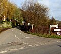
 Junction of the A49 and the A4137 - geograph.org.uk - 3381640.jpg 4,320 × 3,240; 3 MB
-
 Lane near Kynaston farm - geograph.org.uk - 4651323.jpg 640 × 480; 138 KB
-
 Lane under the pylon line - geograph.org.uk - 3024005.jpg 640 × 480; 85 KB
-
 Large pond at Kynaston - geograph.org.uk - 5785691.jpg 1,600 × 1,200; 1.23 MB
-
 Little Dewchurch road, Hoarwithy - geograph.org.uk - 4316767.jpg 623 × 800; 158 KB
-
 Looking west near Gillow Court 1 - geograph.org.uk - 946966.jpg 640 × 480; 101 KB
-
 Looking west near Gillow Court 2 - geograph.org.uk - 946968.jpg 640 × 480; 79 KB
-
 Michaelchurch, trig point - geograph.org.uk - 1810762.jpg 1,024 × 768; 354 KB
-
 Minor road north from Hoarwithy - geograph.org.uk - 4551004.jpg 800 × 698; 176 KB
-
 Minor road SSE from Hoarwithy - geograph.org.uk - 4319191.jpg 800 × 652; 139 KB
-
 Minor road west from Hoarwithy - geograph.org.uk - 4319318.jpg 800 × 687; 144 KB
-
 National Trust sign, Pengethley - geograph.org.uk - 960192.jpg 405 × 640; 135 KB
-
 New hedge, Harewood End - geograph.org.uk - 2759353.jpg 1,024 × 680; 238 KB
-
-
 No through road - geograph.org.uk - 960212.jpg 640 × 480; 189 KB
-
 Not the prettiest crop^ - geograph.org.uk - 894961.jpg 640 × 480; 125 KB
-

-

-
 On Hoarwithy Bridge - geograph.org.uk - 5973553.jpg 640 × 360; 86 KB
-
 On the banks of the Wye - geograph.org.uk - 2260549.jpg 1,024 × 768; 247 KB
-
 On the edge of Hoarwithy at Red Rail - geograph.org.uk - 4651329.jpg 640 × 480; 146 KB
-
 Ordnance Survey Cut Mark - geograph.org.uk - 6127712.jpg 1,024 × 708; 273 KB
-
 Ordnance Survey Cut Mark - geograph.org.uk - 6128203.jpg 1,024 × 763; 356 KB
-
 Ordnance Survey Flush Bracket G2681 - geograph.org.uk - 5209751.jpg 4,000 × 3,000; 3.77 MB
-
 Pasture land with footpath - geograph.org.uk - 895048.jpg 640 × 480; 77 KB
-
 Path above Red Rail farm - geograph.org.uk - 3024011.jpg 640 × 480; 76 KB
-
 Path along top of a valley - geograph.org.uk - 2021994.jpg 1,024 × 768; 508 KB
-
 Path at the top field edge - geograph.org.uk - 3024009.jpg 640 × 480; 84 KB
-
 Path to Tuft Wood from Hentland - geograph.org.uk - 960181.jpg 640 × 480; 262 KB
-
 Pengethley Park (Hentland) - geograph.org.uk - 5894563.jpg 3,648 × 2,736; 4.87 MB
-
 Pengethley Park - geograph.org.uk - 3751406.jpg 4,320 × 2,160; 1.33 MB
-
 Picnic bench by the Wye - geograph.org.uk - 6509612.jpg 4,896 × 3,264; 6.45 MB
-
 Picnic by the river - geograph.org.uk - 6509120.jpg 4,896 × 3,264; 2.79 MB
-
 Pine trees and a pylon - geograph.org.uk - 2758151.jpg 1,024 × 680; 149 KB
-
 Ploughed field near Hoarwithy - geograph.org.uk - 2758143.jpg 1,024 × 680; 224 KB
-
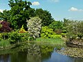
 Pond by Pengethley Park (Hentland) - geograph.org.uk - 5894541.jpg 3,648 × 2,736; 4.94 MB
-
 Potato crop at Kynaston 1 - geograph.org.uk - 894964.jpg 640 × 368; 71 KB
-
 Potato crop at Kynaston 2 - geograph.org.uk - 894966.jpg 640 × 300; 66 KB
-
 Potato crop at Kynaston 3 - geograph.org.uk - 894970.jpg 640 × 368; 65 KB
-
 Potato crop west of Kynaston - geograph.org.uk - 895058.jpg 640 × 480; 132 KB
-
 Power lines passing overhead - geograph.org.uk - 2022054.jpg 1,024 × 768; 461 KB
-
 Power lines through Kynaston - geograph.org.uk - 2022611.jpg 1,024 × 768; 375 KB
-
 Quarry near Hoarwithy - geograph.org.uk - 5212189.jpg 1,024 × 768; 522 KB
-
 Rain coming - geograph.org.uk - 6729657.jpg 1,600 × 900; 251 KB
-
 Red Rail Farm - geograph.org.uk - 2022037.jpg 1,024 × 768; 477 KB
-
 River Wye - geograph.org.uk - 5212196.jpg 1,024 × 768; 406 KB
-
 River Wye at Altbough - geograph.org.uk - 2260576.jpg 1,024 × 768; 218 KB
-
 River Wye near Hoarwithy - geograph.org.uk - 6509638.jpg 4,896 × 3,264; 5.62 MB
-
 Road SE from Harewood End - geograph.org.uk - 4297727.jpg 800 × 600; 140 KB
-
 Road to Carey from Hoarwithy - geograph.org.uk - 973844.jpg 480 × 640; 171 KB
-

-
 Sign at Pengethley Park (Hentland) - geograph.org.uk - 5894527.jpg 3,648 × 2,736; 4.67 MB
-
 Sign at Pengethley Park (Hentland) - geograph.org.uk - 5894534.jpg 3,648 × 2,736; 4.52 MB
-
 Signs at Pengethley Park (Hentland) - geograph.org.uk - 5894532.jpg 3,648 × 2,736; 4.69 MB
-
 Site of medieval settlement - geograph.org.uk - 960190.jpg 640 × 480; 125 KB
-
 South Herefordshire countryside - geograph.org.uk - 946962.jpg 640 × 480; 84 KB
-
 Stile on the Hoarwithy Loop - geograph.org.uk - 2021954.jpg 1,024 × 768; 706 KB
-
 Stream at Hentland - geograph.org.uk - 5894557.jpg 3,648 × 2,736; 5.18 MB
-
 Stubble - in April - geograph.org.uk - 5212162.jpg 1,024 × 768; 340 KB
-
 Summer on Hoarwithy Bridge - geograph.org.uk - 3024067.jpg 640 × 480; 75 KB
-
 The Blue Wye - geograph.org.uk - 4303505.jpg 800 × 403; 147 KB
-
 The end of the A4137 - geograph.org.uk - 6222840.jpg 2,375 × 1,417; 1.53 MB
-
 The Hoarwithy Loop - geograph.org.uk - 2021966.jpg 1,024 × 768; 424 KB
-
 The Lane to Kynaston - geograph.org.uk - 4862173.jpg 4,395 × 2,491; 1.46 MB
-
 The Old Toll House - geograph.org.uk - 2257545.jpg 1,024 × 775; 245 KB
-
 The River Wye above Hoarwithy Bridge - geograph.org.uk - 5807021.jpg 1,024 × 768; 137 KB
-
 The River Wye at Although - geograph.org.uk - 6599450.jpg 640 × 480; 93 KB
-
 The Toll House, Hoarwithy Bridge - geograph.org.uk - 6599420.jpg 480 × 640; 69 KB
-
 The Toll House, Hoarwithy Bridge - geograph.org.uk - 6599425.jpg 480 × 640; 99 KB
-
 To Kynaston and Hoarwithy - geograph.org.uk - 960205.jpg 640 × 480; 95 KB
-
 Toll House, Hoarwithy Bridge - geograph.org.uk - 6036484.jpg 1,024 × 768; 137 KB
-
 Towards Little Peterstow Farm from St Owen's Cross - geograph.org.uk - 4297408.jpg 2,788 × 1,752; 1.05 MB
-
 Track and footpath to Hoarwithy - geograph.org.uk - 2758138.jpg 1,024 × 680; 216 KB
-
 Track off the Hoarwithy Loop - geograph.org.uk - 2021987.jpg 1,024 × 768; 648 KB
-
 Track to Broadway Lands - geograph.org.uk - 1455945.jpg 640 × 480; 246 KB
-
 Track to Cot Barn - geograph.org.uk - 2759191.jpg 1,024 × 680; 194 KB
-
 Track to Cot Barn - geograph.org.uk - 6729654.jpg 1,600 × 900; 602 KB
-
 Trees at Hoarwithy Bridge - geograph.org.uk - 6345355.jpg 3,648 × 2,736; 4.47 MB
-
 Two bus stops on the A49 at Pengethley - geograph.org.uk - 2833654.jpg 1,024 × 768; 194 KB
-
 Unsafe footpath sign - geograph.org.uk - 6509103.jpg 3,264 × 4,896; 5.7 MB
-
 Up a slope into a field near Tretire - geograph.org.uk - 4651315.jpg 640 × 480; 135 KB
-
 View over King's Caple from the Hoarwithy Loop - geograph.org.uk - 2021976.jpg 1,024 × 768; 485 KB
-
 View to Pengethley Hotel - geograph.org.uk - 2759336.jpg 1,024 × 680; 256 KB
-
 View towards the Ridge Hill mast - geograph.org.uk - 2021963.jpg 1,024 × 768; 386 KB
-
 Waist high in buttercups, Pengethley - geograph.org.uk - 836159.jpg 460 × 640; 198 KB
-
 Walkers on the Hoarwithy Loop - geograph.org.uk - 2022622.jpg 1,024 × 768; 548 KB
-
 Walking the Hoarwithy Circular - geograph.org.uk - 1950588.jpg 640 × 480; 212 KB
-
 West across Hoarwithy Bridge - geograph.org.uk - 4551444.jpg 800 × 533; 122 KB
-
 Wheat field next to the A49 - geograph.org.uk - 895076.jpg 640 × 480; 102 KB
-
 Wheat field west of Dason Court - geograph.org.uk - 895069.jpg 640 × 284; 60 KB
-
 Wonderful Wisteria - geograph.org.uk - 5785704.jpg 1,600 × 1,093; 1.17 MB
-
 Wriggle Brook - geograph.org.uk - 5212173.jpg 1,024 × 768; 527 KB
-
 Wriggles Brook - geograph.org.uk - 2264609.jpg 1,024 × 768; 271 KB
-
 Wye from Hoarwithy Bridge - geograph.org.uk - 4551435.jpg 800 × 605; 93 KB
-

-
 Aberhall Farm, Tretire - geograph.org.uk - 713607.jpg 640 × 480; 164 KB
-
 Country road to Kynaston - geograph.org.uk - 601162.jpg 480 × 640; 132 KB
-

-
 Entrance to Gillow Farm - geograph.org.uk - 520201.jpg 640 × 480; 369 KB
-
 Footpath through stubble field - geograph.org.uk - 678275.jpg 640 × 461; 126 KB
-
 Great Treaddow Farm - geograph.org.uk - 678273.jpg 640 × 422; 111 KB
-
 Junction of A49 and A4137 - geograph.org.uk - 520203.jpg 640 × 480; 410 KB
-
 Kynaston - Field gateway - geograph.org.uk - 776448.jpg 640 × 480; 74 KB
-
 Kynaston - Hentland House - geograph.org.uk - 776445.jpg 640 × 480; 73 KB
-
 Kynaston Farm - geograph.org.uk - 776443.jpg 640 × 480; 105 KB
-
 Pond at Kynaston Farm - geograph.org.uk - 115439.jpg 640 × 426; 169 KB
-

-
 The A4137 just north of St Owen's Cross - geograph.org.uk - 115433.jpg 640 × 426; 122 KB
-
 The A4137 south of St Owen's Cross - geograph.org.uk - 138388.jpg 640 × 426; 103 KB


.jpg)


_-_geograph.org.uk_-_5894563.jpg)


_-_geograph.org.uk_-_5894541.jpg)


_-_geograph.org.uk_-_5894527.jpg)
_-_geograph.org.uk_-_5894534.jpg)
_-_geograph.org.uk_-_5894532.jpg)


