Category:Henhull
Jump to navigation
Jump to search
English: Henhull is a former civil parish in the unitary authority area of Cheshire East and the ceremonial county of Cheshire, England, which lies to the north west of Nantwich. For administrative purposes, it was combined with adjacent civil parishes of Acton and Edleston to form a total area of 765 hectares (1890 acres). The parish is predominantly rural with scattered farms and houses and no large settlements. It included the hamlets of Basin End, Bluestone, Welshmen's Green and part of Burford. Nearby villages include Acton and Rease Heath.
former civil parish in Cheshire East, England, UK  | |||||
| Upload media | |||||
| Instance of |
| ||||
|---|---|---|---|---|---|
| Location |
| ||||
 | |||||
Subcategories
This category has the following 2 subcategories, out of 2 total.
N
Media in category "Henhull"
The following 79 files are in this category, out of 79 total.
-

-
 A51 near Holly Farm - geograph.org.uk - 3171320.jpg 640 × 480; 89 KB
-
 Canal Cottage, Nantwich Junction.jpg 640 × 506; 150 KB
-
 Canal towpath near Acton, Cheshire - geograph.org.uk - 3223069.jpg 600 × 800; 386 KB
-
 Cheshire farmland near Acton - geograph.org.uk - 3223398.jpg 600 × 800; 296 KB
-
 Diverted footpath near Nantwich - geograph.org.uk - 4387454.jpg 1,897 × 1,469; 1.15 MB
-
 Diverted footpath north of Nantwich - geograph.org.uk - 4387485.jpg 2,048 × 1,536; 1.88 MB
-

-
 Farmland near Nantwich, Cheshire - geograph.org.uk - 2815589.jpg 800 × 551; 336 KB
-
 Farmland north-west of Nantwich, Cheshire - geograph.org.uk - 3223370.jpg 1,024 × 768; 450 KB
-
 Farmland north-west of Nantwich, Cheshire - geograph.org.uk - 3223389.jpg 1,280 × 726; 482 KB
-
 Fields and Hedgerows near Reaseheath College - geograph.org.uk - 3868923.jpg 4,106 × 2,589; 4.02 MB
-
 Fields near Burford - geograph.org.uk - 3868926.jpg 3,966 × 1,583; 2.13 MB
-

-
 Footpath junction near Nantwich - geograph.org.uk - 4385954.jpg 2,048 × 1,536; 1.42 MB
-
 Footpath north of Nantwich - geograph.org.uk - 4387463.jpg 1,536 × 2,048; 1.19 MB
-
 Footpath off Welshmen's Lane - geograph.org.uk - 4387533.jpg 2,048 × 1,536; 1.15 MB
-
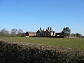
 Henhull Hall - geograph.org.uk - 4387547.jpg 2,048 × 1,536; 790 KB
-
 Henhull Hall near Nantwich - geograph.org.uk - 1742203.jpg 1,024 × 768; 204 KB
-
 Henhullbridge Farm - geograph.org.uk - 2749343.jpg 1,600 × 1,271; 614 KB
-
 Horse sculpture, Nantwich Junction - geograph.org.uk - 5600269.jpg 1,280 × 851; 723 KB
-
 Kingsleyfield Farm (site of) - geograph.org.uk - 4385997.jpg 2,048 × 1,536; 1.32 MB
-
 Malbank School ^ Sixth Form College sports facilities - geograph.org.uk - 4387503.jpg 2,048 × 1,536; 1.14 MB
-
 Moored narrowboats near Acton, Cheshire - geograph.org.uk - 3223452.jpg 703 × 800; 349 KB
-
 Moored narrowboats near Acton, Cheshire - geograph.org.uk - 3223457.jpg 1,024 × 679; 502 KB
-
 Murky morning by the canal at Aston, Cheshire - geograph.org.uk - 3200674.jpg 1,024 × 693; 347 KB
-
 Nantwich Aqueduct - geograph.org.uk - 4598444.jpg 640 × 427; 76 KB
-
 Nantwich Basin - geograph.org.uk - 5704649.jpg 640 × 480; 81 KB
-
 Nantwich Basin, Cheshire - geograph.org.uk - 2815604.jpg 1,024 × 621; 445 KB
-
 Nantwich, footpath off Waterlode - geograph.org.uk - 4387441.jpg 1,730 × 1,285; 1.12 MB
-
 Nantwich, footpath on the edge of Kingsley Village - geograph.org.uk - 4386082.jpg 1,535 × 1,859; 1.06 MB
-
 Nantwich, Kingsley Village - geograph.org.uk - 4386069.jpg 2,048 × 1,536; 934 KB
-
 Nantwich, Malbank Health and Fitness Centre - geograph.org.uk - 4386110.jpg 2,048 × 1,536; 821 KB
-
 Nantwich, Rotary Club trees alongside Waterlode - geograph.org.uk - 4387393.jpg 1,536 × 2,048; 1.49 MB
-
 Nantwich, Weaver Stadium - geograph.org.uk - 4386005.jpg 2,048 × 1,536; 1,022 KB
-
 Nantwich, Weaver Stadium - geograph.org.uk - 4386014.jpg 2,048 × 1,536; 903 KB
-
 Nantwich, Welshmen's Lane allotments - geograph.org.uk - 4387522.jpg 2,048 × 1,536; 1.2 MB
-
 Narrowboat near Acton, Cheshire - geograph.org.uk - 3223050.jpg 800 × 600; 376 KB
-

-

-
 Narrowboats at Nantwich - geograph.org.uk - 5600283.jpg 1,280 × 851; 552 KB
-

-

-

-
 New signpost near Acton, Cheshire - geograph.org.uk - 3223082.jpg 800 × 600; 445 KB
-
 Pasture and woodland near Acton, Cheshire - geograph.org.uk - 3223407.jpg 1,280 × 721; 556 KB
-

-
 Red sky over Acton, Cheshire - geograph.org.uk - 3200581.jpg 616 × 800; 210 KB
-
 Red sky over Acton, Cheshire - geograph.org.uk - 3200587.jpg 1,024 × 768; 345 KB
-
 Sculpture trail plaque - Shropshire Union Canal - geograph.org.uk - 5600282.jpg 1,280 × 851; 442 KB
-
 Shropshire Union Canal - geograph.org.uk - 5704630.jpg 640 × 480; 69 KB
-
 Shropshire Union Canal - geograph.org.uk - 5704655.jpg 640 × 480; 69 KB
-

-

-

-

-

-
 Shropshire Union Canal near Acton, Cheshire - geograph.org.uk - 3223078.jpg 1,024 × 758; 491 KB
-
 Shropshire Union Canal near Burford - geograph.org.uk - 4597742.jpg 640 × 427; 81 KB
-
 Shropshire Union Canal near Burford - geograph.org.uk - 4597743.jpg 640 × 427; 78 KB
-
 Shropshire Union Canal near Burford, Cheshire - geograph.org.uk - 2816079.jpg 1,024 × 553; 403 KB
-

-

-
 Shropshire Union Canal near Nantwich, Cheshire - geograph.org.uk - 2815149.jpg 1,024 × 732; 368 KB
-

-

-
 Shropshire Union Canal, Nantwich - geograph.org.uk - 3662029.jpg 1,280 × 960; 271 KB
-
 Shropshire Union Canal, Nantwich - geograph.org.uk - 5543111.jpg 1,280 × 851; 585 KB
-
 Shropshire Union Canal, Nantwich - geograph.org.uk - 5867270.jpg 851 × 1,280; 444 KB
-

-
 Shropshire Union Canal, Nantwich Junction - geograph.org.uk - 5600265.jpg 1,280 × 851; 416 KB
-
 South along the Shropshire Union Canal, Nantwich - geograph.org.uk - 5898834.jpg 1,024 × 681; 237 KB
-

-
 Stile on Henhull FP4 - geograph.org.uk - 4385965.jpg 2,048 × 1,536; 1.95 MB
-
 Unused farm track - geograph.org.uk - 4385976.jpg 2,048 × 1,536; 1.61 MB
-

-
 Welshmen's Green - geograph.org.uk - 4387554.jpg 2,048 × 1,536; 1.15 MB
-
 Welshmen's Lane - geograph.org.uk - 4387541.jpg 2,048 × 1,536; 1.03 MB
-
 Welshmen's Lane - geograph.org.uk - 4387562.jpg 2,048 × 1,536; 1.32 MB


_-_geograph.org.uk_-_4385997.jpg)


