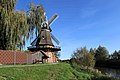
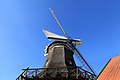
Category:Hengstforder Mühle
Jump to navigation
Jump to search
| Object location | | View all coordinates using: OpenStreetMap |
|---|
 | |||||
| Upload media | |||||
| Instance of | |||||
|---|---|---|---|---|---|
| Location | Apen, Ammerland, Lower Saxony, Germany | ||||
| Heritage designation | |||||
| Source of energy |
| ||||
 | |||||
Media in category "Hengstforder Mühle"
The following 32 files are in this category, out of 32 total.
-
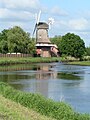
 Apen - Hauptstraße - Hengstforder Mühle + Aper Tief + Freibad 01 ies.jpg 5,616 × 3,744; 21.73 MB
-
 Apen - Hauptstraße - Hengstforder Mühle + Freibad 01 ies.jpg 3,744 × 5,616; 21.58 MB
-
 Apen - Hauptstraße - Hengstforder Mühle + Landgasthof + Freibad 01 ies.jpg 5,616 × 3,744; 19.61 MB
-
 Apen - Hauptstraße - Hengstforder Mühle + Landgasthof 01 ies.jpg 5,616 × 3,744; 21.95 MB
-
 Apen - Hauptstraße - Hengstforder Mühle + Landgasthof 02 ies.jpg 5,616 × 3,744; 20.36 MB
-
 Apen - Hauptstraße - Hengstforder Mühle 01 ies.jpg 3,744 × 5,616; 17.03 MB
-
 Apen - Hauptstraße - Hengstforder Mühle 02 ies.jpg 5,616 × 3,744; 23.03 MB
-
 Apen - Hauptstraße - Hengstforder Mühle 03 ies.jpg 3,744 × 5,616; 19.1 MB
-
 Apen - Hauptstraße - Hengstforder Mühle 04 ies.jpg 3,744 × 5,616; 17.38 MB
-
 Apen - Hauptstraße - Hengstforder Mühle 05 ies.jpg 5,616 × 3,744; 17.36 MB
-
 Apen - Hauptstraße - Hengstforder Mühle 06 ies.jpg 5,616 × 3,744; 19.48 MB
-
 Apen - Hauptstraße - Hengstforder Mühle 07 ies.jpg 5,616 × 3,744; 21.07 MB
-
 Apen - Hauptstraße - Hengstforder Mühle 08 ies.jpg 5,616 × 3,743; 16.28 MB
-
 Apen - Unterster Weg - Aper Tief + Hengstforder Mühle (Aussichtsturm Ost) 01 ies.jpg 5,616 × 3,743; 22.25 MB
-
 Apen - Unterster Weg - Aper Tief + Hengstforder Mühle (Aussichtsturm Ost) 02 ies.jpg 5,616 × 3,744; 19.18 MB
-
 Aper Tief von Aperbergerstr. (Apen) aus gesehen.JPG 2,560 × 1,920; 1.16 MB
-
 Ausdeichungsgebiet Aper Tief bei Hochwasser.jpg 2,048 × 1,536; 1.5 MB
-
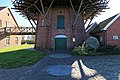
 Backhaus bei der Hengstforder Mühle (Gem. Apen).jpg 4,200 × 3,150; 14.5 MB
-
 Ehem. Müllerhaus der Hengstforder Mühle (Gem. Apen).jpg 4,200 × 2,800; 10.14 MB
-
 Hengstforde Windmühle.JPG 1,536 × 2,048; 653 KB
-
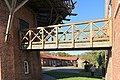
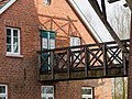 Hengstforder Mühle (Apen) - Brücke zwischen Müllerhaus und Mühlenturm (2023).jpg 4,200 × 3,150; 11.38 MB
-
 Hengstforder Mühle (Apen, 2024).jpg 3,000 × 4,200; 8.35 MB
-
 Hengstforder Mühle in Apen (2024).jpg 3,000 × 4,500; 9.41 MB
-
 Hengstforder Mühle in der Gemeinde Apen (2023).jpg 3,600 × 4,800; 10.51 MB
-
 Hengstforder Mühle mit Müllerhaus (2023).jpg 3,300 × 4,400; 11.15 MB
-
 Hengstforder Mühle und Müllerhaus (2023).jpg 4,200 × 3,150; 11.88 MB
-
 Hengstforder Mühle, Freibad Hengstforde und Aper Tief (2024).jpg 4,800 × 3,000; 11.69 MB
-
 Hengstforder Mühle, gesehen vom Turm Ost beim Aper Tief (2023).jpg 4,800 × 3,600; 12.83 MB
-
 Hengstforder Mühle.jpg 2,592 × 3,872; 5.66 MB
-
 Naturschutzgebiet Aper Tief - 2.jpg 614 × 461; 38 KB
-
 Stallscheune am ehem. Müllerhaus der Hengstforder Mühle (Gem. Apen).jpg 4,200 × 3,150; 12.24 MB
-
 Windmühle, Müllerhaus mit Scheune der Hengstforder Mühle (Gem. Apen).jpg 4,200 × 2,800; 10.46 MB


_01_ies.jpg)
_02_ies.jpg)
_aus_gesehen.JPG)

.jpg)
.jpg)
_-_Br%C3%BCcke_zwischen_M%C3%BCllerhaus_und_M%C3%BChlenturm_(2023).jpg)
.jpg)
.jpg)
.jpg)
.jpg)
.jpg)
.jpg)
.jpg)


.jpg)
.jpg)